
Utility Mapping Services & GIS mapping for Utilities - AABSYS Services for the Electric and Gas Utility Industry The global electric and gas utility industry relies heavily on geographic information system, remote sensing utility mapping services, and computer aided design and drafting technologies for their well-timed and cost effective functioning. AABSyS IT has extensive experience and expertise in the electric and gas utility mapping services and field data capturing of utility networks such as Electricity, Gas and Water. AABSyS IT’s electric and gas utility mapping services help in efficient designing, resource management, outage and distribution management, database planning and installations management, power line management and monitoring. AABSyS electric and gas utility mapping services also helps in documenting the vital underground and overhead assets digitally. AABSyS IT offers the following utility mapping services: Key Services for Electric Utilities Key Services for Gas and Water Utilities Electric Utility Services
GIS for Electricity Network Mapping at AABSyS The fast pace of development and urbanisation has resulted in creation of new cities, townships etc. The new residential or commercial settlements require procurement of amenities such as well-planned out electricity lines that ensure smooth, hassle free transportation of electricity. The use of GIS for electricity has created much fervour in the utility industry. GIS for electricity, Remote Sensing, and CAD play an important role in designing, drafting, and planning of electricity supply lines within a township or from a power station in a time bound and organised manner. The maps of the concerned area are created use high end up-o-date software. Network Mapping Network Re-Alignment Distribution Network Design AM/FM Mapping Consumer Indexing Network Topology Spatial Analysis Energy Auditing Network Analysis Pole Loading Analysis Solar Panel Layout Designs To watch the video on our Electric Asset Data Management services, please Click here .
GE Smallworld - AABSyS AABSyS IT has strong expertise, long standing experience and deep domain knowledge in the Utility industry that has been acquired over a period of time. Together with our strategic partners, we have supported a number of customers in Europe, Australia, US and India for projects on land base data creation, alignment of utility networks with land-base data, data migration from multiple sources to a single platform, network update based on As-Built drawings, Assets records management and GIS integration, etc. AABSyS technical teams have been successfully undertaking projects on the GE Smallworld GIS platform since 2006. AABSyS has significant project experience working on GE Smallworld GIS 4.0 and Smallworld GIS 4.3. * All product names, logos, and brands are the property of their respective owners.
Application Development and Maintenance | GIS Application Development | Mobile Application Development Services AABSyS helps you in implementing enterprise GIS solutions to maintain up-to-date data, geo-spatial analysis and accurate modeling right from establishing requirement, specifying and designing the application, implementation to operating and maintaining in GIS application development life cycle. AABSyS provides end-to-end custom applications which are developed based on specific needs and requirements regardless of their complexity. We understand the customer requirements and provide a complete solutions suite to deliver the functionalities preferred. Our workflow consists of the modules like requirements analysis, design, coding, and deployment. We understand the problems from the grass-root levels to deliver the solution. AABSyS offers end-to-end customization and GIS application development services in common platforms (ESRI Suite products, ERDAS Apollo, Open source and so on) in the mentioned verticals
Parcel Mapping & Land Parcel Maps Services - AABSyS Parcel Mapping is a process in which land parcels are created for efficient and effective land management. Parcel mapping service generates maps, created from base maps, with polygons that have details about the ownership of properties and other related information. The base maps used in parcel mapping are the cadastral maps showing each individual plots in different sub divisions. The land parcels are the fundamental data layer on which different data are referenced. Parcel mapping has a variety of uses such as land administration & property registration by urban and rural governing bodies. Use of parcel mapping services has increased over time and it has been observed that the time required to process and fulfil requests for land registry information has dropped by almost 80% in various countries. Municipal & other Urban Bodies Government Departments Builders Real Estate Agents Appraisers Engineers Surveyors Developers
Topographic Mapping & 3D Topographic Maps at AABSyS Topographic mapping services helps in route planning, thematic data preparation, and decision-making for telecom and transport services and disaster management. The 3D topographic maps cover an area of approximately thousands of square kilometres and therefor require experienced expertise. AABSyS IT offers topographic mapping services to create comprehensive topographic maps and 3D topographic maps to the specified projection parameters, contours with ‘Z’ values, relief & planimetric details. AABSyS IT has successfully executed large-scale topographic mapping and 3D topographic mapping project. Raster to Vector conversion of 3D topographic maps are conducted using high end, up-to-date CAD software such as AutoCAD, MicroStation etc.
Pole Loading Analysis Services - AABSYS IT Federal Communications Commission (FCC), following the National Broadband Plan for future, recognized that lack of access to physical infrastructure, particularly utility poles, is often a significant barrier to deploying communication services. Hence, there was a need to establish a more detailed framework to govern the accessibility timelines, rates, terms and conditions for pole attachments. The establishment of timelines expedited the “make-ready” process considerably and NESC (National Electrical Safety Code) set the ground rules for safety compliance. In order to ensure compliance with NESC, joint use pole owners have to conduct utility pole inspections, including the pole loading analysis, before they allow a communication company to attach a new equipment to it. The pole loading analysis helps estimate and mitigate risk factors.
Ericsson Network Engineer - AABSyS AABSyS IT has strong expertise, long standing experience and deep domain knowledge in the Utility industry that has been acquired over a period of time. Together with our strategic partners, we have supported a number of customers in Europe, Australia, US and India on FTTx Network design, capture of network data along with asset data and physical network inventory, carrying out telecom surveys – long-distance telephony services, creation of As-built drawings (ABD), migration of network data from multiple sources to a single platform and update of As-built data of the network (OSP/ISP) on the enterprise/central GIS via direct or remote access. AABSyS technical teams have been successfully undertaking projects on the Ericsson Network Engineer platform for the past 10 years. The following are our key capabilities in Ericsson Network Engineer supporting the global Utility industry: * All product names, logos, and brands are the property of their respective owners.
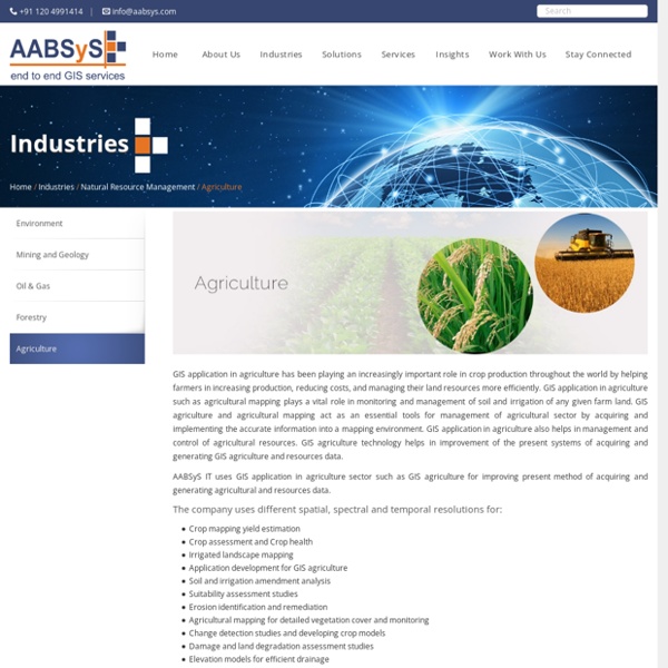
LiDAR Data Processing Services LiDAR technology enables the data capture on field by lighting the target using pulsed laser. As LiDAR also provides elevation data, it finds applications in several industries. AABSyS provides a wide range of LiDAR data processing services that helps in creating Digital Elevation Models (DEM), Digital Terrain Models (DTM) and Triangulated Inverse Networks (TIN) to provide highly accurate detail of the Earth’s surface. Typical LiDAR data processing services by AABSyS IT include: LiDAR data processing of electrical utilities Watershed delineation using LiDAR data processing techniques LiDAR data processing of forestry area LiDAR data processing of agricultural features LiDAR data classification /point cloud classification LiDAR data processing of oil and gas networks In addition, AABSyS also provides the following services on LiDAR data
Cadastral Mapping Services to create cadastral maps - AABSyS Cadastral mapping is a comprehensive register of the details related to the property of an area. These details include the precise location, dimensions, and other geographical classifications of the properties or individual parcels of land. The maps generated using cadastral mapping services help in effective management of public land records. National and local governmental bodies, architecture and engineering firms, real estate developers, industries can uses the cadastral mapping services for making well informed decisions. AABSyS IT provides cadastral mapping for creation of cadastral maps from hard copies of the administrative maps with specific details of each plot, roads, railway lines, water bodies, vegetation, etc. Scanning of hard copy mapsDigitization of the maps using proper layer structureGeo-referencing the individual mapsMerging the individual cadastral maps to a single map pertaining to a specific area
Municipal GIS Services for Municipality Tasks at AABSyS AABSyS has been working with the local and national governmental organisations for a long time now and understands the uniqueness and confidentiality of governmental work. Many government aided bodies are recurring clients of AABSyS, as AABSyS provides a unique platform for generating timely and cost effective deliverables. The work involves GIS services such as georeferencing, satellite image processing, image classification, digitization, attribution, theme creation, map preparation, data analysis and report generation, computer aided designing and drafting services and remote sensing services. A municipal GIS system is a GIS system which manages various tasks of a municipality such as property tax, birth and death registration, socio economic data management and holding registration amongst other tasks. Urban Infrastructure planning, development and analysis for the future infrastructure requires a robust municipal GIS system in place. Need Municipal GIS Services?
AutoCAD 2D & 3D Drafting services - AABSyS AutoCAD Drafting services assist real estate developers, architects, engineers and contractors in creating a computerised version of the blue print, design, layout etc. They are easy to store, edit and share and therefore have become popular mode of data digitisation. The services offer high accuracy with no loss of data. AutoCAD is one of the most common choice of platform of the customers worldwide for its easy, efficient and friendly tools. AABSyS offers the Auto CAD drafting services to real estate developers, architects, engineers and contractors all around the world. AABSyS can convert any original AEC Drawing into a perfectly accurate multi-layer AutoCAD drawing. Conversions including drafting services in different engineering fields, Creation of all type of as-built drawings for mechanical, electrical and plumbing sectors. Electric Utility Services
GIS for Water Distribution Network at AABSyS Water industry requires the assistance of GIS in many verticals. The judicious use and conservation of water is one of the most talked about topics on global platforms. Every country tries to ensure optimisation of water use by using technologies such as GIS for water. Apart from its everyday use, water can be used for multiple purposes and therefore is an important part of the various industries. AABSyS extensive expertise and experience in carrying out projects of the Water Industry using its GIS for water services. The GIS for water industry plays a proactive role in addressing, monitoring and managing the water pipe lines, outlets, etc. in times of emergency and calamities. Distribution Network Mapping of Valves Mapping of Distribution Points Leak History Data Trouble Call Analysis AABSyS has been working in providing GIS for water industry for more than 17 years now and has strong clients base in Europe, North America and Australia.