AutoCAD Drafting Services at AABSyS
AutoCAD Drafting services assist real estate developers, architects, engineers and contractors in creating a computerised version of the blue print, design, layout etc. They are easy to store, edit and share and therefore have become popular mode of data digitisation. The services offer high accuracy with no loss of data. AutoCAD is one of the most common choice of platform of the customers worldwide for its easy, efficient and friendly tools. AutoCAD has the import and export facility to all other advanced and high-end software in the field of CAD and GIS. AutoCAD ensures the
Forestry Mapping Services at AABSyS
Forestry mapping services such as Forestry GIS are often required by government and commercial agencies to perform value assessments for certification, funding, policy recommendations and regulatory compliances. Often, the forest-cover data available with the private and govt. agencies is dated and unreliable. This data is not helpful to the user, forestry GIS can enable creation of updated data. The fast paced growth and the effect of multiple industries have led to the need for a more precise and unique response to manage the forestry data. AABSyS IT’s forestry mapping services use Forestry GIS and other techniques to provide project specific solutions in the field of forest management, watershed management, desertification combat, biodiversity management, environmental monitoring and wildlife habitat encroachment. AABSyS IT’s Forestry GIS services use high end software such as ArcGIS, ERDAS Imagine/ER Mapper, MapInfo and AutoCAD Map, and ArcFM.
GIS for Oil and Gas
The growth and development of nations worldwide has led to a steep rise in the demands for oil and gas. This trend has led to the oil and gas mining industries to invest more in progressive and adaptive technologies like GIS for oil and gas. Crude oil and gas is now found in further deep across the earth’s surface than it was previously, and hence it is essential to use precise technologies like GIS for oil and gas for fuel exploration and appropriate utilization. GIS for oil and gas deals with large amounts of data daily such as data based on the geographic features of the site to data for well-logging, pipeline planning, etc., the data required to understand the impact of the project on the environment. GIS for oil and gas also helps in land management which includes working on centralisation of the data for report creation for regulators or for better analysis of the project.
Municipal GIS Services for Municipality Tasks at AABSyS
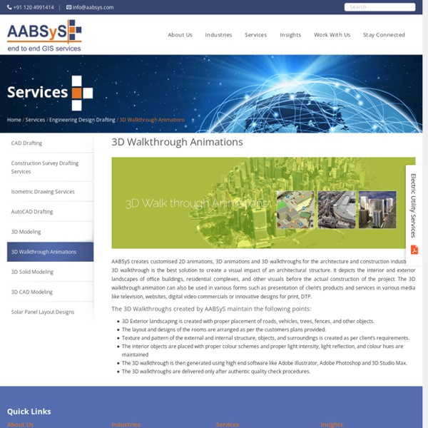
AABSyS has been working with the local and national governmental organisations for a long time now and understands the uniqueness and confidentiality of governmental work. Many government aided bodies are recurring clients of AABSyS, as AABSyS provides a unique platform for generating timely and cost effective deliverables. The work involves GIS services such as georeferencing, satellite image processing, image classification, digitization, attribution, theme creation, map preparation, data analysis and report generation, computer aided designing and drafting services and remote sensing services. The client’s requirements are paid utmost attention and the work is done in close co-ordination with the client. A municipal GIS system is a GIS system which manages various tasks of a municipality such as property tax, birth and death registration, socio economic data management and holding registration amongst other tasks. Need Municipal GIS Services?
Cadastral Mapping Services at AABSyS
Cadastral mapping is a comprehensive register of the details related to the property of an area. These details include the precise location, dimensions, and other geographical classifications of the properties or individual parcels of land. The maps generated using cadastral mapping services help in effective management of public land records.
GIS Application in Agriculture
GIS application in agriculture has been playing an increasingly important role in crop production throughout the world by helping farmers in increasing production, reducing costs, and managing their land resources more efficiently. GIS application in agriculture such as agricultural mapping plays a vital role in monitoring and management of soil and irrigation of any given farm land. GIS agriculture and agricultural mapping act as an essential tools for management of agricultural sector by acquiring and implementing the accurate information into a mapping environment. GIS application in agriculture also helps in management and control of agricultural resources. GIS agriculture technology helps in improvement of the present systems of acquiring and generating GIS agriculture and resources data.
Utility Mapping Services
Utilities industries relies heavily on geographic information system, remote sensing utility mapping services, and computer aided design and drafting technologies for well-timed and cost effective functioning. AABSyS IT has extensive experience and expertise in the utility mapping services and field data capturing of utility networks such as electrical, water, gas, sewage & telecom. AABSyS IT offers utility conversion services for utility supply lines such as water mains, data lines, telephone lines, power lines, gas mains, and sewer lines. AABSyS IT’s utility mapping services help in efficient designing, resource management, outage and distribution management, database planning and installations management, power line management and monitoring. The utility mapping services also helps in documenting the vital underground and overhead assets digitally.
Topographic Mapping & 3D Topographic Maps at AABSyS
Topographic mapping services helps in route planning, thematic data preparation, and decision-making for telecom and transport services and disaster management. The 3D topographic maps cover an area of approximately thousands of square kilometres and therefor require experienced expertise. AABSyS IT offers topographic mapping services to create comprehensive topographic maps and 3D topographic maps to the specified projection parameters, contours with ‘Z’ values, relief & planimetric details.
Parcel Mapping Services & Land Parcel Maps at AABSyS
Parcel Mapping is a process in which land parcels are created for efficient and effective land management. Parcel mapping service generates maps, created from base maps, with polygons that have details about the ownership of properties and other related information. The base maps used in parcel mapping are the cadastral maps showing each individual plots in different sub divisions. The land parcels are the fundamental data layer on which different data are referenced.