
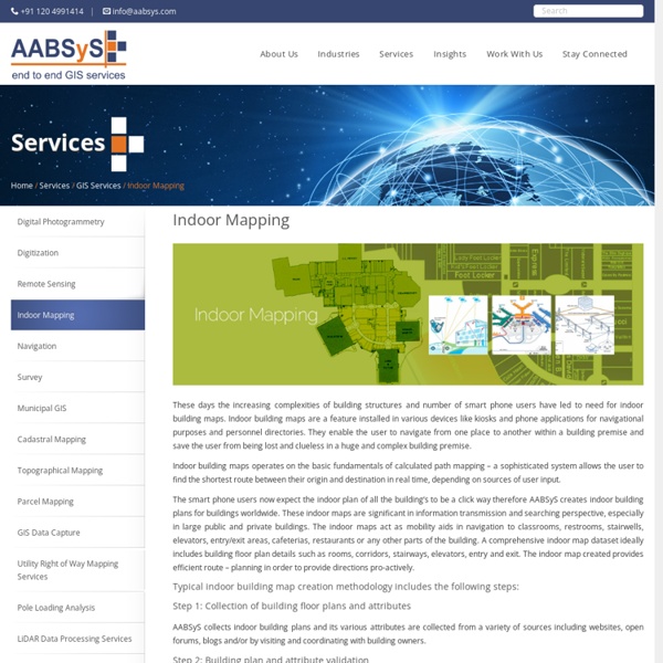
https://www.aabsys.com/services/gis-services/indoor-mapping-services/
Related: kalpanajain11 • ranjujain • Services & Application3d Walkthrough Animations at AABSyS The housing and urban development industry utilise CAD and GIS services provided at AABSyS to generate 3D Models that are useful in study, design and planning of constructed space. The Architectural 3D modeling services are important feature for understanding a building’s architecture. They assist in easy visualization of the exteriors of a residential house, apartment, office, restaurant, and hotel. The Architectural 3D modeling helps AABSyS’s customers to visualize the property for better decision making for selling, leasing, or renting out a house or an office. They present a powerful overview of the actual architectural structure before or after its construction.
Forestry Mapping Services at AABSyS Forestry mapping services such as Forestry GIS are often required by government and commercial agencies to perform value assessments for certification, funding, policy recommendations and regulatory compliances. Often, the forest-cover data available with the private and govt. agencies is dated and unreliable. This data is not helpful to the user, forestry GIS can enable creation of updated data. The fast paced growth and the effect of multiple industries have led to the need for a more precise and unique response to manage the forestry data. 3d Walkthrough Animations at AABSyS AABSyS creates customised 2D animations, 3D animations and 3D walkthroughs for the architecture and construction industry. A 3D walkthrough is the best solution to create a visual impact of an architectural structure. It depicts the interior and exterior landscapes of office buildings, residential complexes, and other visuals before the actual construction of the project. The 3D walkthrough animation can also be used in various forms such as presentation of client’s products and services in various media like television, websites, digital video commercials or innovative designs for print, DTP. 3D Exterior landscaping is created with proper placement of roads, vehicles, trees, fences, and other objects.
AutoCAD Drafting Services at AABSyS AutoCAD Drafting services assist real estate developers, architects, engineers and contractors in creating a computerised version of the blue print, design, layout etc. They are easy to store, edit and share and therefore have become popular mode of data digitisation. The services offer high accuracy with no loss of data. AutoCAD is one of the most common choice of platform of the customers worldwide for its easy, efficient and friendly tools. AutoCAD has the import and export facility to all other advanced and high-end software in the field of CAD and GIS. AutoCAD ensures the
GIS Application in Agriculture GIS application in agriculture has been playing an increasingly important role in crop production throughout the world by helping farmers in increasing production, reducing costs, and managing their land resources more efficiently. GIS application in agriculture such as agricultural mapping plays a vital role in monitoring and management of soil and irrigation of any given farm land. GIS agriculture and agricultural mapping act as an essential tools for management of agricultural sector by acquiring and implementing the accurate information into a mapping environment. Municipal GIS Services for Municipality Tasks at AABSyS AABSyS has been working with the local and national governmental organisations for a long time now and understands the uniqueness and confidentiality of governmental work. Many government aided bodies are recurring clients of AABSyS, as AABSyS provides a unique platform for generating timely and cost effective deliverables. The work involves GIS services such as georeferencing, satellite image processing, image classification, digitization, attribution, theme creation, map preparation, data analysis and report generation, computer aided designing and drafting services and remote sensing services. The client’s requirements are paid utmost attention and the work is done in close co-ordination with the client. A municipal GIS system is a GIS system which manages various tasks of a municipality such as property tax, birth and death registration, socio economic data management and holding registration amongst other tasks. Need Municipal GIS Services?
Cadastral Mapping Services at AABSyS Cadastral mapping is a comprehensive register of the details related to the property of an area. These details include the precise location, dimensions, and other geographical classifications of the properties or individual parcels of land. The maps generated using cadastral mapping services help in effective management of public land records. GIS for Electricity Network Mapping at AABSyS The fast pace of development and urbanisation has resulted in creation of new cities, townships etc. The new residential or commercial settlements require procurement of amenities such as well-planned out electricity lines that ensure smooth, hassle free transportation of electricity. The use of GIS for electricity has created much fervour in the utility industry. GIS for electricity, Remote Sensing, and CAD play an important role in designing, drafting, and planning of electricity supply lines within a township or from a power station in a time bound and organised manner. The maps of the concerned area are created use high end up-o-date software. The company works in multiple GIS for electricity and CAD formats and is therefore an ideally choice for clients worldwide.
Topographic Mapping & 3D Topographic Maps at AABSyS Topographic mapping services helps in route planning, thematic data preparation, and decision-making for telecom and transport services and disaster management. The 3D topographic maps cover an area of approximately thousands of square kilometres and therefor require experienced expertise. AABSyS IT offers topographic mapping services to create comprehensive topographic maps and 3D topographic maps to the specified projection parameters, contours with ‘Z’ values, relief & planimetric details.
Parcel Mapping Services & Land Parcel Maps at AABSyS Parcel Mapping is a process in which land parcels are created for efficient and effective land management. Parcel mapping service generates maps, created from base maps, with polygons that have details about the ownership of properties and other related information. The base maps used in parcel mapping are the cadastral maps showing each individual plots in different sub divisions. The land parcels are the fundamental data layer on which different data are referenced.
GIS for Telecommunication Requirement The customer, a leading Telecom Companies based in Middle-East Asia required AABSyS to provide assetization of a large Telecom Network project in the Middle-East. The main scope of the project included, capturing of conduit network, semi duct fiber network, direct buried cable and aerial cable.
GIS for Environmental Management at AABSyS The world is developing at an astonishing rate and while this development has aided in improving the quality of life, it has also escalated the unaccounted consumption of natural resources. GIS for Environmental Management acts as important management tool that helps in maintaining sustainability of natural resources, environment management. The environmental reforms and policies have grown leaps and bounds from the times of its foundation and therefore the use of modern technologies is inevitable. Modern day technologies like GIS for Environmental Management can help in understanding the effects on the environment from an inter-disciplinary aspect. This holistic approach is not only benefits the flora and fauna but also benefits mankind by achieving sustainable development using GIS for Environmental Management. Environmental Impact Assessment (EIA) studies which define the status of environment (like air quality, water quality data etc.).
GIS for Mining & Geology GIS at AABSyS The depletion of resources at a fast rate and implementation of policies that ensure sustainability of the resources have led mining and geology industry to realize the importance of technologies such as, GIS for mining and geology. While mining and geology industry is a traditional industry, the use of GIS for mining and geology has brought about a revolution by ensuring cost efficient and detailed studies of the concerned area. GIS for mining and geology helps in creation of maps that are an amalgamation of all the information regarding the concerned area. AABSyS GIS for mining and geology services use image analysis software packages such as ENVI, MultiSpec, ArcGIS, ERDAS Imagine / ER Mapper, MapInfo, AutoCAD Map and MicroStation to easily build focused and detailed spectral libraries tailored to the application requirements.
Application Development and Maintenance AABSyS helps you in implementing enterprise GIS solutions to maintain up-to-date data, geo-spatial analysis and accurate modeling right from establishing requirement, specifying and designing the application, implementation to operating and maintaining in GIS application development life cycle. AABSyS provides end-to-end custom applications which are developed based on specific needs and requirements regardless of their complexity. We understand the customer requirements and provide a complete solutions suite to deliver the functionalities preferred. Our workflow consists of the modules like requirements analysis, design, coding, and deployment. We understand the problems from the grass-root levels to deliver the solution. Our broad range of services includes Map Customization, Custom Tool Development, Integration Application Migration, Web GIS, and Mobile GIS apps. development etc.