
LizMap : Publier facilement des cartes web dynamiques - ReLucBlog. GeoWeb OpenSource. Blog Interopérabilité & GéoInformation. GIS, LI & Geospatial Technology: The Fall of the Tiled Map Image. Top 10 coolest softwares discovered at FOSS4G.
Rich Internet Applications, Flex, AIR, Java, Android. Extend GeoServer with customized OWS service. Recently I have been playing with GeoServer by following the online developer manual.
Everything went smoothly until I found the OWS service section of programming guide still remains empty. Just out of curiosity and the believe that the best way to learn GeoServer is to extend it with either a new or a similar existing functionality, I decided to create a fake OWS service end point (I call it 'ags-ows' service, which I will explain later) in GeoServer. This "ags-ows" service implements a minimum set of request parameters from ArcGIS Server RESTAPI for Map Service. To make it have more practical sense and also simple enough to fit in a sample a lot of optional parameters and details are omitted. The only function of "ags-ows" service is simply responding map images to an export request (in syntax of ArcGIS REST API) as below: Or To simplify the problem further, only following request parameters will be recognized and accepted: “bbox”, “layers”, “size”, “imageSR”, and “transparent” 1: <?
5: Implementations - GitHub. MapBox Launches TileStream Hosting and Announces the TileMill Appliance. You can now sign up for TileStream Hosting , our fast and fully managed hosting service for maps made with TileMill (or for any MBTiles files ). We've also released the first details on the TileMill Appliance , a plug in and go map design studio configured with TileMill and TileStream and built to run behind an office firewall or offline out in the field. TileStream Hosting is live now, and the TileMill Appliance will ship this summer - we're currently taking pre-orders.
These two offerings bring real commercial support and new functionality to the existing open source design tools from MapBox , and further our goal of making it easier to design and share highly custom, gorgeous maps to help people tell better stories with complex data. TileStream Hosting is a high performance map tile hosting service. The MapBox infrastructure is designed to serve map tiles incredibly fast across a globally distributed CDN, and it's highly redundant . It's also simple to use.
Tilecache.pdf (Objet application/pdf) Client Side Clustering. Suppose you have a few thousand points of interest (POI) that you would like to display on a Bing Maps map.
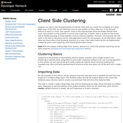
If the POIs are all relatively close to one another, as they often are, it can become difficult to select or hover over specific icons on the map because some are hidden behind other icons. One solution to this problem is server side clustering, in which code is written on the server side to handle grouping of close-together icons to improve usability. However, not everyone has the need or the time to develop a server side application solely for this purpose. As an alternative, when there are fewer than a few thousand locations on a map, client side clustering can be implemented instead of server side clustering, with limited performance issues. Note With the release of Bing Maps AJAX Control, Version 6.3, client side pushpin clustering can be done using the VEShapeLayer.SetClusteringConfiguration Method.
Clustering Basics Importing Data <! Listing 1. Handling Map Events Listing 2. <? Knowledge Cartography. Flex Open Source Geolocation Solutions: OpenScales and WMS/WFS Styling. Web Map Service (WMS) Vs Web Map Feature (WFS) OpenScales Flex API handles both WMS and WFS.
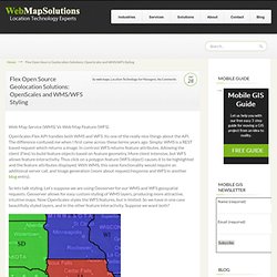
Its one of the really nice things about the API. The difference confused me when I first came across these terms years ago. Simply; WMS is a REST based request which returns a image. In contrast WFS returns feature attributes. So lets talk styling. Certainly there are ways to use one or other of WMS or WFS alone to provide styling and interactivity. The second problem is more challenging. Projects. Neogeo. GIS and Mapping with Drupal (OpenLayers and Geo module)
This session will be focused on demoing the new OpenLayers and Geo module.
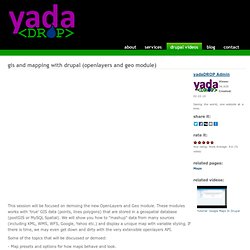
These modules works with 'true' GIS data (points, lines polygons) that are stored in a geospatial database (postGIS or MySQL Spatial). We will show you how to "mashup" data from many sources (including KML, WMS, WFS, Google, Yahoo etc.) and display a unique map with variable styling. If there is time, we may even get down and dirty with the very extensible openlayers API.