
Indicators for the Assessment of Historic Landscape Features for Landscape Indicators - Assessing and Monitoring Landscape Quality.
Informalize! Essays On The Political Economy Of Urban Form. Perchta.fit.vutbr.cz:8000/vyuka-gis/uploads/1/GIS-final2.pdf. Mapa migračních koridorů pro velké savce - Odborné publikace - Šelmy.cz. Autor: Petr Anděl, Tereza Mináriková, Michal Andreas Rok vydání: 2010 Kategorie: Odborná publikace Vydavatel: Evernia s. r. o., AOPK ČR Místo vydání: Praha Počet stránek: 2 Téma: Migrační bariéry a fragmentace Živočichové potřebují pro svou existenci nejen vhodné biotopy pro stálý výskyt, ale také krajinný prostor, ve kterém může probíhat jejich migrace a vzájemná komunikace populací.
Vhodnou modelovou skupinou pro návrh opatření na zachování průchodnosti krajiny jsou velcí savci. Základním ochranným opatřením je vymezení částí krajiny, které mají pro výskyt a migraci druhů zásadní význam. 1) Migračně významná území (MVÚ) – zahrnují oblasti stálého výskytu velkých savců i prostory potřebné k migraci a chrání propustnost krajiny jako celku. Old.ochranaprirody.cz/res/data/179/023151.pdf. CHKO Beskydy. Výsledky obrázků Google pro. Www.uake.cz/frvs/kapitoly_v_pdf/Podklady.pdf. HISTORICKÁ EKOLOGIE. Oficiální stránky zámku Hrubý Rohozec - Stará vyobrazení zámku. Show your ecoducts.
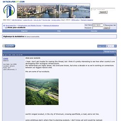
I hope i don't get trouble for making this thread, but i think it's pretty interesting to see how other country's are developping their ecological infrastructure. the netherlands are highly dense, like everyone knows, but since a decade or so we're working on connections between our biggest natural sites this are some of our ecoducts. world's longest ecoduct, in the city of hilversum, crossing sportfields, a road, and a rail line. some ambitious plan's where they're planning ecoducts, i don't know yet wich would be realised. show us how you're country is dealing with natural infrastructure, wich would be mostly ecoducts across highway's. and wich natural site's they connect. or wich natural 'highway' they are part of par example, europe's widest green bridge here, in switzerland.
SkyscraperCity - Powered by vBulletin. Download/Discussion Paper Green Infrastructure Aleksandra Sylwester.pdf. Towards a green infrastructure for Europe - Powerpoint Presentations. Webportal.nature.cz/wps/wcm/connect/7f006600465360d3a7f7efa958acf3df/KOR+Kniha_mala%5B1%5D.pdf?MOD=AJPERES&CACHEID=7f006600465360d3a7f7efa958acf3df. Www.uses.cz/data/sbornik09/Andel.pdf. Www.selmy.cz/data/publications/migracni-koridory-pro-velke-savce.pdf.
Cartography of Protest and Social Change. Neogeography. What do we search for when we look at a map?
What compels us to document the places we’ve seen or the experiences we’ve shared? Maps and photographs are encoded with histories, memories, and power. They tell stories. This is mine. When I first launched Google Earth in the fall of 2006, I followed the usual routine of most newbies. Formed by a necklace of coral outcroppings surrounded by shallow reefs, Enewetak atoll emerges unexpectedly from the vast blue Pacific Ocean. Air Marshall Islands flies a shuttle to Enewetak from the capital of Majuro every two weeks, but only when the one available aircraft is operational.
By nature of its remote location, scant resources, and history of military control, Enewetak atoll has remained largely invisible to most of the world. In one spot, the outline of a perfect circular crater plunges into the brilliant shallows of a coral reef; its shape is mirrored in a gray circle on an adjacent island. I am six years old.
Krajinné plánovanie. Pearltrees videos. Getting started.