
3D print your favorite map tile. 8-Bit Map Maker. Apprendre à utiliser ArcGIS. ArcGIS Online. ArcGIS Story Maps. BatchGeo. Bing Maps. CalTopo. CartoGraf. EarthExplorer. European Digital City Index · EDCI. EOSDIS Worldview. ESA Landsat 8 Web Portal. FacilMap. Field Papers. Framacarte. Free GIS Datasets. Free Map Tools. GéoGratis. GeoGreeting. Geomask. Géoportail.
Georigami. Global Visualization Viewer. Google Earth Map Overlays. Google Maps Canada. Google Maps France. Greg's Cable Map. Heganoo. HistoMap Berlin. History in Motion.
Historypin. How did you contribute to OpenStreetMap ? IDECanarias - Visor. Imagery Offset Database. Khartis - cartographie thématique. Le contenu de ce site internet est fourni par : Sciences Po 27 rue Saint-Guillaume 75337 Paris Cedex 07 Tel. : 01 45 49 50 50 Fax. : 01 42 22 31 26 webmestre@sciencespo.fr Directeur de la publication : Frédéric Mion, administrateur de la Fondation nationale des sciences politiques et directeur de l’Institut d’études politiques de Paris.
Hébergement : Ce site internet est hébergé par la Fondation Nationale des Sciences Politiques (FNSP), Sciences Po - Direction des Systèmes d'Information Code APE : 803Z 27, rue saint Guillaume 75337 Paris cedex 07 Propriété Industrielle et Intellectuelle : Toutes les informations reproduites dans ce site web (textes, photos, logos...) sont protégées par des droits de propriété intellectuelle détenus par Sciences Po ou par ses partenaires. Les liens hypertextes Informatique et Libertés Droit d'accès, modification suppression des données personnelles vous concernant : Photographies et icones. L'Atlas du Canada - Toporama. Majormap.
Maki Icons. Map Channels. Map Icons Collection. Map Icons Designer. Map Warper. Mapbox Studio. MapChart. MapContrib. MapEnvelope. MapFab. MapHub. MapJam.
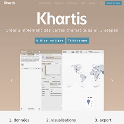
MapMaker. Mapme. Mapping History. MapQuest. Mapskin. Maputnik. MayaArch3D. A web-based 3D GIS for archaeological research The MayaArch3D Project has built a virtual research environment for the documentation and analysis of complex archaeological sites —specifically, it is a web-based, 3D-GIS that can integrate 3D models of cities, landscapes, and objects with associated, geo-referenced archaeological data.
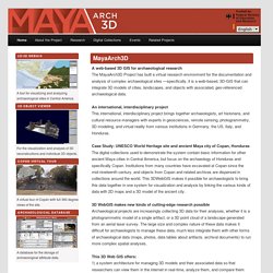
An international, interdisciplinary project This international, interdisciplinary project brings together archaeologists, art historians, and cultural resource managers with experts in geosciences, remote sensing, photogrammetry, 3D modeling, and virtual reality from various institutions in Germany, the US, Italy, and Honduras. Case Study: UNESCO World Heritage site and ancient Maya city of Copan, Honduras The digital collections used to demonstrate the system contain basic information for other ancient Maya cities in Central America, but focus on the archaeology of Honduras and specifically Copan.
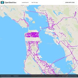
NatGeo Mapmaker Interactive. Newspaper Map. NowCOAST. NUKEMAP. Omnes Viae. OpenHistoricalMap. OpenSeaMap. OpenStreetMap France. OpenStreetView. Effective as of Please read these terms and conditions of use ("Terms of Use") carefully before you access and u e OpenStreetView, an application developed by Telenav, Inc.
("Telenav"). Your access and use of OpenStreetView indicates that you accept these Terms of Use. If you do not accept these Terms of Use, do not access or otherwise use OpenStreetView. These Terms of Use represent the agreement ("Agreement") between you and with respect to OpenStreetView. Telenav may revise these Terms of Use at any time, with or without notice to you. OpenStreetView OpenStreetView is an application developed by Telenav that collects, stores and distributes georeferenced street view imagery with the purpose of helping the OpenStreetMap® ("OSM") community improve the quality of the map data.
Account Information Open Source License OpenStreetView consists of an iOS application, an Android application and a Website-based application from www.openstreetview.com). User Contributed Content Termination. OpenTopography. ORBIS. OSM go. PDF Quads - Trail Maps. FREE Printable USGS PDF TOPO!
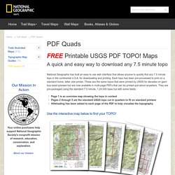
Maps A quick and easy way to download any 7.5 minute topo National Geographic has built an easy to use web interface that allows anyone to quickly find any 7.5 minute topo in the continental U.S.A. for downloading and printing. Each topo has been pre-processed to print on a standard home, letter size printer. These are the same topos that were printed by USGS for decades on giant bus-sized presses but are now available in multi-page PDFs that can be printed just about anywhere. Pixel Map Generator. Plane Finder. Plus code. Rail Map online - UK & Ireland. Scribble Maps.
SIANE. SnapMap. Stamen Maps - Burning Map. Stamen Maps - Terrain. Stamen Maps - Toner. Stamen Maps - Watercolor. The Terrainator. Tile Exporter. uMap. UMapper. US News Map. What3words. Wikimapia.