
Weather Radar Technology Beyond NEXRAD. Interactive Weather and Wave Forecast Maps. Gulf Storm Update & A Tropopause Curiosity 8/31/2011.
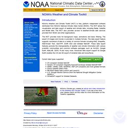
Dam Weather Report 9/1/2011 AM. Meet Katia 9/1/2011 800PM. Weather Update 9/5/2011. Historic Flooding Orders over 100, 000 Mandatory Evacuations for NE Pennsylvania. Paul Douglas on Weather. Jet Stream Position. Department of Atmospheric Sciences - Weather Center. Satellite and Radar Data. S Weather and Climate Toolkit Tutorial. NOAA's Weather and Climate Toolkit (WCT) is free, platform independent software distributed from NOAA's National Climatic Data Center (NCDC).

The WCT allows the visualization and data export of weather and climate data, including Radar, Satellite and Model data. The WCT also provides access to weather/climate web services provided from NCDC and other organizations. The WCT provides tools for background maps, animations and basic filtering. The export of images and movies is provided in multiple formats.
The data export feature supports conversion of data to a variety of common formats including KMZ, Shapefile, Well-Known Text, GeoTIFF, ESRI Grid and Gridded NetCDF. Current data types supported: CF-compliant Gridded NetCDF Generic CF-compliant Irregularly-Spaced/Curvilinear Gridded NetCDF/HDF GRIB1, GRIB2, GINI, GEMPAK, HDF (CF-compliant) and more gridded formats GOES Satellite AREA Files NEXRAD Radar Data (Level-II and Level-III) U.S. EOL data server: Codiac: projects. Www.ncdc.noaa.gov/oa/about/open-access-climate-data-policy.pdf. Chemtrail Hazard Map for July 11, 2011 Purple & White Chemtrails over my house - 7/9/11 WunderMap Interactive Radar & Weather Stations. Canadian Rings n Things 7/09/2011 ALERT! South Dakota North of or Near Big Bend Dam Storm Cell DAVID ICKE - THE BATTLE OF BRITAIN HAS BEGUN IN THE CHEMTRAIL INFOWAR
Texas, Louisiana, Carolinas HAARP ring outbreak New World Order Chemtrails & Olgacom connection explained. Things to see along the way. Sismo de 6 grados de magnitud alarmó a pobladores de Tacna. Katia, Stronger, Slower to Brush E Bermuda, RI & Halifax NS Unless.... Dutchsinse's Channel Saint Louis Missouri 4.2 earthquake HAARP PROOF and PROVING that HAARP RINGS AND BEAMS ARE REAL!!!! TIME LAPSED and RADAR FOOTAGE!!!
04-06-2011 - Hurricane Chemtrails!? - Severe Weather US - Radar Alerts DOPPLER or HAARP? Beam Attack USA - 06-03-2011 Dam Weather Report 9/3/2011 AM. HAARP Ring outbreak ND, SD, NE, MN, WI, MI, OH, TN, WV, NC, PA. The Dam Weather and Radar 9/2/2011 PM. The Dam Weather Report 8/31/2011 AM. Alert: Storm Potential Gulf of Mexico 8/30/2011. UPDATE: Heads Up - Large Storm System off Central East Coast 9/1/2011. Weather - Visible Water Vapor - GOES West Current. US FLOODS UPDATE: 06-03-2011- Unprecedented Flooding Never Seen Before Nuclear Event US - "Unusual" Low Level Emergency - Fort Calhoun Nuclear Station- Nebraska US FLOODS UPDATE: Mandatory Evacuations - Levee Breech Expected - Missouri-Iowa Border Scalar Engineered Severe Weather Predictable from HAARP Radar Returns (Daily Update, Began May 25, 2011)
Japan: Fake Morphing Clouds Drop Black and White Balls Over Fukushuma Daiichi Native American Flute - Singing Bowl - Yoga Music - Relaxation - Sleep New Gulf Storm, Huge Rings: NOLA, Panama Beach, Tallahassee, St' Pete's FL. Katia & The Gulf 9/2/2011 800 PM. Rings & Things - Look for Severe Weather 24-48 Hours 9/1/2011.