
Earth Outreach Before You Begin In order to complete this tutorial, you will need some text, photo and video content to add to your tour. You can use your own text, photos and videos, or you can use the sample content provided by our friends at the Jane Goodall Institute (JGI). Just download the zip file below and extract the contents to a folder on your desktop. Tour_Builder_JGI_sample_content.zip (530k Zip file) Prerequisites To use Tour Builder and create your own tour, you will need a computer with internet access and ideally a web browser which supports the Google Earth Plugin. Click here for more information about the Google Earth Plugin and a list of platforms which currently support it. Let's Get Started! Access Tour Builder by pointing your browser at the URL below: In this section we’ll take a look at the home page and all of the things you can do with Tour Builder. Tour Builder Homepage The first page you will see is the Tour Builder homepage. Signing In Home button
StoryMap JS - Create a Mapped Story to Save in Google Drive StoryMap JS is a nice tool for creating mapped stories. On StoryMap JS you create slides that are matched to locations on your map. Each slide in your story can include images or videos along with text. StoryMap JS integrates with your Google Drive account. Applications for Education One of the best examples of StoryMap JS for classroom use is found in the Manifest Destiny storymap featured on the StoryMap JS homepage.
Tutorial | Mapping Cinematographic Territories Adam’s Wall (director Michael MacKenzie, 2008) This tutorial is a step-by-step guide to help anyone map her own narrative through our AtlasCine application and share it with friends, family and colleagues (see examples here: A more detailed description of this application is also available in the following paper “How can we map stories? A cybercartographic application for narrative cartography” (2014) by S. Caquard and J.P Fiset. This application has been developed using a range of software (Open Source and Proprietary), including Google Drive. The first step is to duplicate the database template in order to develop your own database: The template is currently stored in our account and you will only be able to edit if you copy into your Google drive. 2. The size of this point will be defined by the column “time” (note: it is important to respect the format used for the time columns (HH:MM:SS). 1. =geocode(A2) 2. Sheet “Options” Sheet “Types”
Anywhere out of the world 2015 Les premières L de l’Iroise se sont emparés du monde par la poésie et la cartographie ! « Pour l’enfant, amoureux de cartes et d’estampes, / L’univers est égal à son vaste appétit. » (Charles Baudelaire) A la manière de Baudelaire dans son poème en prose "Anywhere out of the world", mais avec les outils du 21e siècle, les lycéens du projet i-voix ont été invités à dialoguer avec leur âme et à cartographier leur imaginaire : ils ont composé collectivement Anywhere out of the world 2015. Chacun a exploré la destination de son choix via Google Maps et le web, écrit à son sujet un texte en prose d’inspiration baudelairienne, enrichi ce texte d’un montage photo ou audio, fixé sa rêverie poétique sur le blog i-voix et sur une carte collaborative en ligne. Ils vous invitent à leur tour à voyager avec eux ! Cliquez ici pour accéder à la carte « Anywhere out of the world 2015 ». Cliquez ici pour accéder aux textes sur le site i-voix. « Maintenant : tenant en main le monde » (Michel Serres)
Custom Google Maps Style Tool | Think Tank A tool for playing around with Google Maps colours and generating the styling code. The generated Google Maps code can be copied from the bottom of the page. Colours can be controlled with sliders below or by entering a hex value. Tags: api, custom, google maps, maps, styles Written by Myke Cook Mike is a web developer at Evoluted. Like this article? Styling Google Maps Map Stylr is a new Google Maps API Styled Maps wizard that can help you create a unique style for your own Google Maps. Map Stylr includes the Styled Maps wizard and a showcase of styles created by users of the site. The Map Editor allows you to customize the presentation of the standard Google base maps, changing the visual display of such elements as roads, parks, and built-up areas. Instead of using the Map Editor tool you can use the Map Stylr 'showcase' to select from styles created by other map developers. If you want a nice map style for your Google Map but don't want to go to the effort of creating your own unique style then you can find some great map styles on Snazzy Maps. Once you find a map style that you like you can click on its title and grab the style array. Designmodo has also created a nice Google Maps styled maps wizard. The wizard is a handy tool for anyone who wants to experiment with a flat UI style in their Google Maps projects.
un outil de narration cartographique innovant ? Le récit de son espace vécu Il est possible de lier cette cartographie de l'espace vécu avec la notion d'habiter : prélèvement de données sur le terrain, vision de son propre espace de vie (avec une dimension subjective qui rejoint en partie la cartographie sensible). Le prélèvement de données sur le terrain peut se faire avec une application telle que Tactileo Map On peut utiliser également Oruxmaps Une piste de mise en oeuvre pédagogique : La rue Vui Bien, un hyper-lieu ? La mise en récit numérique du territoire : l'agence Urban Expé propose des pistes pour développer des expériences urbaines à créant des liens narratifs avec son territoire. Réaliser une carte sensible de son collège et représenter les zones jugées insécures. Venez découvrir le quartier Paris Rive Gauche. Chicago HomeStories Project : parti de Chicago, le projet encourage les citoyens du monde entier, par des marches civiques, à en savoir plus sur leur quartier. Le carnet ou le journal de voyageLe récit littéraire 2. 3. 4.
Circuit mondial de la noix de cajou Le porte-conteneurs, vecteur de la mondialisation.8- Que peut transporter un porte-conteneurs ?Découvrir l'un des plus gros porte-conteneurs du mondeQuelle est sa capacité en conteneurs ?9- Pourquoi peut-on dire que le conteneur est un élément principal de la mondialisation ? Quels sont ses avantages pour le transport ? Quick tips for mastering the ArcGIS StoryMaps builder Whether you’re new to ArcGIS StoryMaps or have been using it since its days in beta testing, there’s always room to improve your storytelling skills. This list of short, simple tips will help you get the most out of the story builder, especially when it comes to smaller features you may have overlooked. I’ll be adding more tips periodically, too, so be sure to check back every now and again if you find these tidbits helpful. Add media to a minimal cover The minimal cover is a great option for how-to articles, thought pieces, or press-release-style updates. In your story, open the design panel, select Minimal from the list of cover options, and close the design panel. Hide a story’s published date While the StoryMaps builder will automatically update the date in your story’s cover every time you publish, you have the ability to hide this information if you’d prefer. To remove the published date from your cover, open the story builder and expand the More actions menu in the story header.
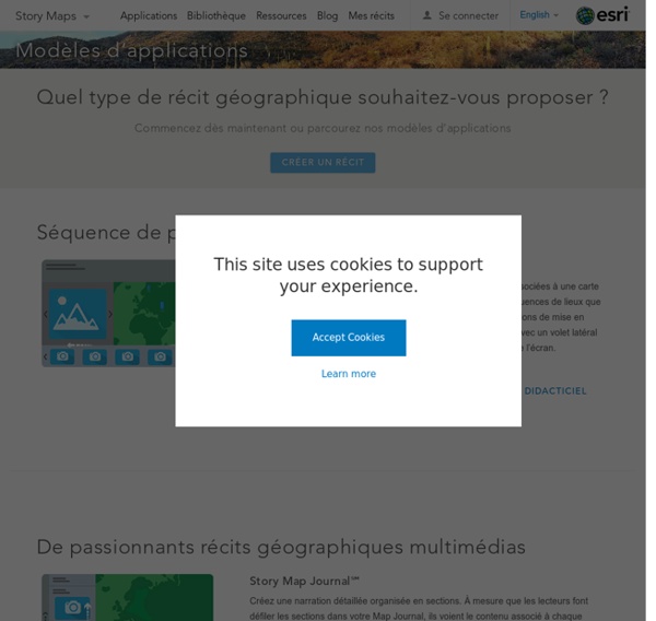
cartenarrative par emmanuelle.benejam sur Genially Index 2.ArcGIS Classic StoryMaps 1.ArcGIS StoryMaps 3.Édugéo 4.Google Earth Project 5.Tableau comparatif 6.Liens utiles ArcGIS Classic StoryMaps - L'inscription - Voir la mise en oeuvre sur "La patate dans tous ses états" - Voir la mise en oeuvre sur Port Grimaud - Accès à Arcgis Classic Storymaps - Voir la mise en oeuvre sur "L'industrie aéronautique à Toulouse"" Choisir son modèle de narration Story Map TourProposez à votre public une visite guidée de photos ou vidéos, qui sont associées à une carte. Story Map JournalCréez une narration détaillée organisée en sections dans un volet latéral déroulant. Story Map CascadeCréez une narration déroulante plein écran détaillée et immersive. Story Map SeriesPrésentez une série de cartes ou d'autres contenus via des onglets, des puces numérotées ou notre commande "d’accordéon latéral". Story Map ShortlistPrésentez des sites d'intérêt organisés en jeu d'onglets. ArcGIS StoryMaps - Voir la mise en oeuvre sur Les Territoires Ultramarins - Accès à Arcgis Storymaps jsp
Esri France - Les solutions SIG (Système d'Information Géographique) et cartographiques - Tutoriels ArcGis Learn more about this provider __anon_idCollects visitor data related to the user's visits to the website, such as the number of visits, average time spent on the website and what pages have been loaded, with the purpose of displaying targeted ads. Expiry: PersistentType: HTML i/jotSets a unique ID for the visitor, that allows third party advertisers to target the visitor with relevant advertisement. Expiry: SessionType: Pixel LogsDatabaseV2:V#||LogsRequestsStorePending Expiry: PersistentType: IDB ServiceWorkerLogsDatabase#SWHealthLogNecessary for the implementation and functionality of YouTube video-content on the website. VISITOR_INFO1_LIVETries to estimate the users' bandwidth on pages with integrated YouTube videos. Expiry: 180 daysType: HTTP YSCRegisters a unique ID to keep statistics of what videos from YouTube the user has seen. Expiry: SessionType: HTTP yt.innertube::nextIdRegisters a unique ID to keep statistics of what videos from YouTube the user has seen. YouTube
Le bassin du Congo, deuxième puits de carbone du monde, entre préservation et exploitation Le bassin du Congo regorge de ressources naturelles, plus ou moins rares et recherchées. L’exploitation de minerais, dont certains sont fortement demandés par l’industrie technologique et numérique, est l'une des principales sources de revenus pour les Etats présents dans cette zone. En 2019, le secteur minier représentait 91 % des exportations de la RDC, essentiellement composées de cuivre et de cobalt. Même si l’exploitation pétrolière reste pour l’instant secondaire (hors exploitation offshore), des contrats pétroliers, pas encore exploités, ont été attribués dans des aires protégées d’Afrique centrale. Au Gabon, dix-neuf contrats pétroliers recouvrent 11,1 % de la superficie des réserves naturelles nationales. Concessions forestières Concessions pétrolières Exploitation de minerais