Street View goes to the Amazon
With Google Street View, you can do amazing things such as hike around Stonehenge or even ski down Whistler’s slopes—all without leaving home. Soon, you’ll be able to float down the Amazon and Rio Negro Rivers of northwest Brazil and experience some of the most remote and biodiverse areas in the world. A few members of our Brazil and U.S. Street View and Google Earth Outreach teams are currently in the Amazon rainforest using our Street View technology to capture images of the river, surrounding forests and adjacent river communities. We’ll pedal the Street View trike along the narrow dirt paths of the Amazon villages and maneuver it up close to where civilization meets the rainforest. Image of the Tumbira community in the Rio Negro Sustainable Development Reserve Image of the Tumbira Community View Larger Map Click the above album for more photos of our team's work in the Amazon, and the communities with which they're working.
ニュースはスマホで読む時代。ニュースアプリまとめ8選
さいきん、日々のニュース閲覧の主力となりつつあるスマホ向けのニュースアプリ。 つい半年くらいまえまでは「ニュースはRSSリーダー最強!」...とか言ってたような気もしますが、Googleリーダーの終了とともにいっきに風向きが変わった感じです。 今回、TABROIDでレビューしているアプリの中でも、とくに人気のあるニュースアプリを集めてみました。 ビジュアルで魅せる! メイン画面に大きなグラフィックを並べるタイプ。 読みたいニュースを自動で選んでくれる 厳選されたニュースを、いちどに30個ほどおすすめしてくれるアプリ。 さらっと読みたい! ニュースを読む前に、200文字くらいの「要約」をチェックできるアプリ。 安心感のある大手ニュースサイト公式アプリ 大手ポータルサイトのニュースアプリ。 おまけ:RSSは死なず とにかく大量のニュースをチェックするなら、いまだにRSSにかなうツールはありません。 (TABROID編集部:金本太郎/元記事を読む) 2013年NEWモデル! SANYO NEW eneloop 急速充電器セット(単3形4個セット) N-TGR01AS三洋電機
Google adds Helicopter view to Google Maps
Google adds Helicopter view to Google Maps Google Maps are now enabled with helicopter view which allows you to view the route in an interactive 3d animation that can be paused and replayed too. Although only a select few might actually travel using a helicopter but helicopter view gives a nice aerial view of the area you will be passing through. User can choose any mode of transport and then choose to view the 3D animation of the route. If you like a particular area in your travelling route, you can pause the 3D animation and can explore that particular area in detail. Google Maps Engineer ‘Paul Yang’ posted on Google Lat Long Blog “Getting directions is one of the most popular features on Google Maps, whether it be for driving, walking, biking or transit. Step1 : Plan the route To view any route in Helicopter view, firstly go ahead and search for a route for e.g “Statue of Liberty, NY to Times Square Towers, New York, NY” and click ‘Get Directions’. Tagged as: Google
Google Takes Street View Photography into the Wild with Camera Backpacks
Google has already photographed quite a bit of our world using a fleet of cars, submarine-style cameras, tricycles, and snowmobiles, so what else is there to include in Street View? Places where vehicles can’t go, of course. The company has begun capturing 360-degree imagery using the Trekker — a special backpack with a Street View camera rig sticking up from the top. The special new 40-pound rig will allow Street View to include panoramas from places like mountains, jungles, hiking trails, ancient ruins, and much more. Google published this short teaser for the rig back in June to give the world an idea of what it’s planning: Nathan Olivarez-Giles of Wired explains what the rig comprises and how it works: The Trekker is basically a smaller version of the equipment the Google uses in its Street View cars — a cluster of 15 camera lenses, each respective lens with a resolution of 5 megapixels, shooting a photo every 2.5 seconds. (via Google Lat Long via Wired)
Prague - 34 Gigapixel Panorama Photo
About this photo This panoramic photo of Prague, Czech Republic was created from 2600 individual photos. These images were stitched together into a single, seamless 360° image which is 260,000 x 130,000 pixels. To navigate the image, click and drag your mouse inside the image. The panorama was shot in May 2013 from the top of Petrin Tower, using a Canon 1-Dx. You can see our other world record gigapixel images we have made of Prague, London, and Tokyo. If you would like us to create a large gigapixel panorama like you see here, please contact 360Cities. Creative Commons This is the first-ever Creative Commons-licensed gigapixel image in the world. To download the entire panorama, use a BitTorrent client such as UTorrent, and then open the .torrent file. You mean, You're giving away this image for FREE? I am free to do anything I want with it? Blog Post describing a trip to Prague Online article discussing the growing popularity of panoramic and gigapixel photography Press Why did we make it?
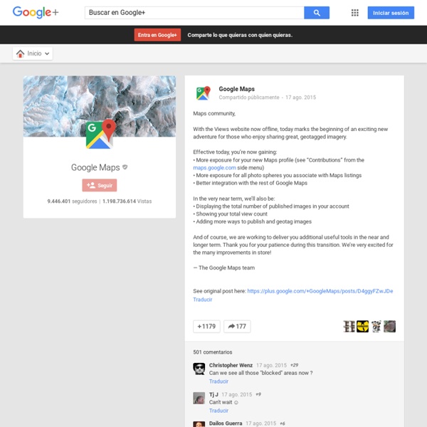
Google Maps Mania
キゾアプレミアムの様々な特典
キゾアではプレミアム会員のみの特典を多数ご用意しております。キゾアプレミアムをご使用になれば、それらの特典をご自由にお楽しみいただけますので、より多彩なアニメーション、効果、切り替え効果などを使用してハイクオリティーなフォトムービーを作成していただけます。 キゾアプレミアムを購入すると、以下の特典をお楽しみいただけます: スライドショーにご自分のMP3を加えることができます。 キゾア上には無料の音楽を数多く取り揃えておりますが、キゾアプレミアムを使用すればご自分のお気に入りの音楽をスライドショーに挿入することができ、より個性的なフォトムービーを作成することができます。 作成したフォトムービーをDVDに焼くことができます。 フォトムービーをビデオに変換していただけます。 スライドショーに複数の音楽を追加できます。 容量無制限で写真の保管をしていただけます。 スライドショー作成の際、プレミアムの特典全てを使用していただけます。 HD(ハイ・ディフィニション)フォーマットのダウンロードも可能です。 レタッチアトリエの効果やフィルターを全てご使用いただけます。
Roadfood.com - The most memorable local eateries along the highways and back roads of America
Windows ストア の Windows 用 リモート デスクトップ アプリ
日本語 (日本) と 109 のその他の言語
I Went on a Wizard Quest
A few months ago, I had the most fun I have ever had in my entire life at a place called Wizard Quest in Wisconsin. I've been trying to explain exactly what it is to people ever since, but haven't had much luck. According to their website, it's a "13000-square-foot fantasy-themed labrynth (we call it the quadrasphere)." If you intend to visit this place in the near future, maybe don't read this blog. These photos make this place look crappy, but that's just because I didn't realize I'd be blogging about Wizard Quest, so the camera I took along wasn't really up to the job. Anyway, this is where our adventure started: in a library room with talking, mystical plasma screen picture frames. Once the mystical plasma screens had explained our mission to us (something about freeing four wizards trapped in elemental realms) this bookcase opened up into a "vortex tunnel." And we were welcomed into the magical kingdom!!!!! Or, if your vagina is too large, by going down these stairs. And yayyyyyy!
Google