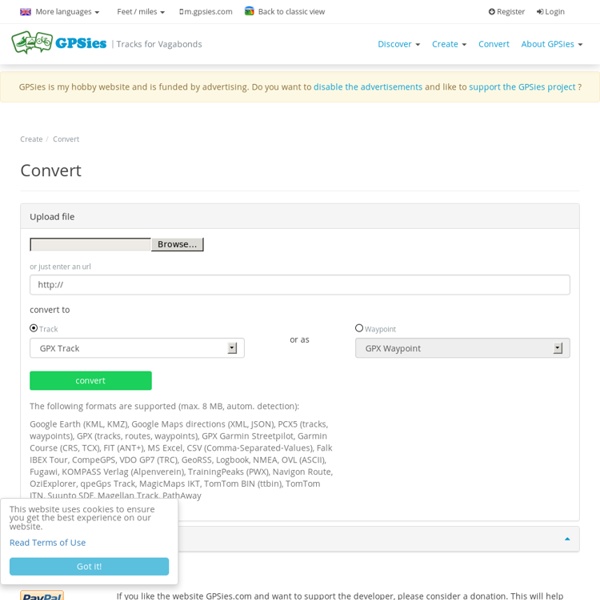
GPS Tracks, GPS Trajets, GPS Convertisseur Convertir
Natation pour tous : vidéos, cours et entraînements
Akoah - Sports Aquatiques Equipement pour les Sports Aquatiques en Natation, Sauvetage, Aquagym
Articles et matériel de plongée et de natation - Bubble Diving, spécialiste de la plongée technique
Related:
Related: