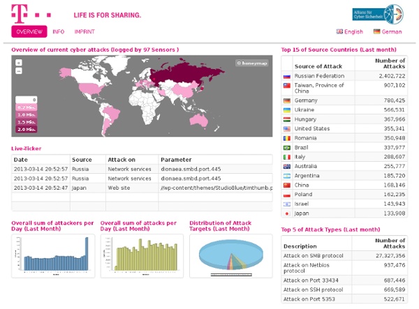


Breathingearth - CO2, birth & death rates by country, simulated real-time SparkleShare - Self hosted, instant, secure file sync HoneyMap Wolfram|Alpha Personal Analytics Connect with Faceook, sign in for free, and get unique, personalized information anad analysis on your social data-computed by Wolfram|Alpha Clustering of your friends What are the groups of friends that make up your network? How do these groups relate to each other? Where in the world are your friends? Where do your friends live? Your network's global reach Who lives farthest from you? How popular are your friends? How many friends do your friends have? What do you talk about on Facebook? The bigger the word, the more often it's used in your conversations. When do you use Facebook? When are you most active? Where are your friends at in life? Do your friends' ages reflect what kinds of relationships they're in? Explore the structure of your friend network How do your friends connect you to your other friends? Who plays the special roles in your network? How are your friends tied together? Your most popular photos What is your most liked photo? Get a new perspective on your friends
World Sunlight Map Watch the sun rise and set all over the world on this real-time, computer-generated illustration of the earth's patterns of sunlight and darkness. The clouds are updated daily with current weather satellite imagery. The Mercator projection used here is one way of looking at the spherical earth as a flat map. Used since the 16th century for navigation, straight lines on this map can be used accurately as compass bearings but the size and shape of continents are distorted. Compare this with Peters, Mollweide or equirectangular projection maps. Also available is a semi-realistic view of dawn and dusk from far above the Earth, a look at the moon, and information about how this works.
Web Reflection: HTML5: How To Create Downloads On The Fly this is a quick one I have implemented already in fuckn.es in the create angry memory button logic ... The New Download Attribute Hopefully soon, most updated browser will implement the download attribute in hypertext links (aka: tag) The quick summary is this one: The download attribute, if present, indicates that the author intends the hyperlink to be used for downloading a resource. And this is a basic example: click here to <a href="resource234.txt" download="license.txt" > download the license </a> What Is Download For Well, I am pretty sure you have read at least once in your life this kind of extra info beside a link: right click to download the content and "Save As ..." Create Downloads On The Fly Via JavaScript When I have read about it, I have instantly realized the potentials of this attribute combined with inline data uri scheme. Only HTML5 ? Nope! Downlaod Canvas As Image Example First example is a classic one: how to save a canvas snapshot as image via "click". Save A Page As PDF
Arbor Networks | ATLAS Dashboard: Global Orwell vs Huxley « À gauche, Aldous Huxley avec son roman "Le Meilleur des mondes". À droite, George Orwell avec "1984". Tous les 2 ont dépeint ce qu'ils imaginaient pour la société future dans leurs romans de SF. Bien des années après, beaucoup pensent que ça y est, nous sommes en plein 1984. Mais est-ce vrai ? La vérité se trouve peut-être un peu entre tout ça. Source Rejoignez les 54792 korbenautes et réveillez le bidouilleur qui est en vous Suivez KorbenUn jour ça vous sauvera la vie.. Map Tunnelling Tool Tunnel to the Other Side of the Earth Have you ever wondered which part of the other side of the earth is directly below you? Find out using this map tunnelling tool. Map Tunnelling Tool Options Unlink Zoom between Map 1 and Map 2 How to use the Map Tunnelling Tool Drag map 1 or 2 by clicking and holding the map as you move it. To make things easier, you can also zoom the map in and out. You can adjust the height of the map by using the small, medium and large buttons. You can also change the map view using the Map, Satellite and Hybrid buttons. About This is a Antipodes Map. Version History 9th March 2014 - Update to fix bug with crosshairs not appearing on the exact centre of the map 11th November 2013 - Implemented Google Maps API V3 21st September 2009 - Removed border around maps for better fit 14th January 2009 - Added Unlink Zoom option 22nd October 2008 - Added dual control so both maps can be the "driver" and the "passenger". Future Developments Relevant Links Google Earth Tunnelling Tool
Virus Tracker Sinowal Active Sinowal Domains Today: Virus Tracker Botnet monitoring Virus Tracker was created to track and monitor some of the largest botnets (with a focus on financial malware botnets). Malware Domain Blacklist By reverse engineering malware and their Domain Generation Algorithms (DGAs), we have compiled a domain blacklist of guaranteed malicious domains. Classify Domains Please enter one domain per line. Ciné-Club - "Brazil" de Terry Gilliam (1985) Cycle : Les Dytopies urbaines dans le cinéma de science-fiction : 5 Amphi Ciné - École Spéciale d’Architecture. "Dans Brazil, le machinisme a pris le pouvoir au cœur d’une société futuriste totalitaire. Le dérèglement d’un ordinateur propulse un fonctionnaire modèle dans une aventure infernale. Tout cela dans un univers de tuyaux, de pompes géantes, une sorte de ville-poumon gigantesque. C’est essentiellement, l’aspect politique de l’architecture qui a intéressé Terry Gilliam, celle de la volonté politique de l’espace, dans la manière d’organiser géographiquement les lieux et donc les déplacements des gens, de limiter et d’autoriser ces déplacements. Plus d’infos sur le CinéClub
SKY-MAP.ORG