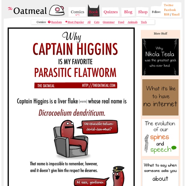
Why Captain Higgins is my favorite parasitic flatworm
Interactive
The World of Seven Billion The map shows population density; the brightest points are the highest densities. Each country is colored according to its average annual gross national income per capita, using categories established by the World Bank (see key below). Some nations— like economic powerhouses China and India—have an especially wide range of incomes. But as the two most populous countries, both are lower middle class when income is averaged per capita.
How to Suck at Facebook
All artwork and content on this site is Copyright © 2015 Matthew Inman. Please don't steal. TheOatmeal.com was lovingly built using CakePHP All artwork and content on this site is Copyright © 2015 Matthew Inman. Please don't steal. TheOatmeal.com was lovingly built using CakePHP
Life in the Year 2050
More Infographics on Good
How to use a semicolon
Joe Gregorio | BitWorking | Projects | Sparklines
If you do this in an email, I hate you
All artwork and content on this site is Copyright © 2014 Matthew Inman. Please don't steal. TheOatmeal.com was lovingly built using CakePHP All artwork and content on this site is Copyright © 2014 Matthew Inman. TheOatmeal.com was lovingly built using CakePHP
Why working at home is both awesome and horrible
Related:
Related:
