background preloader

Download data by country

Download data by country
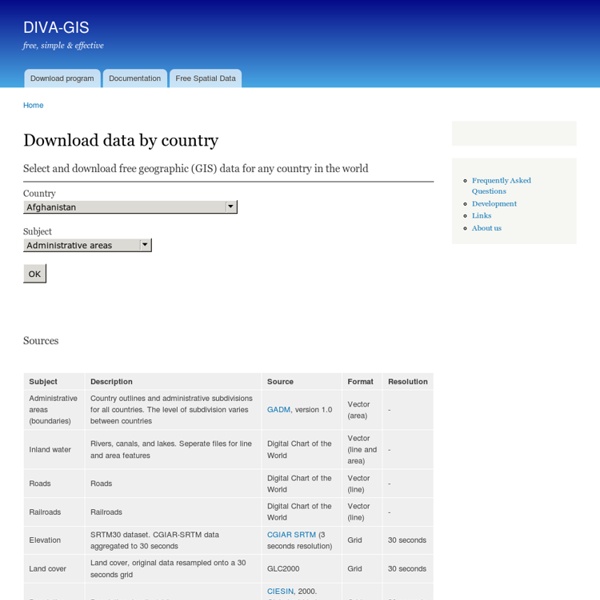
Select and download free geographic (GIS) data for any country in the world Sources Formats The files have been compressed and grouped in ZIP files. You can use programs such as 7-zip, PKZIP or StuffIt to decompress the files. Vector data are stored as ESRI shapefiles Grid (raster) data are stored as DIVA gridfiles Each "shapefile" consist of at least three actual files. Gridfiles are used in DIVA-GIS. A gridfile with "country mask" indicates that the areas outside the selected country are masked out. A DBF (dBase file) is a dbase format database table. Resolution The resolution is the size of each grid cell expressed as the length of one side of one (square) cell.

About GIS As of July 1, 2013 ThinkQuest has been discontinued. We would like to thank everyone for being a part of the ThinkQuest global community: Students - For your limitless creativity and innovation, which inspires us all. Teachers - For your passion in guiding students on their quest. Partners - For your unwavering support and evangelism. Parents - For supporting the use of technology not only as an instrument of learning, but as a means of creating knowledge. We encourage everyone to continue to “Think, Create and Collaborate,” unleashing the power of technology to teach, share, and inspire. Best wishes, The Oracle Education Foundation Rapid Response | EOSDIS - Earth Data Website Visualize and download 100+ NRT products from MODIS, AIRS, and OMI for a variety of hazards and disasters categories. Worldview is supported by the Global Imagery Browse Services (GIBS) - a set of standard services that delivers imagery in a highly responsive manner. Access global, full-resolution MODIS, AIRS and MLS imagery via a variety of standard services, such as Web Map Tile Services (WMTS), Tiled Web Map Service (TWMS) and KML. Download a large number of user-specified, geo-referenced and geographically sub-setted images around the world in GIS-compatible format. Examples include most of the AERONET sun photometer sites and the USDA Foreign Agriculture Service (FAS) sites. View and download swath images for each five-minute interval for Terra and Aqua MODIS data. View and download imagery for interesting events and phenomena from MODIS. Polar Mosaics Download daily Antarctic and Arctic mosaic images at 4km, 2km and 1km resolutions. Learn about Rapid Response

overpass turbo GEOFABRIK Downloadbereich 1 Este documento integra el material del Manual del Usuario del Catálogo de Imágenes de la DGI/INPE. Este catálogo ofrece al usuario informaciones para la obtención de las imágenes a través de criterios objetivos de selección y mecanismos simples y eficientes de acceso e “descarga”. Las operaciones solicitadas son realizadas, en tiempo real, por un sistema semi-automático en el cual el usuario interactúa con la interfaz dirigiendo su búsqueda. Este sistema se basa en una interfaz Web, accesible en www.dgi.inpe.br/CDSR, proyectada para ser de operación simple y de fácil comprensión del usuario. El Catálogo de Imágenes de la DGI/INPE fue totalmente concebido y desarrollado por la División de Procesamiento de Imágenes (DPI) en conjunto con la División de generación de Imágenes (DGI) del INPE. Actualmente integran este Catálogo imágenes Landsat-1, Landsat-2, Landsat-3, Landsat-5, landsat-7, CBERS-2 y CBERS-2B. 2. La cámara WFI opera en dos bandas espectrales con resolución (pixel) de 260 m. y .

Download free ArcGIS GIS shapefile maps Geospatial Data for Digital Cartography Sponsors Page 1 of 4, Go To Next Page Doing GIS doesn't have to be expensive or complicated. If you are new to GIS, check out our free GIS tutorial and atlas. Free World Shapefiles by Country. Ebola Outbreak Maps & Shapefiles IPCC Climate Change Scenario Shapefiles for Precipitation and Temperature, 2000 through 2099. USDA Forest Service Remote Sensing Application Center MODIS and VIIRS Fire Detection GIS Data in Shapefile Format Free U.S. Free Nuclear Reactor Power Plant, U.S. Download Free TIGER/Line 2010 Census Redistricting (P.L. 94-171) ArcGIS Shapefiles. Global, coarse-resolution soil moisture data (25-50 km) are derived from backscatter measurements acquired with scatterometers onboard the satellites ERS-1 and ERS-2 (1991 to present) and the three MetOp satellites (2006-2020). Ionia website provides access to a number of Earth Observation Level 3 and Level 4 products generated by ESA projects, using a variety of instruments, including non-ESA satellite data. U.S. Spread the Word Thanks,

D G Rossiter - Publications & Computer Programs Rossiter, DG 2012. Introduction to the R Project for Statistical Computing for use at ITC 14-Aug-2012, v + 136 pp. (First version 2003) On-line, version 4.0 (3 Mb) Rossiter, DG 2014. Tutorial: Using the R Environment for Statistical Computing: An example with the Mercer-Hall wheat yield dataset Version 2.9, 09-Jan-2013. iv+234 pp.

Data - GIS at University of Chicago Some of these data sites are more specific by subject or by region than others. However, it is suggested to first try the links under the “National and International Data” heading before going to more specific sites. The National and International sites are more generic in some instances and may have the data that you are trying to locate. When searching these sites, the keywords of “GIS” and the “subject” in question are usually good starting points if you are having difficulty. Map Collection (Regenstein Library) The University of Chicago Libraries have access to a large number of digital GIS datasets. Some spatial information is not in digital format. National and International Data Regional (Chicago and Illinois) Data International Data Africa South Africa Antarctica British Antarctic Survey Biological, physical, geologic, and mapping data collected over the past 10 years USGS Atlas of Antarctic Research Various images, maps, and elevation data compiled by the USGS Australia Asia China

Downloads Data themes are available in three levels of detail. For each scale, themes are listed on Cultural, Physical, and Raster category pages. Stay up to date! Know when a new version of Natural Earth is released by subscribing to our announcement list. Overwhelmed? The Natural Earth quick start kit (219 mb) provides a small sample of Natural Earth themes styled in in a QGIS document. Natural Earth is the creation of many volunteers and is supported by NACIS. Large scale data, 1:10m Cultural Physical Raster The most detailed. 1:10,000,000 1″ = 158 miles 1 cm = 100 km Medium scale data, 1:50m Cultural Physical Raster Suitable for making zoomed-out maps of countries and regions. 1:50,000,000 1″ = 790 miles 1 cm = 500 km Small scale data, 1:110m Cultural Physical Suitable for schematic maps of the world on a postcard or as a small locator globe.

Ressources pour les SIG - [la cordonnerie] Certains formats de fichiers nécessitent une conversion. En cas de besoin, voir ici. Ces données sont utiles en 1S et TS pour enseigner la tectonique des plaques. Un TP (en anglais) montre où trouver des données. Un ensemble de données est disponibles sur cette page de l’académie d’Orléans ; hélas leur provenance n’est pas indiquée ! Volcans Sur le site de NGDC (National Geophysic Data Center) : on peut avoirl a liste de tous les volcans tous les volcans ; à partir de cette page fabriquer un fichier csv à l’aide d’un tableur. On trouve un fichier au format esri shapefile sur cette page ; télécharger le fichier zippé. Un autre site intéressant : Global Volcanism Program Séismes Sur le site de l’ANSS ; un formulaire pour choisir le lieu et l’intensite. Le site de NGDC (National Geophysic Data Center) permet de choisir les séismes sur cette page. Sur le site de l’USGS. Chaines de montagnes et fosses océaniques Pour la bathymetrie, on peut obtenir les données à partir de cette page. Hot spots

Download free Hurricane GIS Shapefile Map Layers With hurrican Irene on its way. I thought some of you may be interested in these historical hurricane shapefiles. These cover the period from 1851 up to 2004. I'm working also to include more recent hurricanes in the near future. The paths of tropical cyclones and major hurricanes from 1851 to 2004. The term "tropical cyclone" is a generic term for a low-pressure storm system that usually forms in the tropics. Download the free hurricane GIS shapefile map layers here Mike Meuser GIS Project Development, Data Research and Custom Shapefile CreationFree GIS Software, Shapefiles, Maps and TutorialsFree GPS, Aerial, TOPO Maps and News If you have data, GIS project or custom shapefile needs send me an email Premium Shapefiles: ZipCode, Indian & Federal Lands, School Districts, Tornadoes, Dams, Climate Change & Global Warming

Aide:Cartographie/Ressources cartographiques géoréférencées Une page de Wikipédia, l'encyclopédie libre. Cette page répertorie de façon non-exhaustive les outils, ressources et liens externes pour la création cartographique au sein de Wikipédia en utilisant des modèles numériques de terrain et plus généralement des données numériques géoréférencées. Ne sont donc pas mentionnés ici par exemple les sites proposant des cartes libres prêtes à l'emploi ou autres ressources permettant de tracer des cartes à main levée qui sont traités par d'autres pages d'aides cartographiques complémentaires à celle-ci. Voir aussi : Didacticiel de création de carte avec QGIS — QGIS pouvant ouvrir et exploiter ces fichiers.Aide:Cartographie — pour les conventions cartographiques.Projet Cartographie : Ressources cartographiques Outils[modifier | modifier le code] Logiciels SIG[modifier | modifier le code] GRASS GIS (site) : libre et multiplate-forme. 3DEM : gratuit, uniquement MS Windows 32 bits. – ne permet pas la re-projection en UTM si la carte couvre plus d'une zone UTM ;

Données Raster IGN BDAlti La BDAlti de l'IGN est un MNT disponible sur la France en différentes résolutions. les versions 250 m, 500 m et 1000 m sont disponibles gratuitement. Emprise des données : France (dont DOM/TOM) Télécharger la BDAlti 250 m ASTER est un modèle numérique de terrain (MNT) disponible sur le monde entier (sauf pour des latitudes extrêmes) produit en collaboration entre la NASA et le METI (Japon). Emprise des données : mondiale Télécharger les données ASTER SRTM est un modèle numérique de terrain (MNT) disponible sur le monde entier (sauf pour des latitudes extrêmes) produit par une mission de la NASA. Version actuelle : 4 Télécharger des données SRTM Gtopo30 Gtopo30 est un autre MNT gratuit disponible sur le monde entier. Télécharger des données Gtopo30 Données Vecteur Répertoire Géographique des Communes Les données RGC sont des données sous forme de fichier texte contenant les coordonnées X,Y des mairies des communes. Emprise des données : France Métropolitaine, DOM Précision : 1/50000

Related: