
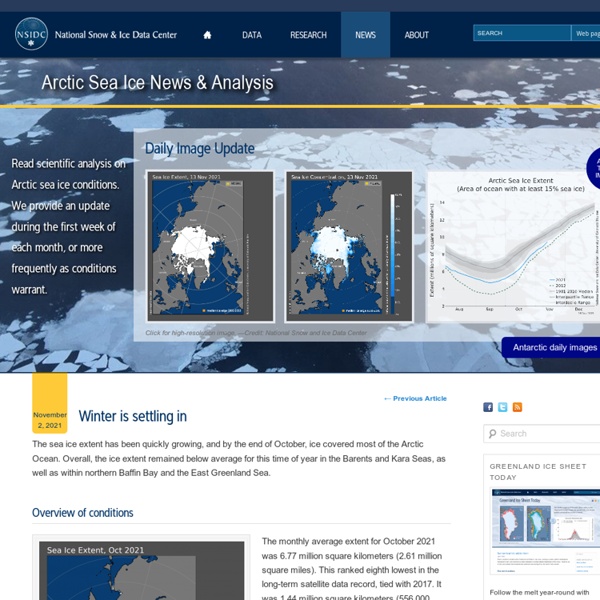
http://nsidc.org/arcticseaicenews/
Related: askurCurrent State of Sea Ice Cover | Earth J. C. Comiso, C. L. Parkinson, T. Markus, D. The sea ice cover is one of the key components of the polar climate system. Figure 1: 10-year averages between 1979 and 2018 and yearly averages for 2007, 2012, and 2022 of the daily (a) ice extent and (b) ice area in the Northern Hemisphere and a listing of the extent and area of the current, historical mean, minimum, and maximum values in km2. Figure 2: Color-coded map of the daily sea ice concentration in the Northern Hemisphere for the indicated recent date along with the contours of the 15% edge during the years with the least extent of ice (in red) and the greatest extent of ice (in yellow) during the period from November 1978 to the present. Figure 3. Figure 4: Color-coded animation displaying the last 2 weeks of the daily sea ice concentrations in the Northern Hemisphere. Figure 7. Figure 8: Color-coded animation displaying the last 2 weeks of the daily sea ice concentrations in the Southern Hemisphere. J. Figure 3. Figure 7.
Weather - Canada Canadian Weather Choose a province or territory: Date modified: Nouveau record de fonte de glace pour le pôle Nord - Sciences L'Arctique fond et fond même à vue de satellite. Des scientifiques de la NASA et du National Snow Ice Data Center (NSIDC) ont expliqué lundi que la calotte glacière a atteint sa plus petite superficie dimanche dernier. Cela fait déjà 30 ans que des satellites permettent de mesurer la banquise de la mer arctique. Ce 26 août 2012, la calotte glacière ne faisait plus que 4,10 millions de kilomètres carrés. Les données sont surprenantes car les experts expliquaient le record de 2007 par un contexte climatique exceptionnel. Mais ce qui étonne les spécialistes cette année c'est la précocité de ce phénomène.
Ice Safety At the Canadian Ice Service (CIS), our mission is to provide the most accurate and timely information about ice in Canada's navigable waters. We work to promote safe and efficient maritime operations and to help protect Canada's environment. For the latest ice conditions, click the appropriate regional area on the map. Arctic Ocean | Western Arctic | Eastern Arctic | Hudson Bay | East Coast | Great Lakes Full Resolution Map | Animated Map (last 10 days) This map displays the latest ice cover in Canadian waters. To learn more about our products and how to interpret them, take a look at our Ice Products Guide. SOTC: Introduction NSIDC's State of the Cryosphere provides an overview of the status of snow, ice, and permafrost as indicators of climate change. This site provides time-series data for Northern Hemisphere snow cover, mountain glacier fluctuations, sea ice extent and concentration, changes in ice shelves, and global sea level. It also provides a snapshot of current permafrost conditions. Image credits clockwise from top left: Formosat image of icebergs © 2008 Dr. Cheng-Chien Liu, National Cheng-Kung University and Dr. An-Ming Wu, National Space Organization, Taiwan; photo of ptarmigan tracks by Andrew Slater, NSIDC; photo of James Ross Island by Rob Bauer, NSIDC; International Space Station astronaut photo of Pared Norte Glacier courtesy NASA. Introduction: Are global temperatures rising? Northern Hemisphere Snow: What satellite sensors are telling us about snow cover Glaciers: Mountain glacier fluctuations Permafrost and Frozen Ground: Insights from a Northern Hemisphere map and field observations
Lifestyle changes may combat a dementia that strikes people in their 40s and 50s The first symptom is likely a loss of interest in life and the well-being of others. A person might ignore their spouse or children's feelings, get uncharacteristically frustrated and say or do inappropriate things -- such as laugh at a funeral. Even worse, they'll likely have no idea they have changed. "It's a pretty devastating disease that impacts people in the prime of their lives," said neurologist Kaitlin Casaletto, an assistant professor in the Memory and Aging Center at the University of California, San Francisco. Science has struggled to provide interventions to help these patients. Casaletto and her colleagues followed the activity levels of 105 people with the inherited form of the disease, the first study to do so in this population. "This is an extremely important study providing the strongest evidence yet that lifestyle factors can positively impact brain health, not only for Alzheimer's disease, but frontotemporal lobar dementia as well," said neurologist Dr.
Ryan Maue PhD Meteorology Post by Dr. Ryan N. Maue Dr. Judith Curry is quoted in a classic Seth Borenstein AP screed connecting disparate extreme weather events into a tidy AGW-narrative: “Sometimes it seems as if we have weather amnesia.” …Judith Curry of Georgia Tech disagreed, saying that while humans are changing the climate, these extremes have happened before, pointing to the 1950s… she is correct but just who/what is she disagreeing with? The AP article sets up the typical “arguing amongst experts” debate where the non-expert journalist assembles the narrative. The AP article begins: “Nature is pummelling the United States this year with extremes. Of course we know that natural disasters occur globally, and are often modulated by the El Niño Southern Oscillation (e.g. Dr. I’m sure Masters is tired of the website hits and advertising revenue, but this statement is not scientific but anecdotal. The AP article continues: “What’s happening, say experts, is mostly random chance or bad luck. Who says what? Dr. Dr.
Strong Summer Cyclone Churns Over the Arctic An unusually large, long-lasting, and powerful cyclone was churning over the Arctic in early August 2012. Two smaller systems merged on August 5 to form the storm, which at the time occupied much of the Beaufort-Chukchi Sea and Canadian Basin. On average, Arctic cyclones last about 40 hours; as of August 9, 2012, this storm had lasted more than five days. The Visible Infrared Imaging Radiometer Suite (VIIRS) on Suomi NPP captured this view of the storm on August 7, 2012. Arctic cyclones are more common during the summer than winter; however, summer cyclones tend to be weaker than the storms that batter the region during the winter. The number of cyclones affecting the Arctic appears to be increasing. The cause of the increase is an open question, but climate change may be affecting Arctic cyclones. One way climate change may affect Arctic cyclones is by changing the sea ice and ocean temperature. Further Reading NASA. (2008, October 6). Instrument(s): Suomi NPP - VIIRS
On temperature and CO2 in the past Posted on 29 May 2010 by Riccardo Guest post by Riccardo One of the most famous paleoclimate graphs for "amateur climatologists" like me is the Vostok ice core reconstructions of temperature and CO2 concentration over the last 420 kyr. It shows how nicely the two follow each other and that our climate has overall "oscillated" within two relatively well defined limits. One may wish to look at this correlation a little better. So let's take the Dome C ice core data which cover 800 Kyrs and plot temperature versus CO2 concentration. Fig. 1: Dome C temperature and CO2 concentration data (dots) with the best fit line (red line). This graph shows how our climate system behaves naturally. This concept is made explicit in a recent paper (Etkin 2010) where the author makes a state-space (or phase-space) analysis of ice cores and recent instrumental measurements. Fig. 2: State-space plot of the Vostok, EPICA and Law Dome ice core data and Mauna Loa direct measurements.
World Glacier Monitoring Service For more than a century, the World Glacier Monitoring Service (WGMS) and its predecessor organizations have been compiling and disseminating standardized data on glacier fluctuations. Thereto, the WGMS annually collects glacier data through its scientific collaboration network that is active in more than 30 countries. More... In close collaboration with the U.S. photo: participants of the WGMS General Assembly 2010 (by F. Alzheimer's Found To Be Mostly Genetic: Largest Twin Study Ever Undertaken Confirms Highest Estimates Of Genetic Risk -- ScienceDaily Alzheimer disease has a genetic cause in up to 80 percent of cases, according to a University of Southern California- led study of nearly 12,000 twin pairs. The study appears in the February 2006 issue of Archives of General Psychiatry, a journal of the American Medical Association. Margaret Gatz, professor of psychology in the USC College of Letters, Arts, and Sciences, led an international team of researchers from Göteborg University, Jönköping University and Karolinska Institutet in Sweden, as well as from USC, the University of California at Riverside and the University of South Florida. Past estimates of Alzheimer's risk varied widely, with the highest numbers sometimes greeted with skepticism. "Our finding confirms the higher estimates that have been suggested previously. The study raises doubts about the widely held view that Alzheimer's has two forms: the "familial," with genetic roots, and the "sporadic," with environmental causes.
Linea Meteo