
Virtual Tour: Antarctica Before you start this tour, here are some things you should know: There is a way to get back to this page and a link to a site map of the virtual tour at the bottom of every page on this virtual tour. The tiny ("thumbnail") images of people and places found throughout this tour are meant to just give you the idea of the image; to retrieve the full-sized image, simply click on the thumbnail. (We did it this way to make the pages load faster.) Regardless of where you live or which country you work for, to get to the South Pole, you almost certainly go through New Zealand and then land at McMurdo on the coast of Antarctica on your way to the center of the continent and the bottom of the Earth: the South Pole. This image came from The Earth and Moon Viewer, specifically a request like this. Want to learn more about the territorial claims on Antarctica? Go on to New Zealand, McMurdo, and South Pole. All photos on this tour are from CARA unless otherwise specified. For more information
Home - Sky Rainforest Rescue Antarctica Continent Composite satellite image of Antarctica (2002) Antarctica ()[note 1] is Earth's southernmost and least-populated continent. Situated almost entirely south of the Antarctic Circle and surrounded by the Southern Ocean, it contains the geographic South Pole. Antarctica is, on average, the coldest, driest, and windiest of the continents, and it has the highest average elevation. The ice shelves of Antarctica were probably first seen in 1820, during a Russian expedition led by Fabian Gottlieb von Bellingshausen and Mikhail Lazarev. Antarctica is governed by about 30 countries, all of which are parties of the 1959 Antarctic Treaty System. Etymology Until the discovery, belief by Europeans in the existence of a Terra Australis—a vast continent in the far south of the globe to balance the northern lands of Europe, Asia, and North Africa—had existed as an intellectual concept since classical antiquity. Geography East Antarctica comprises Coats Land, Queen Maud Land, Enderby Land, Mac.
Recce 3D Maps - discover the world around you Arctic Marine Life For marine life, the Arctic Ocean is a unique place to live. It is the coldest ocean on Earth and is often capped with sea ice. During the coldest winter months there is little or no sunshine penetrating the water. During the summer months, the sun shines up to 24 hours a day. Animals that can survive in the Arctic Ocean are adapted for this extreme environment. Some have a special substance within their bodies that prevents their blood from freezing. Shop Windows to the Universe Science Store! The Fall 2009 issue of The Earth Scientist, which includes articles on student research into building design for earthquakes and a classroom lab on the composition of the Earth’s ancient atmosphere, is available in our online store. You might also be interested in: Kingdom Protista Members of the Kingdom Protista are the simplest of the eukaryotes. Sea Ice in the Arctic and Antarctic Sea ice is frozen seawater. The Cryosphere Frozen water is found in many different places on Earth. Arctic Tundra
Mommy Maestra: Día de los Muertos, Day of the Dead Lesson Plans and Activities Día de los Muertos is quickly approaching, so I thought I would share some of the many fabulous resources that I have discovered over the years. Because this holiday is so popular, there is a growing number of lesson plans, units, and crafts now available on-line. Thematic Units: - By far, one of the best curriculum units has been created by Lori Langer de Ramirez, creator of MisCositas. It is geared for third year (intermediate) Spanish students. This is a comprehensive unit with 63 pages of activities, vocabulary, and more. • AZCentral.com also has a shorter (31 pages) Teacher Packet with a really great bibliography. • Day of the Dead Mini-Unit A simpler lesson plan that includes a short description and example of “Calavera” Poems. • Remembrance Lesson Plan An original lesson to show children how the lives of people can be celebrated by remembering the lives of people that have died. • Lesson Planet has 26 lessons related to Dia de los Muertos that you can scroll through. Websites: Books:
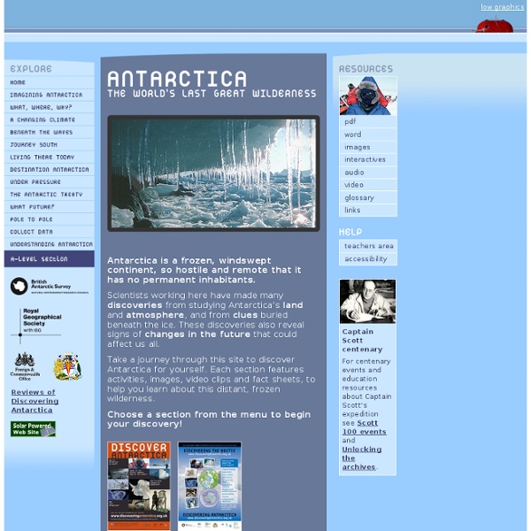
Unlocking the Archives Antarctica is the coldest continent - Russia's Vostok Station recorded the world's coldest temperature of -89°C in 1983. It is also the driest continent with an average annual snowfall of 125mm. It has no permanent inhabitants and it is the most isolated continent. It is of immense value to scientists for the study of climate change as it has an important effect on the world's climate and ocean systems. It was the geographers of ancient Greece who first suggested that there was a large landmass around the South Pole. In 1895, the International Geographical Congress claimed 'the exploration of the Antarctic region is the greatest piece of geographical exploration still to be undertaken' and the 'heroic' age of Antarctic discovery began. Discover the story of the race to the Pole. What were their views of Antarctica? What is the climate and landscape like? How has Antarctica been used for science? How has Antarctica been used for commercial profit?
OS GB Mapping from The Hug GeoScenic Home Page | British Geological Survey Welcome to GeoScenic, where you can view and download images from the vast collections of geological photographs in BGS. Download of 1000 x 1000 pixel images is free for all non-commercial use - all we ask in return is for you to acknowledge BGS when using our images. Click our Terms and Conditions link below for information on acknowledgement text, and to find out about using our images commercially. All images in this site can be viewed without registering. However, by registering, you can save images to your lightbox for future sessions and download images at your leisure. You are not currently logged in. Authors in all Elsevier journals can now include GeoScenic image identifiers from BGS (www.bgs.ac.uk) into their article on ScienceDirect. For more information on BGS GeoScenic identifiers and database linking with Elsevier please see Visit the new BGS Geoheritage image blog! View spatially referenced images on your mobile. J.D.