
Taoism Taoist rite at the Qingyanggong (Bronze Ram Temple) in Chengdu, Sichuan. Taoism, or Daoism, is a philosophical, ethical, and religious tradition of Chinese origin that emphasizes living in harmony with the Tao (also romanized as Dao). The term Tao means "way", "path" or "principle", and can also be found in Chinese philosophies and religions other than Taoism. In Taoism, however, Tao denotes something that is both the source and the driving force behind everything that exists. It is ultimately ineffable: "The Tao that can be told is not the eternal Tao. While Taoism drew its cosmological notions from the tenets of the School of Yin Yang, the Tao Te Ching, a compact and ambiguous book containing teachings attributed to Laozi (Chinese: 老子; pinyin: Lǎozǐ; Wade–Giles: Lao Tzu), is widely considered its keystone work. After Laozi and Zhuangzi, the literature of Taoism grew steadily and was compiled in form of a canon—the Daozang—which was published at the behest of the emperor. Ethics[edit]
Machu Picchu Machu Picchu (in hispanicized spelling, Spanish pronunciation: [ˈmatʃu ˈpiktʃu]) or Machu Pikchu (Quechua machu old, old person, pikchu peak; mountain or prominence with a broad base which ends in sharp peaks,[1] "old peak", pronunciation [ˈmɑtʃu ˈpixtʃu]) is a 15th-century Inca site located 2,430 metres (7,970 ft) above sea level.[2][3] It is located in the Cusco Region, Urubamba Province, Machupicchu District in Peru.[4] It is situated on a mountain ridge above the Sacred Valley which is 80 kilometres (50 mi) northwest of Cusco and through which the Urubamba River flows. Most archaeologists believe that Machu Picchu was built as an estate for the Inca emperor Pachacuti (1438–1472). Often mistakenly referred to as the "Lost City of the Incas", it is perhaps the most familiar icon of Inca civilization. The Incas built the estate around 1450, but abandoned it a century later at the time of the Spanish Conquest. Machu Picchu is vulnerable to threats. History Early encounters Geography
Cusco Cusco /ˈkuːzkoʊ/, often spelled Cuzco (Spanish: Cuzco, [ˈkusko]; Quechua: Qusqu or Qosqo, IPA: [ˈqɔsqɔ]), is a city in southeastern Peru, near the Urubamba Valley of the Andes mountain range. It is the capital of the Cusco Region as well as the Cuzco Province. In 2009, the city had a population of 510,000. Cusco was the site of the historic capital of the Inca Empire and was declared a World Heritage Site in 1983 by UNESCO. Spelling and etymology[edit] The indigenous name of this city is Qusqu. "Go fly over there (they say his wings were born), and by sitting down there take possession in the very seat where that milestone appears, because we'll then settle and live there". The Spanish conquistadors adopted the local name, transliterating it into Spanish as Cuzco or less often Cozco. In English, both s[5][6] and z[7][8] are accepted, as there is no international, official spelling. History[edit] Killke culture[edit] Inca history[edit] Cusco after the Spanish invasion[edit] Honors[edit]
Colosseum The Colosseum or Coliseum, also known as the Flavian Amphitheatre (Latin: Amphitheatrum Flavium; Italian: Anfiteatro Flavio or Colosseo) is an elliptical amphitheatre in the centre of the city of Rome, Italy. Built of concrete and stone,[1] it was the largest amphitheatre of the Roman Empire, and is considered one of the greatest works of Roman architecture and engineering. It is the largest amphitheatre in the world.[2] The Colosseum could hold, it is estimated, between 50,000 and 80,000 spectators,[6][7] and was used for gladiatorial contests and public spectacles such as mock sea battles, animal hunts, executions, re-enactments of famous battles, and dramas based on Classical mythology. The building ceased to be used for entertainment in the early medieval era. It was later reused for such purposes as housing, workshops, quarters for a religious order, a fortress, a quarry, and a Christian shrine. The Colosseum is also depicted on the Italian version of the five-cent euro coin. Name
Dos Pilas Coordinates: The Central Plaza of Dos Pilas. Dos Pilas is a Pre-Columbian site of the Maya civilization located in what is now the department of Petén, Guatemala. It dates to the Late Classic Period, being founded by an offshoot of the dynasty of the great city of Tikal in AD 629 in order to control trade routes in the Petexbatún region, particularly the Pasión River.[2] In AD 648 Dos Pilas broke away from Tikal and became a vassal state of Calakmul, although the first two kings of Dos Pilas continued to use the same emblem glyph that Tikal did.[3][4] It was a predator state from the beginning, conquering Itzan, Arroyo de Piedra and Tamarindito. Dos Pilas and a nearby city, Aguateca, eventually became the twin capitals of a single ruling dynasty.[5] The kingdom as a whole has been named as the Petexbatun Kingdom, after Lake Petexbatún, a body of water draining into the Pasión River.[6] Etymology[edit] Location[edit] Known rulers[edit] Itzamnaaj B'alam (c. 697[5]) had a short reign.
Taj Mahal The Taj Mahal (/ˈtɑːdʒ məˈhɑːl/ often /ˈtɑːʒ/;,[2] from Persian and Arabic,[3][4] "crown of palaces", pronounced [ˈt̪aːdʒ mɛˈɦɛl]; also "the Taj"[5]) is a white marble mausoleum located in Agra, Uttar Pradesh, India. It was built by Mughal emperor Shah Jahan in memory of his third wife, Mumtaz Mahal. The Taj Mahal is widely recognized as "the jewel of Muslim art in India and one of the universally admired masterpieces of the world's heritage".[6] Taj Mahal is regarded by many as the finest example of Mughal architecture, a style that combines elements from Islamic, Persian, Ottoman Turkish and Indian architectural styles.[7][8] In 1983, the Taj Mahal became a UNESCO World Heritage Site. While the white domed marble mausoleum is the most familiar component of the Taj Mahal, it is actually an integrated complex of structures. Origin and inspiration Taj Mahal site plan. Should guilty seek asylum here, Like one pardoned, he becomes free from sin. Tomb Eastern panaromic view by day Garden
Epi-Olmec culture Important Epi-Olmec sites The Epi-Olmec culture was a cultural area in the central region of the present-day Mexican state of Veracruz, concentrated in the Papaloapan River basin, a culture that existed during the Late Formative period, from roughly 300 BCE to roughly 250 CE.[1] Epi-Olmec was a successor culture to the Olmec, hence the prefix "epi-" or "post-". Although Epi-Olmec did not attain the far-reaching achievements of that earlier culture, it did realize, with its sophisticated calendrics and writing system, a level of cultural complexity unknown to the Olmecs.[2] Cultural context[edit] Left side image of La Mojarra Stela 1 showing a person identified as "Harvester Mountain Lord" In contrast to earlier Olmec art, Epi-Olmec art displays a general loss of detail and quality. (See also Tres Zapotes site layout and societal organization) Epi-Olmec sculpture[edit] Script and calendrics[edit] Subject matter[edit] Final transformation[edit] Notes[edit] References[edit]
Great Pyramid of Giza The Great Pyramid of Giza (also known as the Pyramid of Khufu or the Pyramid of Cheops) is the oldest and largest of the three pyramids in the Giza Necropolis bordering what is now El Giza, Egypt. It is the oldest of the Seven Wonders of the Ancient World, and the only one to remain largely intact. Based on a mark in an interior chamber naming the work gang and a reference to fourth dynasty Egyptian Pharaoh Khufu,[1][2] Egyptologists believe that the pyramid was built as a tomb over a 10 to 20-year period concluding around 2560 BC. Initially at 146.5 metres (481 feet), the Great Pyramid was the tallest man-made structure in the world for over 3,800 years. Originally, the Great Pyramid was covered by casing stones that formed a smooth outer surface; what is seen today is the underlying core structure. Some of the casing stones that once covered the structure can still be seen around the base. There are three known chambers inside the Great Pyramid. History and description[edit]
Han Dynasty Etymology According to the Records of the Grand Historian, after the collapse of the Qin Dynasty the hegemon Xiang Yu appointed Liu Bang as prince of the small fief of Hanzhong. Following Liu Bang's victory in the Chu–Han Contention, the resulting Han dynasty was named after the Hanzhong fief.[6] History Western Han China's first imperial dynasty was the Qin dynasty (221–206 BC). Military expansion To the north of China proper, the nomadic Xiongnu chieftain Modu Chanyu (r. 209–174 BC) conquered various tribes inhabiting the eastern portion of the Eurasian Steppe. After Wu's reign, Han forces continued to prevail against the Xiongnu. A gilded bronze oil lamp in the shape of a kneeling female servant, dated 2nd century BC, found in the tomb of Dou Wan, wife of the Han prince Liu Sheng; its sliding shutter allows for adjustments in the direction and brightness in light while it also traps smoke within the body.[27]
Christ the Redeemer (statue) Aerial view of the statue The idea of building a large statue atop Corcovado was first suggested in the mid-1850s, when Catholic priest Pedro Maria Boss requested financing from Princess Isabel to build a large religious monument. Princess Isabel did not think much of the idea and it was dismissed in 1889, when Brazil became a republic with laws mandating the separation of church and state.[6] The second proposal for a landmark statue on the mountain was made in 1920 by the Catholic Circle of Rio.[7] The group organized an event called Semana do Monumento ("Monument Week") to attract donations and collect signatures to support the building of the statue. The donations came mostly from Brazilian Catholics.[3] The designs considered for the "Statue of the Christ" included a representation of the Christian cross, a statue of Jesus with a globe in his hands, and a pedestal symbolizing the world.[8] The statue of Christ the Redeemer with open arms, a symbol of peace, was chosen.
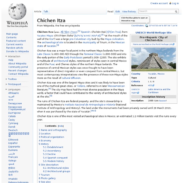
Maya civilization Uxmal, Nunnery Quadrangle Artist's copy of Bonampak Painting, Mexico, 700 C.E. Throne 1 of Piedras Negras The Maya is a Mesoamerican civilization, noted for Maya script, the only known fully developed writing system of the pre-Columbian Americas, as well as for its art, architecture, and mathematical and astronomical systems. Initially established during the Pre-Classic period (c. 2000 BC to AD 250), according to the Mesoamerican chronology, many Maya cities reached their highest state of development during the Classic period (c. AD 250 to 900), and continued throughout the Post-Classic period until the arrival of the Spanish. The Maya civilization shares many features with other Mesoamerican civilizations due to the high degree of interaction and cultural diffusion that characterized the region. The Maya peoples survived the Classic period collapse and the arrival of the Spanish conquistadores and sixteenth-century Spanish colonization of the Americas. Geographical extent History