
Mapping ICT is a compulsory part of the National Curriculum. The existing programme for ICT, however, has been suspended as dull, boring and unsatisfactory and replaced by new courses of ICT study. These are expected to prepare the pupils for the increasingly digital world and give them the necessary knowledge and skills to find decent jobs. The Responses to Changes of the National Curriculum for ICT Study The leading experts and the ICT industry support the changes of the National Curriculum for ICT Study. The suspended National Curriculum for ICT Study did not prepare the students adequately for the needs of the industry or give them computer skills they need to succeed in life. The Difference between the Old and New ICT Programme The new National Curriculum for ICT gives incomparably more freedom to schools and teachers in what and how they will teach their pupils relevant skills and make the courses more exciting. Challenges of the New Curriculum for ICT Study
3 Interesting Tools for Creating Maps with Students June 16, 2015 Today we are introducing you to some good web tools to use for creating maps with students. These are new tools that we are featuring here for the first time. Using these tools students will be able to create custom maps, draw on maps, insert text and custom images to their maps, place markers, and many more. 1- ZeeMaps This is a great tool for creating interactive maps. It provides unlimited markers per map and has 3 level access control for each map: viewer, member and admin. 2- Click2Map Click2Map is another web application that enable you to easily create maps and add points of interest to any geographic location of your choosing. 3- Scribble Maps Scribble Maps lets you create and customize your maps the way you want.
Audio and video Passport to the world "I stumbled upon your fun interactive geography games from a link on the Massachusetts Geographic Alliance Website. Since then, your games have become quite a hit with my competitive colleagues!" --Candice Gomes, Education Outreach Coordinator, Boston Public Library Sheppard Software's geography games were featured in the Boston Public Library's 2006 Exhibition on Mapping! "Terrific online educational games, especially geography." "I am a middle school social studies teacher who also sponsors a geography club after school. "Awesome site... it is the only reason I am passing my World Geography class!" "We love your interactive maps and are using them for 10th grade world history." "Let me say that you guys have an awesome website.
9 Must-Have Virtual Reality Tools for Teaching with Google Cardboard Yesterday I had the chance to lead a session for teachers on favorite tools for the reading classroom at the State of Maryland’s Annual Reading Conference. So what does this have to do with Google Cardboard? Well halfway through the session I shared Nearpod, a fantastic formative assessment (aka #FormativeTech) tool for teachers. In addition to embedding interactive activities there is the option to add a virtual reality experiences into your lesson. It was so much fun seeing teachers from across the state of Maryland standing up in the conference room and spinning around as they viewed a gorgeous panoramic picture of Santorini on their mobile devices. Tip: If you don’t have access to mobile devices or a Google Cardboard headset most of this content can be viewed on a Chromebook, laptop or interactive whiteboard. The first thing you’ll need is a headset to accompany your mobile device. 1. 2. 3. 4. 5. 6. 7. 8. Have you tried Google Cardboard or virtual reality in your classroom? Monica
eBay - Achetez et vendez vos objets neufs ou d'occasion. Enchères, prix fixe, petites annonces - Et vous, vous achetez comment ? Découvrez notre très vaste sélection de produits d’occasion et offrez-vous des objets d’exception au meilleur prix. C'est l'opportunité que vous attendiez : achetez et vendez des objets d’occasion sur eBay. High-Tech Vous souhaitez changer de smartphone ou vous recherchez une tablette ? Sur eBay, vous trouverez du High-Tech d’occasion des marques Apple, Dell, Acer, Asus, Sony et Samsung. Pour les passionnés de photo, laissez-vous tenter par nos appareils photo et les accessoires qui vont avec. Mode Si vous avez envie de rénover votre garde-robe avec des pièces d’occasion, jetez un coup d’œil sur notre sélection mode pour homme, femme et enfant. Sports Saviez-vous que sur eBay vous pouviez dénicher des maillots des plus grandes équipes de foot, des VTT, des appareils fitness à prix mini ? Instruments de musique Et enfin, si vous cherchez une guitare Ibanez, un synthétiseur Korg ou une batterie Yamaha, vous ne pouviez pas mieux tomber ! Cadeaux de Noël d’occasion Alors, sautez sur l’occasion !
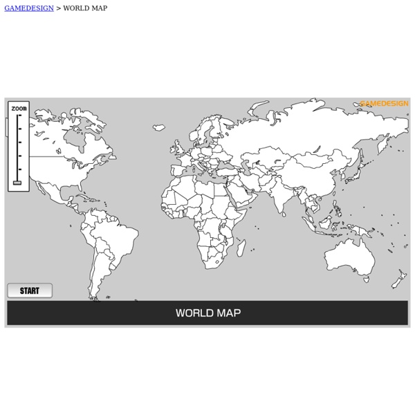
Mapping This page offers interactive Flash based activities to help the user gain a number of skills in understanding maps. These activities can be used by a teacher as a demonstration tool or by the student in the classroom or at home. There are three lessons available. Clicking on the links to the left will bring up the activities. Activity 1: Using grid lines - this short activity is designed to help the student understand the basics of using grid lines. Paper Based Grid Activity - this .pdf document can be printed. The activities on this site require the free Macromedia Flash plugin. shockwave/flash 20 Good Map Creation Tools for Students A couple of years ago I published a list of 21 online map creation tools. Since then some of those tools have gone offline and new tools have replaced them. Here's my updated list of online map creation tools for students and teachers. Wikia Maps is a map creation tool from Wikia. Odyssey.js is an open source map creation tool from CartoDB. Visits is an online tool for creating a location history timeline by using your Flickr images and Google Maps. National Geographic's Map Maker Interactive offers themes on which users can create custom map displays. ikiMap is a free service for creating custom maps online. Animaps is a service that was built for the purpose of allowing users to create animated Google Maps. Tripline is a service designed to enable anyone to record a trip they've taken or to plan a trip itinerary. Scribble Maps is a fun and useful application for drawing and typing on Google Maps. Mapfaire is a free tool for quickly creating maps that contain simple placemarks.
Mapping 1 | 2 Description (Page 1) The People's Republic of China is the world's fourth largest country (by total area), and one of only five remaining Communist states in the world. As with the ancient Roman and Egyptian empires, China led most of the world in the arts and sciences for hundreds of years. Pre-history began with civilizations that originated in numerous regions along the Yellow River and Yangtze River valleys over a million years ago. By 2100 BC the Xia Dynasty had formed, becoming China's first dynasty - according to ancient historical records. Following the Xias, the Shang Dynasty rose to power, and then were ultimately overrun by the Zhou Dynasty in 1066 BC. Emerging from the Yellow River valley, the Zhous were the longest-lasting dynasty in China, establishing their rule under a semi-feudal system. The use of iron and the evolution of written script into its modern form were both introduced during the Zhou Dynasty. Description continued...
8 of The Best Web Tools for Taking Students On Virtual Field Trips April 3, 2017 The Internet has brought the entire world right into our own homes. The world’s knowledge is just a click away. Our students have benefitted and continue to benefit from the wonders of the web in their own learning. Virtual field trips, the topic of our post today, is one simple example of how the web technologies have tremendously transformed learning and teaching. Without leaving their own desks and right from within their classroom, students get to visit popular world museums, explore ancient monuments in Egypt and Rome, tour major cities in the world using web tools that are readily available either for free or at a cheap cost. The collection we have for you today features an updated list of some of the best web technologies you can use with your students for virtual field trips. Google Earth VR , a new service that allows users to virtually explore the world from different perspectives and right from the comforts of their own place. 2- Flyover feature in Apple Maps
Sognare sugli atlanti – Geografia multimediale per la prima media | donadoniblog Da ragazzo sognavo sugli atlanti. Vi immaginavo viaggi e avventure… Questa è forse la ragione per cui da adulto ho deciso di visitare tutti i luoghi il cui nome aveva un tempo colpito la mia immaginazione, come Samarcanda o Tumbuctou, il fortino di Alamo o il Rio delle Amazzoni, e mi mancano ancora solo Mompracem e Casablanca. Umberto Eco Sognare sugli atlanti è un ebook di geografia per la prima media liberamente scaricabile e utilizzabile in classe. Per svolgere gli esercizi inseriti nel pdf è consigliabile istallare Adobe Acrobat Reader. La segnalazione di eventuali sviste e refusi è molto gradita (nel caso, scrivere a didadada.web@gmail.com). Mi piace: Mi piace Caricamento... Correlati Modulo I - L'abbiccì della geografia Da ragazzo sognavo sugli atlanti. In "Modulo I - L'abbiccì della geografia" Atlante in 3D delle opere di Renzo Piano Materiali, adatti a una terza media, per una lezione multimediale in bilico tra arte, geografia e scienze. In "Il ripassìno"