
::. Visites virtuelles - Nature et paysages en photographie panoramique 360 degrés Acropole des Draveurs aux Hautes-Gorges de la Rivière Malbaie Automne Québécois aux chutes de Ste Ursule Arc-en-ciel au village des Escoumins en Haute-Côte-Nord du Québec La Malbaie vue de Cap-à-l'Aigle dans la région de Charlevoix en panorama Observation des baleines à Cap-de-Bon-Désir aux Escoumins Baie de Tadoussac et sa chapelle indienne en réalité virtuelle Panorama au lever de soleil au lac Memphremagog en Estrie Vue aérienne du lac glaciaire Jökulsárlón en Islande et visite interactive
Le port antique de Rome revit grâce au virtuel Des chercheurs ont déblayé virtuellement le plus grand port antique de Méditerranée, aujourd’hui complètement ensablé, et ont remis en mouvement l’eau qui s’y trouvait. Un travail qui a permis de répondre à une question qui taraudait les archéologues depuis longtemps. Le port antique de Rome, le Portus, fut le plus grand port du monde méditerranéen antique. Il y a deux millénaires, son bassin s’étalait à perte de vue sur le delta du Tibre. Heureusement, grâce à la magie du virtuel, une équipe de géoarchéologues et d’océanographes a réussi (link is external) à déblayer l’immense bassin et à le rouvrir à la circulation de l’eau et des sédiments1 ! Grand comme… 275 terrains de foot ! Situé à 32 kilomètres à l’ouest de Rome, le Portus a été construit à partir de l’an 42 apr. Embouchure actuelle du Tibre. La structure globale du Portus est connue depuis plus de 400 ans déjà. Lors de sa construction au IIe s. ap. Les scientifiques avaient cependant déjà émis une hypothèse. R.
Artsteps | explorer l'art dans les galeries virtuelles 3D MayaArch3D A web-based 3D GIS for archaeological research The MayaArch3D Project has built a virtual research environment for the documentation and analysis of complex archaeological sites —specifically, it is a web-based, 3D-GIS that can integrate 3D models of cities, landscapes, and objects with associated, geo-referenced archaeological data. An international, interdisciplinary project This international, interdisciplinary project brings together archaeologists, art historians, and cultural resource managers with experts in geosciences, remote sensing, photogrammetry, 3D modeling, and virtual reality from various institutions in Germany, the US, Italy, and Honduras. Case Study: UNESCO World Heritage site and ancient Maya city of Copan, Honduras The digital collections used to demonstrate the system contain basic information for other ancient Maya cities in Central America, but focus on the archaeology of Honduras and specifically Copan.
Google Street View – Explore natural wonders and world landmarks Zhoucun Ancient Town Zhoucun ancient commercial town now is national AAAA level tourism scenic spot, cradle land of Lushang culture, demonstration base of national culture industry, provincial level key cultural relic protection unit, provincial level civilized scenic spot, provincial level patriotic education base and one of top ten film shooting bases in Shandong. The total area of planning scenic spots is 4.92 sq.m, having protection area, control area and transition area. The protection area consists of historical cultural streets and districts such as: Da Jie (the main street), silk market street and silver market street.
Mount Everest-Monte Everest -360 panorama view from summit - Climbing Mt Everest - Nepal Trekking-panoramic photo from top of Mont Everest It is from a book titled Everest: Reflections From the Top by Christine Gee & Garry Weare which just been published. It contains contributions from many of the climbers who have reached the top during the last 50 years. Why did I climb Everest? What did I think of on the summit? On the summit I felt a mixture of apprehension and curiosity. My work in India has been eased slightly by my ascent of Everest. Roderick Mackenzie French translation from Google: Ce panorama de plein a été publié dans le cadre de les 50 ans de la création en Mai 2003, pour la première qui atteint le sommet de l'Everest Il ya 50 ans, Mai 29 1953 Le sommet du mont Everest était atteint pour la première fois par Edmund Hillary et Tenzing Norgay. Roderick Mackenzie fait l'image en haut du mont Everest 24 Mai 1989. C'est dans un livre intitulé Everest: Reflections From the Top par Christine Gee & Garry Weare qui viennent d'être publiés. Pourquoi ai-je monter l'Everest? Qu'est-ce que je pense sur le sommet?
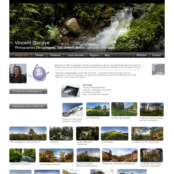
Virtual tours - ::. photoJPL.com :: photos panoramiques .:: 16 visites virtuelles de lieux historiques en France (en 3D, 360 degrés) Quels sont les monuments français qui proposent des visites 3D ou 360 degrés ? Le blog de la médiathèque du CDDP de l’Oise dresse une liste de 16 lieux français patrimoniaux à visiter via son ordinateur (voire via un outil connecté mobile) qui offrent ainsi une découverte inédite de monuments, architectures, châteaux, vallées, musées, endroits de batailles, églises et musées reconstitués sous une forme virtuelle avec légendes, apports textuels mais également audio/sonores. On retrouve ainsi des liens directs vers les visites virtuelles de la Cathédrale Notre-Dame-de-Paris, la Tour Eiffel, la Grotte de Lascaux, le Château de Versailles, la Ville de Saint-Denis, le Débarquement d’Arromanches… Tous ces projets ont un point commun : ils sont issus de l’Etat, de collectivités territoriales ou d’institutions publiques. Licence : Creative Commons by-nc-saGéographie : France
Acropole d'Athènes The Propylaia, famous already in antiquity for its brilliant coffered ceilings and the unique design of the monumental entrance to the sanctuary of Athena, was a work of the architect Mnesikles (437-432 B.C.). It consists of a central building with two six-columned Doric porticoes east and west and two Ionic colonnades in the interior, framed at the north and south by two wings with porches in the Doric order. The outbreak of the Peloponnesian War meant that the final work on the surfaces of the monument was never completed. Pyramides de Gizeh 3841 tombs and monuments listed. Thanks to 10 years of collected research, Dassault Systèmes was able to reconstruct the Giza Necropolis as accurately as possible. Cathédrale de Strasbourg - Visites, horloge astronomique Heures d'ouverture de la Cathédrale La Cathédrale est ouverte tous les jours de 7h00 à 11h20 et de 12h40 à 19h00. Accueil : du lundi au samedi de 9h30 à 11h15 et de 14h à 18h, le dimanche de 14h à 18h Visites de la Cathédrale Avec environ 4 millions de visiteurs par an, la Cathédrale de Strasbourg est la deuxième cathédrale la plus visitée de France après Notre Dame de Paris et ses 12 millions de visiteurs, bien avant Reims et Chartres. Un règlement de visite à l'intention des guides a été établi ; il est affiché près de l'entrée au fond de la Cathédrale et peut également être consulté en suivant ce lien >>> L’entrée se fait par la porte latérale arrière, côté Maison Kammerzell ; dès l’entrée un guide historique et culturel est disponible à partir d’un distributeur automatique ; Chaque visiteur peut ainsi appréhender l’édifice qu’il pénètre , à savoir une église, un lieu de prière et de recueillement. La sortie se fait par la porte latérale arrière, côté Poste. Fondations millénaires
Notre Dame de Paris Ces vues panoramiques ont été réalisées et très aimablement mises à disposition de la cathédrale par Andrew TALLON. Le chœur de la Piéta Le chœur de la Piéta Cliquez sur la photo ci-dessus pour naviguer dans le panoramique. © Andrew TALLON Le déambulatoire du chœur au niveau de l’abside Le déambulatoire du chœur au niveau de l’abside Le déambulatoire Sud et la clôture du chœur Le déambulatoire Sud et la clôture du chœur Le transept Sud Le transept Sud La croisée des Transepts et le maître-autel La croisée des Transepts et le maître-autel Le bas-côté sud au niveau du Transept Le bas-côté Sud au niveau du Transept Le bas-côté Sud de la nef Le bas-côté Sud de la nef Le bas-côté Nord Le bas-côté Nord La nef La nef Le Portail de la Vierge Le Portail de la Vierge Le Portail du Jugement Le Portail du Jugement Le Portail Sainte-Anne Le Portail Sainte-Anne Cliquez sur la photo ci-dessus pour naviguer dans l’image panoramique. © Andrew TALLON