background preloader

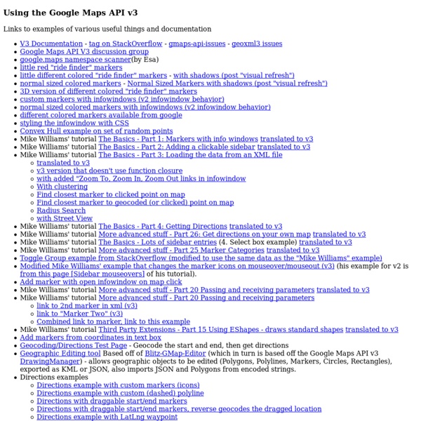
Google Maps API links

Google Maps API links

Google Maps Engine - Display Directions on InfoWindow Need to add "directions to here" link in infowindow Add get directions link to InfoWindow Google maps V3 Easily Link to Places/Directions using the New Google Maps Since the release of the new Google Maps API, there are some really powerful ways to create links from your site. These links could be a simple location, or they could be directions or even local searches. Here are some ideas of how to link to the New Google Maps. There are multiple ways to link to the new Google Maps now, I will show a few different syntaxes to demonstrate alternate methods. Place/Address The most basic is a simple destination. Select All Directions (with empty starting point) The following will link to an address and automatically focus the cursor on the starting location input. To add the traffic layer on any of these links, add this to the query string: &layer=t Directions (with set starting point)

Responsive Retina Ready Google Maps - Rob and Lauren So I was work­ing on a respon­sive wed­ding web­site last week, and one of the require­ments was an inline google map with impor­tant loca­tions plot­ted on it. The require­ments also stated that I pro­vide a key with info about each, and a link for the full direc­tions, and the style needed to match the look of the site. This is how I tack­led it, and made the sucker responsive. First I toyed with the idea of the sta­tic maps api, but the allure of a fully inter­ac­tive map was much too entic­ing. After a bit of research, it looked doable, and it was! I’ll run you through each piece indi­vid­u­ally, but if you’d rather just grab the code and check it out, here is the demo. I included both jQuery and Lo-Dash on the site, so dump­ing tem­plates into the DOM seemed like a no brainer. I real­ized early on that I would need an easy way to con­fig­ure this map. One thing to note is the styles array above. $.getJSON('map.json', function ( data ) { // All code here }); Well, thats’s about it.

Map Links The maps URL scheme is used to show geographical locations and to generate driving directions between two points. If your app includes address or location information, you can use map links to forward that information to the Maps app on iOS or OS X. Unlike some schemes, map URLs do not start with a “maps” scheme identifier. Instead, map links are specified as regular http links and are opened either in Safari or the Maps app on the target platform. HTML link:Native app URL string: The following examples show the strings you would use to provide driving directions between San Francisco and Cupertino: HTML link:Native app string: URLs that contain no path parameters or that contain specific map paths are opened in Safari and displayed there. The rules for creating a valid map link are as follows: The domain must be maps.apple.com.The path cannot be /maps/*.A parameter cannot be q=* if the value is a URL (so KML is not picked up).The parameters cannot include view=text or dirflg=r.

Opening native map apps from the mobile browser As mobile devices grow in popularity towards being the most common way people access the web, so does the desire of both business owners and developers to leverage the devices' new capabilities. Often this comes in the form of an application, but with the advent of responsive design and improved mobile browsing it is taking place with increasing frequency in the browser. One of the most obvious and useful features to employ in the mobile context is location finding. Picture this. The answer is yes. So, how do we make this work? Zelen Shoes 894 Granville Street Vancouver, BC V6Z 1K3 URL Structure To find this location on the Google Maps website you'd need a link like this: <a href=" iPhone The good news is that an iPhone would actually hijack this URL and open the map app automatically. <a href=" Here we are setting the source address to "Current Location" and the destination address to our store. Android Find Us BlackBerry URL Overview Default Find Us

Maps URL Scheme   |   Google Maps SDK for iOS   You can use the Google Maps URL scheme to launch the Google Maps app for iOS and perform searches, get direction requests, and display map views. When you launch Google Maps your bundle identifier is automatically sent as part of the request. Overview A URL scheme allows you to launch a native iOS application from another iOS app or a web application. com and comgooglemaps-x- - These schemes allow you to launch the Google Maps app for iOS and perform one of several actions:Display a map at a specified location and zoom level.Search for locations or places, and display them on a map.Request directions from one location to another. Launch the Google Maps app for iOS and perform a specific function To launch the Google Maps app for iOS and optionally perform one of the supported functions, use a URL scheme of the following form: com or: comgooglemaps-x- Parameters are described in detail later in this document. Objective-C Swift Display a map Search

Launch Native iOS Google Maps Via Your Web App "Google has introduced a Google Maps URL Scheme (comgooglemaps) to allow you launch a native iOS Google Maps from your HTML web application" View this demo in your iOS device Have you ever think of improving your web app’s user experience (UX) by enabling your users to easily search and get directions of your business? Yes! Here is a good news for you to allow your web app users to navigate your business direction using their native iOS Google Maps instead of web version of Google Maps. Google has introduced a Google Maps URL Scheme to allow you launch a native iOS Google Maps from your web application. Display map at a specified location and zoom.Search for location and display them on map.Request direction from one direction to another in 3 modes available: driving, walking and public transit. How To Use Google Maps URL Scheme? Before you present this URL to your web app users, you should first check that are they using iOS devices (iPod, iPhone, iPad). Step 2:

Google Map Template with Marker at Nearest Location to User's Location (Example 7) Google Maps API - Tutorial Google Map with Marker at Nearest Location to User's LocationOpenGeoCode.OrgFeb. 21, 2014 Google Map with Marker at Nearest Location to User's Location (Example 7) In this example, we explain how to find the nearest location to a user from a list of locations and place a marker on a Google Map at the nearest location. Below the explanation is a code example that illustrates this task and may be used as a template. In this example, a Google map is displayed and centered at the location that is nearest to the User's Location with corresponding marker. Define the width and height of the Google map as CSS style declaration for the attribute id 'map-canvas'. The location determined by the browser is passed to 'UserLocation()' in the parameter 'position'. Declare a map options parameter 'mapOptions' to set the zoom and center of the map. The array 'locations' contains the coordinate data for the cities Seattle, Los Angeles, Austin and Columbus.

Using the navigator object to detect client's browser Using the navigator object to detect client's browser Last updated: January 20th, 15' Until one browser remains standing on the web (if ever), browser detection will continue to be part of any good JavaScripter's life. Whether you're gliding a div across the screen or creating an image rollover, it's fundamental that only relevant browsers pick up on your code. In this tutorial we'll probe the navigator object of JavaScript, and show how to use it to perform browser detection, whether the subject is Firefox, Internet Explorer, Opera, etc. The navigator object The navigator object was conceived back in the days when Netscape Navigator reined supreme. The navigator object of JavaScript contains the following core properties: Let's see exactly what these properties reveal of the browser you're currently using: appCodeName: MozillaappName: NetscapeappVersion: 5.0 (X11)userAgent: Mozilla/5.0 (X11; Ubuntu; Linux x86_64; rv:17.0) Gecko/20100101 Firefox/17.0platform: Linux x86_64 At a glance Output:

Use Geo Location to Give Your Customers Driving Directions - Tuts+ Code Article This tutorial is an update to a previous one in which we looked at how to show driving instructions directly on a WordPress Website using the the Google Maps API. In the first tutorial, our users had to manually enter their address into a form on the website – then the directions would be displayed. This was a good example of how to use the Google Maps API but the ability to detect a users' current location, in addition to being able to enter an address manually, was a feature often requested. There's quite a lot of ground to cover here, but a large portion of it was covered in the previous tutorial. To save me having to repeat myself, please review the first tutorial "Give your Customers Driving Directions" where you'll find everything that isn't explained in this one. This is a list of things we are not going to cover in this tutorial. How to register custom settings in the WordPress Admin Panel. In addition to what we achieved in the previous tutorial, we will also: map.phpmap.jsmap.css

Related: