Making Virtual Reality Less Virtual
A decade ago, the dream of a separate, virtual world didn’t seem so far-fetched. Second Life, a digital world where people could create and interact with human-like avatars, seemed poised to blow up. A magazine wrote a cover story about a Second Life millionaire. Politicians made policy announcements in the virtual world. Reuters, CNN, Wired, and other media outlets built bureaus there. Second Life never took off as predicted. But that might be changing. Rosedale is also back on the virtual reality scene with the new venture. Even if Rosedale is right, that’s probably a while away. At this early stage in the gestation process, though, it’s fascinating to take a closer look at Rosedale’s mission, because it exposes a lot of basic, mind-bending questions. Like many other new technologies, Rosedale predicts, the rise of virtual reality will come not in a wave, but with a creep—as it becomes more useful, it will start to seem more normal. More From The Atlantic
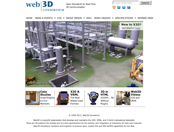
X3D: Extensible 3D Graphics for Web Authors
start [VIBE]
In the News Virtual Worlds as Venues for Public Archaeology at Society for Historical Archaeology Blog By Beverly Chiarulli and Marion Smeltzer 3 virtual environment platforms that inspire learning at Hypergrid Business News By Ann Cudworth Recent Speaking Events or Publications Congratulations to Dr. Design and Evaluation of a Simulation for Pediatric Dentistry in Virtual Worlds Ustream recordings (right click and open in new tab/page) OpenSimulator Community Conference 2013: The Fantastic Voyage of Converting to OpenSim for Biology and Archaeology Education VSTE: Stephen Gasior, Sept. 16, 2013 SIGVE Speaker: Stephen Gasior, Sept. 17, 2013 Second Life - Staff House OpenSim VIBE Grid Login-URI: Registration Web Interface: just put URI in Grid manager and registration is splash page Grid Name: vibe Hypergrid Address: vibe.bio-se.info:9000:VIBE Please see the Hypergrid page for more information on how to access the VIBE grid. About Facebook and SecondLife Builders Archeology
Future-Talk 3D
Ubick, une solution de cartographie en 3D 100 % française
Cette vue du quartier de la tour Montparnasse à Paris (XIVe arrondissement) illustre la qualité et le niveau de détail que peut offrir la base de données cartographiques Ubick. Elle couvre déjà 30 villes françaises. © Ubick Ubick, une solution de cartographie en 3D 100 % française - 2 Photos Lorsqu’on parle de cartographie numérique en 3D, on pense généralement à des services comme Google Earth, Apple Plans ou Nokia Here. On peut désormais ajouter Ubick, un service de cartographie 3D haute précision entièrement conçu en France. Ubick dispose d’un mode 3D stéréoscopique dont on peut profiter en se servant de lunettes anaglyphes. Cinq caméras embarquées pour Ubick Créée en 2001, cette société dont le siège se trouve à Limoges (Limousin) est spécialisée dans la cartographie aérienne par photo numérique et lidar. Pour réaliser les prises de vue aériennes destinées à Ubick, Imao a aménagé l’un de ses avions avec un système comportant cinq caméras et une centrale inertielle. Sur le même sujet
Lecture, mémoire, bibliothèque, lecture numérique
Ce texte est une reprise largement remaniée de ma communication au séminaire général de l'ITEM, " De l'archive manuscrite au scriptorium électronique ", à l'invitation d'Aurèle Crasson, en 2005. Je remercie mes amis de l'ITEM de m'avoir incité à ce retour sur une expérience qu'ils avaient si bien accompagnée. précédents Le projet de " Poste de Lecture Assistée par l'Ordinateur " de la Bibliothèque de France - souvent désigné à l'époque par l'acronyme " P.L.A.O " - n'était pas sans précédents. Le plus célèbre était le dispositif imaginé par Vannevar Bush au tournant de la seconde Guerre Mondiale et intitulé " Memex ". En réalité, le projet de Bush lui même avait été précédé d'une station de lecture de microfiches, conçue par Golberg, avec le parrainage de Paul Otlet, une des grandes figures du monde des bibliothèques. Evidemment la liste organisée de la collection est une des pièces maîtresses de son système. prospective bibliothèque numérique épisodes pratiques fonctionnalités lecture numérique
FrontPage
You have arrived at the permanent landing page for EVO sessions. Note: If you cannot see all of the text on the right, click on the tiny arrow above the words Page History in the upper right corner to expand to Fullscreen View. Call for Participation Electronic Village Online (EVO) 2020 For five weeks in January and February, TESOL experts and participants from around the world engage in collaborative online discussions or hands-on virtual workshops of professional and scholarly benefit. Sessions are free and open to anyone around the globe. Convention in order to participate. We invite you to choose a session from this year's offerings listed below. Click on the link for the session you want to attend, scroll down to the bottom of the page and find the joining instructions for each session there. The Electronic Village Online Hashtag is: #evosessions Click on the title of a session below to view the complete session description. Thank you for helping spread the word!
Musée virtuel
Un article de Wikipédia, l'encyclopédie libre. Un musée virtuel est une galerie, essentiellement située sur le Web. Définitions[modifier | modifier le code] Gilles Deleuze définit le mot virtuel comme « tout champ problématique susceptible d’établir des liens entre des objets ou des processus en apparence étrangers les uns aux autres : le virtuel est entièrement réel même si tout en lui n’est pas actualisé » (Deloche, 2001). Le musée virtuel relève donc de cette même définition couplée à celle de l’institution muséale. Cette définition, somme toute assez ancienne, se limite trop à un musée virtuel qui ne serait qu'un pâle reflet du musée réel. Les missions du musée virtuel[modifier | modifier le code] Le musée virtuel peut avoir également différentes missions, notamment d’enseignement et de diffusion de la culture, mais aussi de rendement et de promotion, et enfin des objectifs proprement politiques. Bibliographie[modifier | modifier le code] Références[modifier | modifier le code]