
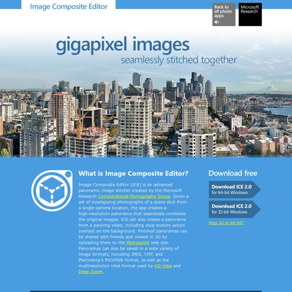
http://research.microsoft.com/en-us/um/redmond/projects/ice/
Texas Stadium Implosion - BigLook360 The death of an iconic stadium and an Immersive Media Dodeca 2360 Spherical Video Camera. From Dallas, TX, where both BigLook360 and Immersive Media have offices, comes a video that is grabbing the attention of sports fans, concert goers, tech geeks, and fans of destruction alike. Sometimes you just have to say, "Let's go for it!" to make something that will appeal to a broad audience. Image Viewer - Powerful and Intuitive Photo Viewer, Editor and Batch Converter FastStone Image Viewer is a fast, stable, user-friendly image browser, converter and editor. It has a nice array of features that include image viewing, management, comparison, red-eye removal, emailing, resizing, cropping, retouching and color adjustments. Its innovative but intuitive full-screen mode provides quick access to EXIF information, thumbnail browser and major functionalities via hidden toolbars that pop up when your mouse touches one of the four edges of the screen. Other features include a high quality magnifier and a musical slideshow with 150+ transitional effects, as well as lossless JPEG transitions, drop shadow effects, image annotation, scanner support, histogram and much more. It supports all major graphic formats (BMP, JPEG, JPEG 2000, animated GIF, PNG, PCX, PSD, EPS, TIFF, WMF, ICO and TGA) and popular digital camera RAW formats (CRW, CR2, NEF, PEF, RAF, MRW, ORF, SRF, ARW, SR2, RW2 and DNG). No Adware.
藝術與科技的跨越和融合| |來賓部落格 來自上海世博,從台北移師到台中展出的「會動的清明上河圖」,同樣造成轟動。九百年前北宋首都汴京的風華彷彿歷歷在目,各行各業庶民生活躍然紙上,原本平面的長卷放大成為立體後,相信觀者很難不被張擇端描繪的城市紋理和細節所撼動,就像一部有聲有影的動畫片,娓娓道來百姓生活的大千世界。 能將國寶級藝術品做這樣的展示,完全是拜數位科技之賜,十二世紀的時空、畫中的人物不再遙不可及,賦予靜態著名展品難得的親和力,將現在的真實與過去的擬真並置交錯,這不僅是特殊的觀展經驗,其遊戲和趣味特質,更打破因年齡、性別、職業、教育程度的不同對欣賞藝術所可能產生的隔閡,實為一舉數得。 Riding Shotgun With Google Street View’s Revolutionary Camera For the past seven months, Kevin Nanzer has been on the road almost nonstop, living in and out of motel rooms and corporate apartments. He's crisscrossed the country, living for weeks at a time in cities like Austin, Texas, Oklahoma City, Okla., Raleigh, N.C., and Albany, N.Y. Nanzer, 23, is a geoimmersive data producer for Immersive Media, a Canadian company that specializes in the fast-growing world of "spherical video"—aka mapping the world for Google and beyond. For 5 hours each day (the most he can film because of the sun's angle to the Earth), Nanzer and a co-worker drive anywhere from 80 to 200 miles through a major city, capturing video and location data of every single street, bridge and highway.
GIMP Portable image editing on the go GIMP Portable is the popular GIMP for Windows image editor packaged as a portable app, so you can take your images with you and do your editing on the go. Version 2.8.18 for Windows, Multilingual 62MB download / 202-273MB installed (Details) 用畫面喚起意念 - 郝廣才的創意觀測站 《森林大熊》是一本探討人與自然,自然與工業文明,工業文明與人三角關係的名作。故事寓意深遠,而情節卻十分幽默,處處有令人噴飯的意外。繪者採用漫畫框的格式,配合細膩的描繪,是一次成功的嘗試。 故事一開始:「樹葉開始往下落,野雁成群向南飛。」
Cameras Archives April 02, 2009 my Technomadic Hacks in Cyberpunk Non-Fiction; "C/Punk/Doc" I met Laszlo Kovacs, Director of C/Punk/Doc through the amazing forums @ Cyberpunk Review. He invited me to submit media just as they were wrapping production, so we have a 1.5 minute segment on my Wearable and Nomadic Computing work that begins Act 2. Narration is by Hawk from American Gladiators, over the song Teenage Hitman by Encephalon.
Het Fotografieinstituut - Word Freelance Fotograaf of Start een Geweldige Nieuwe Hobby! Word Freelance Fotograaf of Start een Geweldige Nieuwe Hobby! De Professionele Fotografiecursus wordt online, via het internet gegeven. U studeert waar en wanneer u maar wilt en in uw eigen tempo. Innovatieve online fotografiecursus met diploma.
Chapter-08 Introduction to Multimedia Arts 視覺原理 包浩斯學派﹝Bauhous School﹞的創始人華特‧葛羅畢斯﹝Walter Gropius﹞在其〝Education Towards Creative Design〞著書中,略謂現代藝術與造形設計,是根據視覺語言,諸如錯覺、空間的虛實關係、光和影、色彩心理、比例與對照,以及主觀的解釋和客觀的事實,藉以作為表現抽象造形的要素。 誠然,一件藝術品的造形,雖產生自靈感,而畫家的靈感,往往又是由入世而出世,繼之而超世,甚至超出倫理和理性,結果以致作品無法為人了解。 由於上述的關係,我們必須從玄學中的另一方面,即根據科學尋求一項視覺的共通性,俾使觀賞者藉此共通性得以與藝術家在思想上互相溝通;同時又藉該項共通性,對藝術家的創作行為加以有限度的管制。 對這項視覺的共通性,我們稱之為「視覺原理」。根據這個原理,人類對於相同的事物,如果用適當的時間和空間呈現,就會產生視覺的聯結,於是產生事物運動的知覺。
» Papervision3D CornFlex, Script by Q. FLARToolKit: AS3 Augmented Reality Written by Quentin LengeléPosted in Flash,Papervision3DMarch 25, 2009 Months ago, I saw lots of video examples on blogs and YouTube and finally I got some time and found AS3 sources from some brilliant japanese guys (Libspark). They built an AS3 library called FLARToolKit which is translated from a Java library (NyARToolkit). This library can detect a “marker” on a video source and calculate its position in a three-dimensional space. Theses coordinates can be easily used with Papervision3D and applied on a Collada Object or anything else.
Fotosizer Batch Image Resizer - Home Shooting 360-degree video with four GoPro HD Hero cameras Posted by ryanjackson on Feb 8, 2011 in 360 Panoramas, DIY, photos, training, video | First off, watch my 360-degree Video of the World Record Dodgeball Game at the U of A So last year I shot this video of the University of Alberta setting a world record for most people playing dodgeball and the video got over 650,000 hits. I’ve seen a few 360-degree videos out there but not as many as you would think considering how freaking cool they are.
Compressor.io - optimize and compress your images and photos DIY Street-View Camera If you use Google Maps, you're probably familiar with its Street View feature, which shows actual ground-level photos of many cities around the world. Google creates the images by mounting special cameras on vehicles and driving them around. Now wouldn't it be great if you could have your own Street View–like camera? You could hike a trail and later share the photos with friends. The photos would carry GPS tags, so you could display them on Google Earth and include annotations—good water here, poison ivy there. Realtors could display whole neighborhoods to potential clients.