
Mappe socioculturali. Mapping Reality. Geografia fantastica e dello spirito. Map Editor. In viaggio. Technique. Create and Annotate Maps. Cartothèque. Maps. Cartothèque. Interactive Maps. Carto. Cartographie. Cartographie.
Cartographie. Google Maps. How to Save and Organise Your Favourite Spots All Over the World Using Google Maps. When you save a location to a custom list, it will appear on your Maps view with a blue marker.
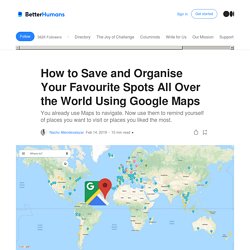
When you are exploring a place, either in person or virtually on maps, you can load up your list and see any saved locations in that area instantly. I find this incredibly useful, especially by naming my lists by context. For example, when I find myself in a cosy cafe, I simply save it on my FAV Coffee & Chill list. A great escape room in Manchester goes into FAV Activities, and a remote mountain viewpoint gets saved into FAV Places to See. Use a Good Naming Convention I write FAV (short for Favourites) at the beginning of every list where I save awesome places that I’ve already been and I want to remember.
Pretty much every FAV list has a partner list, WTG (short for ‘want to go’). This separation allows me to easily keep track of both the places I’ve been to and the places I would like to go. Alternative a Google Maps ed a Google Transit - Le Alternative. Maps for Life. Esri Story Maps - Harness the Power of Maps to Tell Your Story. Storymap : pour créer des cartes narratives. Bing Maps. Wikimapia. House Street City Country.
OsmAnd - Offline Mobile Maps and Navigation. Tour Builder. Carte IGM di tutta l’Italia on line – Cose&Robe – Rielaborazioni dataset opendata – @gbvitrano. Visualizzatori - Geoportale Nazionale. PeakVisor Identify Mountains. MapCrunch - Random Google Street View. Maps And Mapping. NatGeo Mapmaker Interactive. Maphill: Web’s Largest Map Gallery. How to Find the Most Recent Satellite Imagery Anywhere on Earth. At Azavea, we help our clients use machine learning and satellite imagery to map places all over the world—we’ve trained AI to map everything from buildings, to bodies of water, to solar panels and crosswalks.
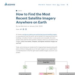
But every project starts with the same question: based on what you care about in the imagery, what’s the newest, cheapest, and highest-resolution imagery we can find? Today, we’re sharing our simple tool for triaging these requests along with plenty of links to help guide you to the right image for your needs! Here is a simple flowchart to find the right recent satellite imagery source for your project: Free, browsable data If you are just curious about seeing the most recent high-resolution image you can find for a given area of interest, and you don’t care about getting access to the raw images or using what you see for some commercial purpose, far-and-away the best tool you can use is Google Earth’s Explore New Satellite Imagery Tool.
Paid, browsable data Free, downloadable data. Explore Earth. Allerta meteo - Regione Toscana. The Map is not the territory. World-wide Ancient Site Database. La mappa dell'arte in Italia. Frankenplace. Grid Reference Finder. OpenStreetMap. Here.com. Find Latitude and Longitude. The true size of ... CARTO. Dessous des cartes. Cartothèque. Cartothèque. Cartes. Cartes. 25 Free Vector World Maps. Generally, finding World map templates is not an easy task.
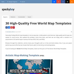
Unlike patterns and textures, high-quality world maps are not the easiest to come across. We realized this problem some time back, and here we are today, with a solution to it — an assortment of 20 world maps in various formats (PSD, SVG, and PNG). Browse through the collection, and do share your thoughts with us in the comments below. Also, if you are aware of any world map source file that we missed, feel free to add it to the list by commenting below.
If you’re looking for Vector World Map Templates, check out this post: 20 Free Vector World Map Templates. Mapping & Cartography. Maps. Maps. Maps. Maps. Hike & Bike Map. WhatWasThere. SepiaTown. Maps. Cartes géographie. Country Maps · Public Domain · PAT, the free, open source, portable atlas. Maps. Home page Down to: 6th to 15th Centuries | 16th and 19th Centuries | 1901 to World War Two | 1946 to 21st Century The Ancient World ... index of places Aegean Region, to 300 BCE Aegean Region, 185 BCE Africa, 2500 to 1500 BCE Africa to 500 CE African Language Families Alexander in the East (334 to 323 BCE) Ashoka, Empire of (269 to 232 BCE) Athenian Empire (431 BCE) China, Korea and Japan (1st to 5th century CE) China's Warring States (245 to 235 BCE)

10000+ online newspapers in the world, translate with one click. Flightradar24 Live Flight Tracker. OpenSignalMaps - Cell Phone Tower and Signal Maps. Roundabouts Worldwide. Lakes and Oceans. Find a Dark Sky Place. Filter by Map Data Map data ©2016 Google, INEGI.
WikiLoc. Croquis de randonnee - Trucs et astuces. Geolocation. Géolocalisation. Geo Maps & Stats. GPS TRACKS. The Official Global GPS Cache Hunt Site. GPS planification. Useful Stuff. GIS. UX Patterns for Maps. Phantom Islands — A Sonic Atlas. The true size of countries. Nature Soundmap. 'Welcome to the Anthropocene' Earth Animation. Black Marble: NASA Releases Incredibly Detailed Photos of Earth at Night. You’ve probably heard of The Blue Marble , an iconic photo of Earth captured in 1972 from 28,000 miles away by astronauts on the Apollo 17 spacecraft. Well, NASA has just released a number of photographs titled “Black Marble.” They offer the same perspective as the iconic photo, except these new images show what our planet looks like at night !
The photograph above shows North and South America (original resolution here ). It’s a composite photograph created using images snapped by a satellite over the period of around three weeks in April and October of this year. It took the satellite 312 orbits around our planet to capture 2.5 terabytes of imagery. The satellite used a special new imaging system that can detect extremely dim signals. Here are a couple more Black Marble photographs showing different sections of our planet (click the photos for highest-res versions): Here’s a zoomed-in view of the United States and Europe using the same imagery: Generateurs 3D. World Map Projections. Find Latitude and Longitude. Lists of extreme points. Orientation. Ventusky - Wind, Rain and Temperature Maps. Passion Météo - Cartes techniques - Vents Méditerranée. Air Traffic in Real Time.
Carte en temps réel des navires - AIS - trafic maritime et positions. World Maps: Political, Physical, Satellite, Africa, Asia, Europe. INTRODUCTION - guide_de_lecture_de_la_carte_geologique_a_1_50_000.pdf. INITIATION A L’INTERPRETATION DES CARTES GEOLOGIQUES - CartographieSVTU_S3.pdf. Coupe géologique. Les coupes géologiques permettent de montrer la structure en profondeur.
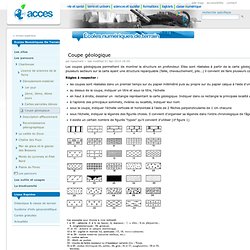
Elles sont réalisées à partir de la carte géologique interprétative, perpendiculairement aux principales structures. S'il y a plusieurs secteurs sur la carte ayant une structure reparquable (faille, chevauchement, plis...) il convient de faire plusieurs coupes. Règles à respecter : les coupes sont réalisées dans un premier temps sur du papier millimétré puis au propre sur du papier calque à l'aide d'un stylo noir très fin au dessus de la coupe, indiquer un titre et sous ce titre, l'échelle en haut à droite, dessiner un rectangle représentant la carte géologique. Indiquer dans ce rectangle la principale localité ainsi que le trait de coupe. à l'aplomb des principaux sommets, rivières ou localités, indiquer leur nom sous la coupe, indiquer l'échelle verticale et horizontale à l'aide de 2 flèches perpendiculaires de 1 cm chacune sous l'échelle, indiquer la légende des figurés choisis.