
FEEFHS: Polish Provinces 1902. Country Resources. Ostsiedlung. Ostsiedlung (German pronunciation: [ˈɔstˌziːdlʊŋ], literally east settling), also called German eastward expansion, was the medieval eastward migration and settlement of German speakers from the Holy Roman Empire (present day Germany, Austria, and Switzerland) into less-populated regions and countries of eastern Central Europe and Eastern Europe.
The affected area roughly stretched from Slovenia to Estonia, and southwards into Transylvania. In part, Ostsiedlung followed the territorial expansion of the Holy Roman Empire and the Teutonic Order. According to Jedlicki (1950), in many cases the term "German colonization" does not refer to an actual migration of Germans, but rather to the internal migration of native populations (Poles, Hungarians, etc.) from the countryside to the cities, which then adopted laws modeled on those of the German towns of Magdeburg and Lübeck[why?]. Background[edit] Central Europe before the eastern expansion[edit] Europe ca. 650 A.D. German minority in Poland.
The registered German minority in Poland at the 2011 national census consisted of 148,000 people, of whom 64,000 declared both German and Polish nationalities and 45,000 solely German nationality.[1] At a 2002 census there were 152,900 people declaring German nationality[2][3][4] therefore the last census noted a 4,900 decrease in the number of Germans in Poland.
There are 325 Polish schools that use the German language as the first language of instruction, with over 37,000 students. Most members of the German minority are Roman Catholic, and some are Protestants (the Evangelical-Augsburg Church). A number of German language newspapers and magazines are published in Poland. Statistical data[edit] German minority in Upper Silesia: Opole Voivodeship (west) and Silesian Voivodeship (east).
German minority in Masuria. Towns with particularly high concentrations of German speakers in Opole Voivodeship include: Strzelce Opolskie; Dobrodzien; Prudnik; Glogowek; and Gogolin.[5] Powiat słupecki. Powiat słupecki powstał w 1867 w wyniku wydzielenia z zachodniej części powiatu konińskiego w guberni kaliskiej Królestwa Polskiego[1].
Podział administracyjny[edytuj | edytuj kod] W skład powiatu wchodzą: Położenie[edytuj | edytuj kod] Historia[edytuj | edytuj kod] Dzisiejszy powiat słupecki jest czwartym w historii powiatem z siedzibą w Słupcy. 1973-19751 stycznia 1973 roku zniesiono gromady i osiedla, a w ich miejsce reaktywowano gminy. 1975-1998 Po reformie administracyjnej obowiązującej od 1 czerwca 1975 roku terytorium zniesionego powiatu słupeckiego włączono do nowo utworzonego województwa konińskiego[6].
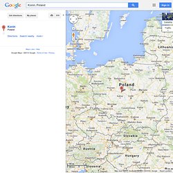
Powiat słupecki zajmuje powierzchnię 837,9 km², co stanowi 2,8% województwa wielkopolskiego i jest 14. pod względem powierzchni powiatem w województwie. Poczet starostów[edytuj | edytuj kod] Edukacja[edytuj | edytuj kod] Starosta jest organem prowadzącym następujących szkół: Liceum Ogólnokształcące im. FAQ: Posen including South and New East Prussia. Konin, Poland - Google Maps. Screen reader users: click here for plain HTML MoreEven more from Google Sign in 100 km 100 mi Satellite Traffic Photos Terrain Bicycling Konin, Poland Exit Report a problem Map data ©2014 GeoBasis-DE/BKG (©2009), Google - Konin.
Konin. Details Details Zugriffe: 6621 Konin Die Kreisstadt Konin an der Warthe ist eine Gründung nach deutschem Recht (13.Jahrh.).
Als Vogt wird hier 1365 Wilhelm genannt. 1331 wurde Konin von den Kreuzrittern zerstört. Friedrich ÖhlersSamuel FibichMichael LempkeKarl LiebeNikolaus WunderlichJohann SchönweißChristoph HöftAugust RederMichael FriedrichChristian ThimmGottlieb EngelJohann GesseMartin PeschkeF. Auf dem flachen Lande u Konin begann schon nach 1750 die deutsche Siedlungstätigkeit. 1767 entstand auf den Ländereien des Gutes Sławsk, deren Besitzer Leszczyce – Zielonawski gewesen, die Siedlung Węglewskie Holendry. Im J.1840 erbaute Pastor Hinz das jetzige gemauerte Pfarrhaus. 1843 gründete er das Filial Maślaki, das er 12-mal jährlich bereiste.
Pinkas Hakehillot Polin: Konin, Poland. "Konin" - Encyclopedia of Jewish Communities in Poland, Volume I (Poland) Translation of "Konin" chapter from Pinkas Hakehillot Polin Published by Yad Vashem Published in Jerusalem Click here to see how to add a Memorial Plaque to this Yizkor Book Acknowledgments Project Coordinator Morris Wirth Our sincere appreciation to Yad Vashem for permission to put this material on the JewishGen web site.
This is a translation from: Pinkas Hakehillot: Encyclopedia of Jewish Communities, Poland, Volume I, pages 235-238, published by Yad Vashem, Jerusalem This material is made available by JewishGen, Inc. and the Yizkor Book Project for the purpose of fulfilling our mission of disseminating information about the Holocaust and destroyed Jewish communities. JewishGen, Inc. makes no representations regarding the accuracy of the translation. (pages 235-238) Konin(District of Konin) Translated by Morris Gradel The Jewish Community in Konin until 1918 Konin began as an urban settlement in the 12th century.