
Ley line. Ley lines /leɪ laɪnz/ are supposed alignments of numerous places of geographical and historical interest, such as ancient monuments and megaliths, natural ridge-tops and water-fords.
The phrase was coined in 1921 by the amateur archaeologist Alfred Watkins, in his books Early British Trackways and The Old Straight Track. He sought to identify ancient trackways in the British landscape. Watkins later developed theories that these alignments were created for ease of overland trekking by line-of-sight navigation during neolithic times, and had persisted in the landscape over millennia.[1] Since the publication of Michell's book, the spiritualised version of the concept has been adopted by other authors and applied to landscapes in many places around the world. Both versions of the theory have been criticised on the grounds that a random distribution of a sufficient number of points will inevitably create "alignments".
Alfred Watkins and The Old Straight Track[edit] His work referred to G. Earth Grid Research - Fringe Science. Version 0.4 :: March 22, 2010 Original :: Jun 2006 UPDATE: Interface fixed.
You can now use a convenient web interface to generate Google Earth files that show earth overlaid with one of the five platonic solids (or the Becker-Hagens grid) with all vertices connected by lines. Simply visit the following two links and follow the instructions. Google EarthGrid (Coordinates) Google EarthGrid (Bearing) This does away with having to download and install the Python framework. Summary This is a quick write-up of my ongoing research into the earth grid. Within the spherical center of large masses is a neutral center. Neutral centers can be created electromagnetically via radially converging or diverging electric current pulses, spherical standing waves in piezoelectric materials, or via the radial null vectors of large masses as described above.
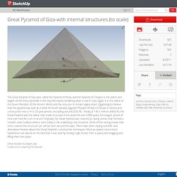
The earth’s own neutral center is a dimensional window that vibrates at frequencies resonant with the earth’s own spherical harmonics. Platonic Grids 1. 2. Great Pyramid of Giza with internal structures (to scale) by Finnian. 3D Warehouse Advanced Search Sign In Error Download Downloads .skp File Size 507 kB Polygons Materials Uploaded Last Modified Share <> Embed Thumbnail3D Viewer Tags ancient, burial, Cairo, Cheops, desert, Egypt, engineering, Giza, histroy, middle east, Nile, Pyramid, structure Add to Great Pyramid of Giza with internal structures (to scale)
Exploring the UVG Grid with Google Earth. Basic Instructions for Exploring the UVG Grid with Google Earth Bethe Hagens Nazca The basic Google Earth program is available for PC and Mac—free!
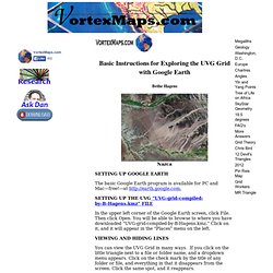
—at SETTING UP THE UVG “UVG-grid-compiled-by-B-Hagens.kmz” FILE In the upper left corner of the Google Earth screen, click File. You can view the UVG Grid in many ways. If you go into the folder titled “Regular Geometric Solids,’ you can see subfolders and can look at (or hide) all of the different geometric figures and great circles that make up the UVG Grid.
Every line of the UVG is part of a great circle (equator) that divides the sphere of Earth in half. Bill Becker, with whom I worked closely on this project for 12 years from 1981 until 1993, was a colleague of Buckminster Fuller. COLOR CODING The vertices (corners) of all five Platonic Solids—and two other diamond-faced regular figures, the rhombic triacontahedron and rhombic dodecahedron—align with the 62 grid points (“corners’) of the Basic UVG Grid (a “spherical’ hexakis icosahedron).