Carte FFVL. Cartothèque. Itinéraire, Plan, Guide tourisme, Réservation hôtel, Carte routière France Europe, trafic. Plans, itinéraires, guide d'adresses en Europe. Google map. Let's describe the whole world! Map Maker. Souhaitez-vous tracer les contours de l'immeuble ?
Souhaitez-vous tracer les limites du site ? Souhaitez-vous délimiter le contour du bâtiment ou tracer la limite du site ? Place Closed Place Removed Impossible de modifier cette adresse, en raison d'une modification effectuée par un autre utilisateur en attente. Adresse (numéro d'appartement, résidence, étage, etc.) Indiquez à quelles catégories appartient l'élément géographique Vous ne pouvez pas attribuer de nom aux éléments géographiques de cette catégorie Saisissez les noms de cet élément géographique Pour changer un nom, accédez au menu "Modifier" pour ce tracé et modifiez la route correspondante. Indiquez la population de ce lieu Vitesse moy.
Vitesse max. Saisissez les attributs du bâtiment Hauteur (pieds): Hauteur (mètres): Hauteur (pieds)Hauteur (mètres) Lieu signalé comme double Indiquez les horaires d'ouverture Contour de l'élément géographique signalé Définissez le contour de ce lieu comme bâtiment ou comme limite Resolve Website Incorrect: État. OpenStreetMap. Maps Engine Lite. Cube. Cartes - itinéraires, trafic et conditions routières. Géoportail - le portail des territoires et des citoyens.
Hypergéo. Visualiseur InfoTerre. Web Geo Services - Le Portail Géo-Connecté - Anonymous. Réalisation de thermographie aérienne et terrestre. La thermographie : pour réduire la facture énergétique et l'effet de serre La thermographie, technique rapide et simple, permet de déterminer, à distance et sans contact la température d'un objet.

Dans le cas d'une ville, elle est utilisée pour connaître, pour chaque bâtiment, public et privé, d'un territoire donné, le niveau des déperditions de chaleur. Chaque habitant de la commune étudiée, peut donc connaître le niveau de déperditions de chaleur de son habitation et savoir ainsi si son logement est suffisamment isolé ou s'il lui est conseillé de procéder à des travaux d'isolation.
Pour obtenir un diagnostic complet d'un bâtiment, on combine deux types de thermographie : la thermographie aérienne qui permet de visualiser les déperditions énergétiques des toitures la thermographie terrestre, dite de façades, qui permet de visualiser les dépertitions thermiques des façades des bâtiments (murs, portes, fenêtres…). Comment se déroule une thermographie aérienne ? La saviez vous ? Day and Night World Map. +1 this page: Follow us on Google+: Like/share this page: Follow us on facebook: The map below shows the current position of the Sun and the Moon.
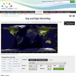
It shows which parts of the Earth are in daylight and which are in night. See where the moon is over the horizon Map notes The day and night parts of the Earth shown are as of Saturday, April 12, 2014 at 00:08:00 UTC.The Sun's position is marked with this symbol: . Position of the Sun. Solar System Scope. Mars. Moon.
Planétarium - Carte des étoiles interactive et ciel virtuel. Cartes - La documentation Française. TargetMap - Create & share customized data maps on Googlemaps. Free Online Mapping tool. SIG Politique de la Ville. Member Map. StatPlanet - Interactive Maps of World Development. Newspaper map. The carbon map: making sense of climate change responsibility and vulnerability. Photos of the World.