
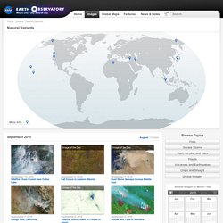
Satellite Chart. EO Natural Hazards: Natural Hazards Main Page. More Info September 9, 2015 Fall Colors in Eastern Siberia September 6, 2015 Tropical Storm Leads to Floods in Japan September 5, 2015 Smoke and Fires in Sumatra September 1, 2015 Dust Marches Across Iraq and Iran September 7, 2015 Dust Storm Sweeps Across Middle East.
Mapping. Visible Earth: The Blue Marble. This spectacular “blue marble” image is the most detailed true-color image of the entire Earth to date.
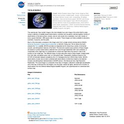
Using a collection of satellite-based observations, scientists and visualizers stitched together months of observations of the land surface, oceans, sea ice, and clouds into a seamless, true-color mosaic of every square kilometer (.386 square mile) of our planet. These images are freely available to educators, scientists, museums, and the public. Much of the information contained in this image came from a single remote-sensing device-NASA’s Moderate Resolution Imaging Spectroradiometer, or MODIS. Maps/GIS. Geocaching. Geocaching.