
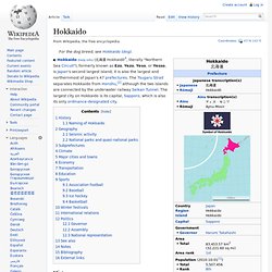
Area of Scotland. Hokkaido. History[edit] Map of Hokkaido Hokkaido was settled by the Ainu,[3] Nivkh, and Orok peoples 20,000 years ago.[4] The Nihon Shoki, finished in 720 AD, is often said to be the first mention of Hokkaido in recorded history.
According to the text, Abe no Hirafu[4] led a large navy and army to northern areas from 658 to 660 and came into contact with the Mishihase and Emishi. One of the places Hirafu went to was called Watarishima (渡島?) , which is often believed to be present-day Hokkaido. During the Nara and Heian periods (710–1185), people in Hokkaido conducted trade with Dewa Province, an outpost of the Japanese central government. During the Muromachi period (1336–1573), the Japanese created a settlement at the south of the Oshima Peninsula. The Matsumae clan rule over the Ainu must be understood in the context of the expansion of the Japanese feudal state. There were numerous revolts by the Ainu against feudal rule.
Hokkaido was known as Ezochi until the Meiji Restoration. Geography[edit] Basic Information < About Hokkaido < Visit Hokkaido. Are you planning to visit Hokkaido in summer or winter?
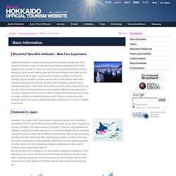
Well, you can enjoy both seasons equally! During summertime, you can enjoy driving to the foothills filed with beautiful flora, or go trekking to the mountains and enjoy alpine plants only seen in Hokkaido. For those who are interested in getting more active, river rafting, and paragliding in the sky are some of the great options for you. During wintertime, it is highly recommended to experience outdoor activities on snow.
Skiing and snowboarding on excellent powder snow are must do's, plus snowboarding on the snowfield and banana-boat on the frozen lake are assures you to have great fun. Hokkaido. Maine. Maine ( i/ˈmeɪn/; French: État du Maine) is a state in the New England region of the northeastern United States, bordered by the Atlantic Ocean to the east and south; New Hampshire to the west; the Canadian provinces of Quebec to the northwest; and New Brunswick to the northeast.
Maine is both the northernmost and easternmost portion of New England. It is known for its scenery—its jagged, mostly rocky coastline, its low, rolling mountains, its heavily forested interior, and picturesque waterways—as well as for its seafood cuisine, especially lobsters and clams. Maine: Map, History, Population, Facts, Capitol, Flag, Tree, Geography, Symbols. Maine Geography from NETSTATE. Located in the far northeast corner of the United States, Maine is the largest of the New England states.
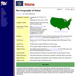
The Maine penninsula, West Quoddy Head, is the easternmost land area of the United States. The Pine Tree State (Almost 90% of Maine is forested.) can be divided into three geographic land areas stretching from the Atlantic Ocean in the east, northwest to the White Mountains. Coastal Lowlands: The Coastal Lowlands start at the Atlantic Ocean and extend from ten to forty miles inland. This area is characterized by flat, sandy beaches in the south and small sandy beaches in small inlets between higher cliffs in the north. Thousands of years ago, this land was much higher. Eastern New England Uplands: To the northwest of the Coastal Lowlands, is a section of the Eastern New England Uplands that stretch from Canada south to Connecticut. .
( Maine Close-up ) Panama. Panama ( i/ˈpænəmɑː/ PAN-ə-mah ; Spanish: Panamá ), officially the Republic of Panama (Spanish: República de Panamá [reˈpuβlika ðe panaˈma]), is the southernmost country of Central America and the whole of North America.
Situated on the isthmus connecting North and South America, it is bordered by Costa Rica to the west, Colombia to the southeast, the Caribbean to the north and the Pacific Ocean to the south. The capital is Panama City. Explored and settled by the Spanish in the 16th century, Panama broke with Spain in 1821 and joined a union of Nueva Granada, Ecuador, and Venezuela, named the Republic of Gran Colombia. When Gran Colombia dissolved in 1831, Panama and Nueva Granada remained joined. Etymology[edit] There are several theories about the origin of the name "Panama". The best-known version is that a fishing village and its nearby beach bore the name "Panamá", which meant "an abundance of fish". History[edit] Pre-Columbian period[edit] Conquest to 1799[edit] 1800s[edit] Panama: Basic Facts.
• Capital City: Panama City (Metro Area Population: 1.1 million)
Panama: Maps, History, Geography, Government, Culture, Facts, Guide & Travel/Holidays/Cities. Republic of Panama The southernmost of the Central American nations, Panama is south of Costa Rica and north of Colombia.
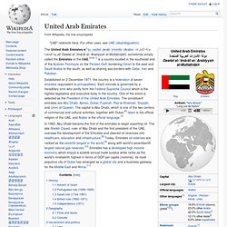
The Panama Canal bisects the isthmus at its narrowest and lowest point, allowing passage from the Caribbean Sea to the Pacific Ocean. Panama is slightly smaller than South Carolina. It is marked by a chain of mountains in the west, moderate hills in the interior, and a low range on the east coast. There are extensive forests in the fertile Caribbean area. Constitutional democracy. Explored by Columbus in 1502 and by Balboa in 1513, Panama was the principal shipping point to and from South and Central America in colonial days. For canal rights in perpetuity, the U.S. paid Panama $10 million and agreed to pay $250,000 each year, which was increased to $430,000 in 1933 and to $1,930,000 in 1955. Nicolas Ardito Barletta, Panama's first directly elected president in 16 years, was inaugurated on Oct. 11, 1984, for a five-year term. See also Encyclopedia: Panama . United Arab Emirates. The United Arab Emirates i/juːˌnaɪtɨd ˌærəb ˈɛmɪrɨts/ (Arabic: دولة الإمارات العربية المتحدة Dawlat al-ʾImārāt al-ʿArabiyyah al-Muttaḥidah), sometimes simply called the Emirates or the UAE,[note 1] is a country located in the southeast end of the Arabian Peninsula on the Persian Gulf, bordering Oman to the east and Saudi Arabia to the south, as well as sharing sea borders with Qatar, Iran and Pakistan.
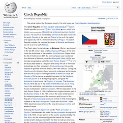
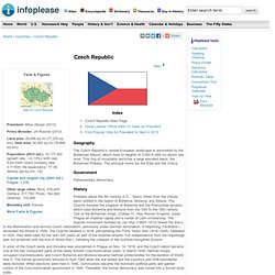
UNITED ARAB EMIRATES: GEOGRAPHY. United Arab Emirates: Maps, History, Geography, Government, Culture, Facts, Guide & Travel/Holidays/Cities. Czech Republic. The Czech Republic ( i/ˈtʃɛk rɨˈpʌblɪk/ CHEK RƏPUBLIK;[10] Czech: Česká republika, pronounced [ˈt͡ʃɛskaː ˈrɛpuˌblɪka] ( ), short form Česko Czech pronunciation: [ˈt͡ʃɛsko]) is a landlocked country in Central Europe.
The country is bordered by Germany to the west, Austria to the south, Slovakia to the east and Poland to the north. Its capital and largest city, with 1.3 million inhabitants, is Prague. Agricultural land in Czech Republic. Czech Republic: Maps, History, Geography, Government, Culture, Facts, Guide & Travel/Holidays/Cities. The Czech Republic's central European landscape is dominated by the Bohemian Massif, which rises to heights of 3,000 ft (900 m) above sea level.
This ring of mountains encircles a large elevated basin, the Bohemian Plateau. The Area of the Czech Republic.