
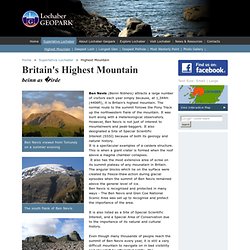
Ben Nevis. The mountain is a popular destination, attracting an estimated 100,000 ascents a year,[2] around three-quarters of which use the Pony Track from Glen Nevis.[3] The 700-metre (2,300 ft) cliffs of the north face are among the highest in the United Kingdom, providing classic scrambles and rock climbs of all difficulties for climbers and mountaineers.
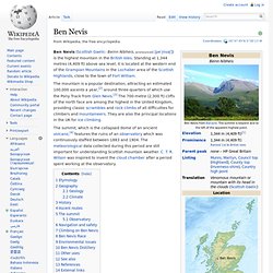
They are also the principal locations in the UK for ice climbing. The summit, which is the collapsed dome of an ancient volcano,[4] features the ruins of an observatory which was continuously staffed between 1883 and 1904. The meteorological data collected during this period are still important for understanding Scottish mountain weather. C. T. Etymology[edit] "Ben Nevis" is an Anglicisation of the Scottish Gaelic name "Beinn Nibheis". As is common for many Scottish mountains, it is known both to locals and visitors as simply "the Ben".[7][8] Geography[edit] Geology[edit] Climate[edit] History[edit] Ben Nevis Feature Page on Undiscovered Scotland.
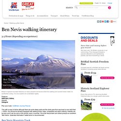
At 4,406ft or 1,344m, Ben Nevis is the highest mountain in the country.
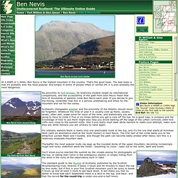
That's the good news. The bad news is that it's probably also the most popular. And simply in terms of people lifted or carried off, it is also probably the most dangerous. Its proximity to Fort William, its relatively modest height by international comparisons, and the accessibility of the path from Glen Nevis mean that tens of thousands of walkers climb Ben Nevis each year. If you decide to join the throng, remember that this is a serious undertaking and dress for the mountain and not for the valley. Hompage. Ben Nevis Scotland - Mountaineering & Accommodation. Ben Nevis attracts a huge number of visitors each year and it’s easy to see why.
At 1,344 metres, Britain’s highest mountain is an impressive presence that towers over Fort William. It is listed as a Site of Special Scientific Interest (SSSI) because of its geology, natural and cultural history and the Ben Nevis and Glen Coe National Scenic Area was established to protect and recognise the importance of the area. If you want to achieve all you are capable of in the Outdoor Capital of the UK; regardless of the level of adventure in the mountains you choose, a mountain guide will always transform your experience from merely interesting to enlightening, enriching and deeply personally fulfilling. Walking or Climbing Ben Nevis. Ben Nevis Fort William. Warning: You are using an old browser that is not supported by this website.
You can continue browsing but some features (like the search box) won't work as expected. In order to be able to fully experience this website you need install a newer browser. We recommend FireFox, it's fast, free, and standards compliant. Ben Nevis is the highest mountain in the British Isles and is probably the most climbed mountain since there's something about being able to say "I've climbed Ben Nevis ! ". Mountain Viewpoints, Gondola Rides, Mountain Biking and Winter Snowsports. Ben Nevis, Britains Highest Mountain. Home > Superlative Lochaber > Highest Mountain.
Ben Nevis (Munro) - MunroMagic.com. Ascent of Ben Nevis. Ben Nevis is the highest mountain in the British Isles, and probably the most often climbed (at least it was on the day I went up!).
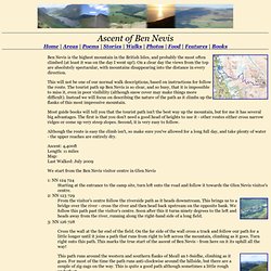
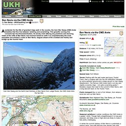
On a clear day the views from the top are absolutely spectacular, with mountains disappearing into the distance in every direction. This will not be one of our normal walk descriptions, based on instructions for follow the route. The tourist path up Ben Nevis is so clear, and so busy, that it is impossible to miss it, even in poor visibility (although snow cover may make things more difficult). Instead we will focus on describing the nature of the path as it climbs up the flanks of this most impressive mountain. Most guide books will tell you that the tourist path isn't the best way up the mountain, but for me it has several big advantages. Although the route is easy the climb isn't, so make sure you've allowed for a long full day, and take plenty of water - the upper reaches are entirely dry. Ascent: 4,400ft Length: 11 miles Map: Last Walked: July 2009. UKH Route Cards - 'Ben Nevis via the CMD Arete' Highland, SCOTLAND Graded difficult Distance 11.62 miles (18.70 km) Total ascent 1,935m.
Scotland Mountains - Route Descriptions - Ben Nevis. Introduction Ben Nevis is the highest mountain in the British isles, and of course the highest of the munros in Scotland (a Munro is a mountain higher than 3000 feet).
The mountain attracks large crowds of hikers every year and the erosion up the tourist trail is seen from a long distance. Ben Nevis walking itinerary. Distance: 4400 feet (1300m) Airports: Glasgow Plan your route: VisitBritain Journey Planner The path is easy to follow although there are some steep parts and the climb goes from sea level to over 4400 feet / 1300m.
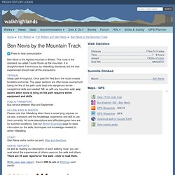
You should be sensibly equipped with walking boots, maps, compasses and warm clothing. Visibility can be poor, and it can be cold on the summit, even in summer. Ben Nevis by the Mountain Track. Hear pronunciation Press to hear pronunciation Ben Nevis is the highest mountain in Britain.
This route is the standard, so-called Tourist Route up the mountain. It is straightforward, if strenuous, by hillwalking standards, but the less experienced should read all the precautions. Terrain Steep path throughout. Ben Nevis Mountain Guides - Adventure Nevis. Maximum Adventure - Ben Nevis - Winter. Ben Nevis is the highest mountain in Britain and stands 1344m high, rising from sea level at Loch Linnhe and towering over the town of Fort William. A winter ascent of Ben Nevis is not an undertaking for the fainthearted! It is cold, can be very windy and has a substantial snow covering! Ben Nevis Navigation. Thousands of people climb Ben Nevis every year and the vast majority make it back down safely. However there are accidents every year and this information aims to reduce the number of incidents which occur due to errors in navigation.
During periods of good visibility the navigation is relatively straightforward but as soon as the mist comes down the plateau can be an extremely confusing and frightening place, especially under conditions of snow and ice. Sound map and compass skills along with a little forethought will go a long way towards avoiding the epics which the unprepared often experience, sometimes with disastrous consequences. To have a fighting chance of navigating effectively on Ben Nevis it is essential to be armed with at least one map, with a waterproof cover, and a decent compass.
Opinions vary as to the best maps for Ben Nevis. A map without a waterproof cover is a liability; so invest in a map case. Climbing Ben Nevis - Scotland's Highest Point. Ben Nevis - National Three Peaks Challenge. Ben Nevis, the highest of the three peaks at 1344 metres (4409 ft), has one main path, marked clearly on the OS Explorer 392 map.
Unlike Snowdon and Scafell Pike, the path to Ben Nevis starts close to sea level, meaning much greater vertical ascent. Up and down Britain's highest mountain – 4409 ft. The Ben Nevis Webcam from Fort William Scotland. The Ben Nevis HDWebcam is located at Tomacharich, Fort William. Camera Time is BST (GMT+1) in summer and GMT in winter. The camera viewing angle changes every 5 minutes, rotating through a selection of preset webcam views. The WebCam usually operates between dawn and dusk. Depending on YOUR time of day and location you may not see the mountain live due to night-time darkness in the UK. The Ben Nevis HDWebcams are currently experiencing very high volumes of traffic. Panorama view of Aonach Mor, Carn Mhor Dearg and Ben NevisImage captured at 21:20 Europe/London on 27th April 2014 Panorama view of Aonach Mor, Carn Mhor Dearg and Ben NevisImage captured at 21:10 Europe/London on 27th April 2014 Panorama view of Aonach Mor, Carn Mhor Dearg and Ben NevisImage captured at 21:00 Europe/London on 27th April 2014 Panorama view of Aonach Mor, Carn Mhor Dearg and Ben NevisImage captured at 20:50 Europe/London on 27th April 2014 Click arrow above to view earlier images.
MWIS: Mountain Weather Information Service. Mountain Webcams Ben Nevis & Loch Linnhe - Ben Nevis seen from across Loch Linnhe in HD Please click on the image to visit the webcam's website. Choose a webcam ... Mountain Viewpoints, Gondola Rides, Mountain Biking and Winter Snowsports. Ben Nevis owned by the John Muir Trust. Ben Nevis Weather. Geological Society - Granite, Ben Nevis, Scotland. Ben Nevis and the Grey Corries. Ben Nevis Distillery. Brass band rescues injured woman from Ben Nevis - Odd. An unusual band aid came to the rescue an injured walker on Britain’s highest mountain.