
Blockchain Development Services. AABSyS offers reliable and accurate Blockchain Development services, for customers globally.
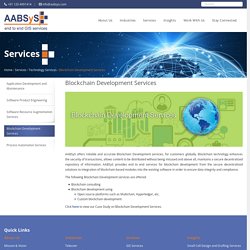
Blockchain technology enhances the security of transactions, allows content to be distributed without being misused and above all, maintains a secure decentralized repository of information. AABSyS provides end to end services for blockchain development from the secure decentralized solutions to integration of blockchain-based modules into the existing software in order to ensure data integrity and compliance. The following Blockchain Development services are offered: Blockchain consulting Blockchain development using Open source platforms such as Multichain, Hyperledger, etc. Custom blockchain development Click here to view our Case Study on Blockchain Development Services. 3-GIS Services. Utility Right of Way Mapping Services. A utility right of way is a registered easement on private land that allows the local administration and various utility companies the right to access the utilities or services that are routed within the right of way.
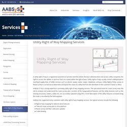
Utility rights of way usually contain underground or overhead supply lines of utility services such as electric power, water, sewer, telephone, and gas. Utility Right of Way survey or Route survey is carried out to determine and layout the route of a utility link from the distributer to the customer’s home or office. AABSyS IT has a strong expertise in providing utility right of way mapping services. The specialised team for route survey visits the site to analyze and understand the route survey plan. Location of the topographical features and the utility features such as the existing structures, towers, cables etc. are accurately captured using GPS. FTTX Network Design. FTTx encompasses all possible optical fiber topologies from a telecom or cable carrier to customer premises based on the location of the termination point of the fiber connection.
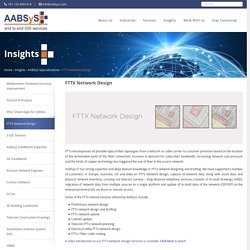
Increase in demand for subscriber bandwidth, increasing network cost pressure and the limits of copper technology has triggered the use of fiber in the access network. Technology Services at AABSyS. AABSyS focuses on end to end offerings in technology services.
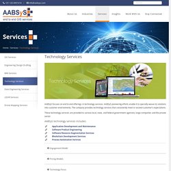
AABSyS pioneering efforts enable it to specially weave its solutions into customer environments. The company provides technology services that consistently meet or exceed customer’s expectations. These technology services are provided to various local, state, and federal government agencies; large companies and the private sector. AABSys provides product development and substance engineering thought its state of the art ISO 19001 Global offshore delivery center based out of Bhubaneswar, India. The offshore team works an an extended team to the client’s existing team providing the much need scalability and flexibility to client’s product development life-cycle.
Software Resource Augmentation Services - Resource Augmentation & IT Outsourcing Services. AABSyS IT has proven experience and expertise in providing software resource augmentation services for a wide spectrum of GIS technologies including ESRI, MapInfo, Autodesk, Intergraph, GeoServer, MapServer and other open source geospatial platforms.
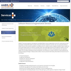
AABSyS resources have technical capabilities in providing services for software solutions ranging for desktop to large, scalable and secure web-enabled systems for enterprise and public portals. We provide highly experienced and skilled GIS software resources for building customized solutions or to assist the maintenance and support of the client’s existing applications. Solar Panel Layout Designs. Solar panels with photovoltaic power systems are designed to convert sunlight directly into electricity.
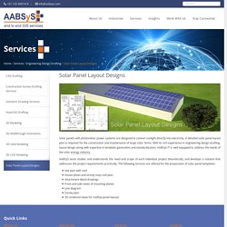
A detailed solar panel layout plan is required for the construction and maintenance of large solar farms. With its rich experience in engineering design drafting, layout design along with expertise in template generation and standardization, AABSyS IT is well equipped to address the needs of the solar energy industry. AABSyS team studies and understands the need and scope of each individual project theoretically, and develops a solution that addresses the project requirements practically. The following services are offered for the preparation of solar panel templates: Survey GIS at AABSyS. Survey has played an important role in collecting data from areas that don’t have updated maps.
Survey maps also play a crucial role in ground truthing the concerned area for creation of accurate land information maps. These maps also assists companies in understanding the market trends, land information for real estate, architecture, mining and utilities industries. These maps bring about a multi-dimensional perspective for making informed decisions. Telecom Construction Drawings. AABSyS has a long standing experience in supporting the global telecommunications industry through different kinds of services.
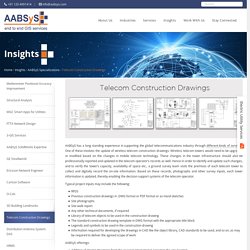
One of these involves the update of wireless telecom construction drawings. Wireless telecom towers would need to be upgraded or modified based on the changes in mobile telecom technology. These changes in the tower infrastructure should also be professionally reported and updated in the telecom operator’s records as well. Hence in order to identify and update such changes, and to verify the tower’s capacity, availability of space etc., a ground survey team visits the premises of each telecom tower to collect and digitally record the on-site information. Based on these records, photographs and other survey inputs, each tower information is updated, thereby enabling the decision support systems of the telecom operator.
Typical project inputs may include the following: Architectural 3D CAD Modeling at AABSyS. The architectural team at AABSyS comprise of experts architects, engineers, draftsmen etc.
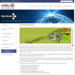
They have vast experience and expertise to create 3D modeling of floor plans, convert the 2D floor plans into 3D floor plans and create a 3D model of the said houses or building complexes. The 3D architectural floor plans and 3D models can be augmented with AABSyS’s 3D services to provide a realistic view to the model. This model is created on any platform that is suitable to the client and is delivered after strict quality assurance procedures. AABSyS can create interior and exterior views of houses or other complexes using a customized 3D CAD modelling technique which can be used during building construction or renovation. Apart from the uses in architecture industry 3D CAD Modeling is also used by in civil industry. Architectural CAD Drafting Services at AABSyS. The architecture industry requires architectural CAD drafting services that create floor plans, furniture arrangements plans, elevations and cross-sectional views for residence and multi-stored building.

These architectural CAD drafting services create deigns are generated from raster images or hand sketches. Computer aided designing involves creation of architectural CAD drafting designs. The architectural CAD drafting services play a crucial role in understanding space occupancy, forecast space needs and generating, stacking and blocking diagrams for space planning. 2D Floor Plans of Houses and Offices. The housing and urban development industry utilise CAD and GIS services provided at AABSyS to generate floor plans that are useful in study, design and planning of constructed space.
Architectural floor plans are important feature of any building’s sketch. They assist in easy visualization of the interior setup of a residential house, apartment, office, restaurant, and hotel. The architectural floor plans help AABSyS’s customers to visualize the property to sell, lease, or rent a house or office, which everyone can understand. 3D floor plans allow someone who has no experience in reading plans to understand a layout instantly.
They are such a powerful tool that they leave out nothing for guesswork during marketing, sale and leasing of property. The architectural floor plans with furniture layout, floor coverings, wall textures, colour schemes to be utilized for a better look to the interior of the architectural construction. GIS for Business Geographics at AABSyS. A start-up venture or an established business often requires support in managing the large amounts of data. This data if utilised to its full potential can be immensely helpful in the growth of the company. With the modernisation and advancement in technology many tools such as GIS can help in accomplishing an array of tasks such as marketing, site selection, survey and data management. The spatial data management and analysis can help in better strategic marketing and management of any business vertical.
Business geographics can assist in monitoring of the prelaunch and launch of a product by giving insights about market penetration, product reception and sale analysis. GIS for Water Distribution Network at AABSyS. Water industry requires the assistance of GIS in many verticals. The judicious use and conservation of water is one of the most talked about topics on global platforms. Every country tries to ensure optimisation of water use by using technologies such as GIS for water. Apart from its everyday use, water can be used for multiple purposes and therefore is an important part of the various industries.
O-Calc. AABSyS IT has been successful through delivery of GIS and CAD services for a range of industries from utilities to design, civil engineering and architecture for the past several years. Together with our strategic partners, AABSyS has supported customers in Europe, Australia, US and India through a range of services including digitization, utility mapping, CAD plan re-drafting, survey plan conversion, PDF to CAD conversion, 2D to 3D model conversions, 3D building model rendering and generation of virtual walkthroughs. Our deep domain expertise in the utility industry also includes providing pole loading analysis and make-ready engineering services in the O-Calc platform. O-Calc specializes in pole loading analysis, equipped with user friendly calculation tools, modelling, automatic analysis with sag and tension calculator etc.
The following are the tasks accomplished by AABSyS during pole loading analysis with O-Calc: Ericsson Network Engineer. GE Smallworld. AABSyS IT has strong expertise, long standing experience and deep domain knowledge in the Utility industry that has been acquired over a period of time. Together with our strategic partners, we have supported a number of customers in Europe, Australia, US and India for projects on land base data creation, alignment of utility networks with land-base data, data migration from multiple sources to a single platform, network update based on As-Built drawings, Assets records management and GIS integration, etc.
AABSyS technical teams have been successfully undertaking projects on the GE Smallworld GIS platform since 2006. AABSyS has significant project experience working on GE Smallworld GIS 4.0 and Smallworld GIS 4.3. Utility Mapping Services. LiDAR Data Processing Services. LiDAR technology enables the data capture on field by lighting the target using pulsed laser. As LiDAR also provides elevation data, it finds applications in several industries. Pole Loading Analysis - Pole Loading Factors for Utility Data Collection. Federal Communications Commission (FCC), following the National Broadband Plan for future, recognized that lack of access to physical infrastructure, particularly utility poles, is often a significant barrier to deploying communication services. Hence, there was a need to establish a more detailed framework to govern the accessibility timelines, rates, terms and conditions for pole attachments.
The establishment of timelines expedited the “make-ready” process considerably and NESC (National Electrical Safety Code) set the ground rules for safety compliance. Digitization Services at AABSyS. Application Development and Maintenance. AABSyS helps you in implementing enterprise GIS solutions to maintain up-to-date data, geo-spatial analysis and accurate modeling right from establishing requirement, specifying and designing the application, implementation to operating and maintaining in GIS application development life cycle.
AABSyS provides end-to-end custom applications which are developed based on specific needs and requirements regardless of their complexity. We understand the customer requirements and provide a complete solutions suite to deliver the functionalities preferred. GIS for Telecommunication. Requirement The customer, a leading Telecom Companies based in Middle-East Asia required AABSyS to provide assetization of a large Telecom Network project in the Middle-East. The main scope of the project included, capturing of conduit network, semi duct fiber network, direct buried cable and aerial cable. GIS for Electricity Network Mapping at AABSyS.
The fast pace of development and urbanisation has resulted in creation of new cities, townships etc. The new residential or commercial settlements require procurement of amenities such as well-planned out electricity lines that ensure smooth, hassle free transportation of electricity. GIS Application in Agriculture. GIS application in agriculture has been playing an increasingly important role in crop production throughout the world by helping farmers in increasing production, reducing costs, and managing their land resources more efficiently. Forestry Mapping Services at AABSyS. Forestry mapping services such as Forestry GIS are often required by government and commercial agencies to perform value assessments for certification, funding, policy recommendations and regulatory compliances. Often, the forest-cover data available with the private and govt. agencies is dated and unreliable. This data is not helpful to the user, forestry GIS can enable creation of updated data.
The fast paced growth and the effect of multiple industries have led to the need for a more precise and unique response to manage the forestry data. GIS for Oil and Gas. Geology GIS at AABSyS. GIS for Environmental Management at AABSyS. Land Parcel Maps at AABSyS. 3D Topographic Maps at AABSyS. Cadastral Mapping Services. GIS for Municipality Tasks at AABSyS. AutoCAD Drafting Services at AABSyS. 3d Walkthrough Animations at AABSyS. Architectural 3d Modeling Services. CAD Outsourcing Company. Engineering Design and Drafting Services. Indoor Building Plans. Photorealistic 3D Models at AABSyS. Remote Sensing Applications at AABSyS. Raster to Vector Conversion Services. Paper to CAD Conversion Services at AABSyS. 3D Digitizing Services. Digital Photogrammetry Services. GIS Mapping Companies, Data Conversions. GIS, CAD Services India.