

Séjour au Glen Nevis (Ecosse)- Ben Nevis (1344m) Itinéraire Topos sur les montagnes d’Ecosse : L’Automne est certainement la meilleure saison pour se rendre en Ecosse et y faire de la randonnée.
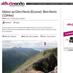
La bruyère, la fougère et l’herbe haute qui parent les versants des montagnes prennent des teintes fauves, et les premiers frimas chapeautent de blanc les sommets des montagnes. Les journées sont courtes, mais le soleil reste toujours proche de l’horizon, arrosant le paysage de ces lueurs aux couleurs chaudes constamment changeantes. West Highland Way. Écosse : randonner sur le West Highland Way.
Séjour au Glen Nevis (Ecosse)- Ben Nevis (1344m) Itinéraire Topos sur les montagnes d’Ecosse : L’Automne est certainement la meilleure saison pour se rendre en Ecosse et y faire de la randonnée.
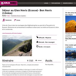
La bruyère, la fougère et l’herbe haute qui parent les versants des montagnes prennent des teintes fauves, et les premiers frimas chapeautent de blanc les sommets des montagnes. Les journées sont courtes, mais le soleil reste toujours proche de l’horizon, arrosant le paysage de ces lueurs aux couleurs chaudes constamment changeantes. L’été indien qui a suivi la canicule en France a cessé particulièrement tôt cette année, pour recouvrir prématurément nos montagnes de neige, au point d’y élever les indices de risques d’avalanches à des niveaux non négligeables. Cependant, Novembre 2003 battit tous les records de chaleur en Ecosse enregistrés depuis 50 ans, au point d’élever la température jusqu’à 18°C dans les vallées. 08 / 11 / 2003 : Cruach Ardrain L’état du ciel me déçut : il faisait gris, un ciel bas. 10 / 11 / 2003 : Carn Mor Dearg , Ben Nevis.
Loch Lomond and The Trossachs National Park. Trotternish Ridge. Hear pronunciation Press to hear pronunciation One of the finest ridge traverses in Britain.
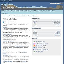
Spectacular views throughout. Terrain A very long and challenging walk with much ascent and descent; surprisingly for a major ridge there is no path most of the way, though there is much firm grassy going. Most people split it into a 2 day hike with a camp or bivvy on the ridge itself. Public Transport This is a linear walk finishing in Portree - public transport can be used to reach the start.
Hillwalking in Winter Please note that hillwalking when there is snow lying requires an ice-axe, crampons and the knowledge, experience and skill to use them correctly. Start Start of Loch Langaig/Harsco footpath, Flodigarry. Users' reports As well as reading our description of each walking route, you can read about the experiences of others users on this walk and others.There are 4 user reports for this walk - click to read them.
Write your own report - there's £90 to win at Webtogs each month. East Loch Lomond Camping Byelaws - Loch Lomond and The Trossachs National Park. It is an offence to camp in the East Loch Lomond Restricted Zone at any time of day or night, except if you are using one of the official designated sites.The byelaws apply from 1 March to 31 October every year. Download a map of the restricted zone. The restrictions apply to: Tents, wigwams, bivouacs at any time Gazebos overnight. The West Highland Way. The West Highland Way A walking holiday in the Scottish Highlands Introduction The West Highland Way is a 95-mile (152km) walk from Milngavie, just outside Glasgow, to Fort William on the west coast of Scotland, at the foot of Ben Nevis.
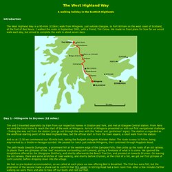
I walked the route in September 2001, with a friend, Tim Calow. We made no fixed plans for how far we would walk each day, but aimed to complete the walk in about seven days. Day 1 - Milngavie to Drymen (12 miles) Tim and I travelled separately by train from our respective homes in Skipton and York, and met at Glasgow Central station. And so at 12.30 we commenced our 95-mile trek, taking the footpath alongside Allander Water. The path heads towards Dumgoyne, a prominent hill at the western edge of the Campsie Fells, then picks up the route of an old railway.
We had no pre-booked accommodation, so we called at each place we saw offering Bed & Breakfast. Skye Trail. Map_2012.jpg (Image JPEG, 233x1000 pixels) - Redimensionnée (61%) Melrose to Kelso. This is the longest stage of the Borders Abbeys Way, much of it in close promixity to the River Tweed.
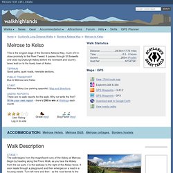
It passes through St Boswells and close by Dryburgh Abbey before the riverbank and country lanes lead on to the lovely town of Kelso. Terrain Good paths, quiet roads, riverside sections. Public Transport Bus to Melrose and Kelso Start Melrose Abbey (car parking opposite). Users' reports There are no walk reports for this walk. User RatingLog in to vote Bog Factor (key)