
BBC Weather. Met Office. Satellite. Switch to visible satellite image sequence These images come from satellites which remain above a fixed point on the Earth (i.e. they are “geostationary”).
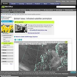
The infrared image shows the invisible infrared radiation emitted directly by cloud tops and land or ocean surfaces. The warmer an object is, the more intensely it emits radiation, thus allowing us to determine its temperature. These intensities can be converted into greyscale tones, with cooler temperatures showing as lighter tones and warmer as darker. Lighter areas of cloud show where the cloud tops are cooler and therefore where weather features like fronts and shower clouds are.