
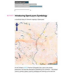
The Marauding Carto-nerd. Tes. End the age of gotham-everywhere If you’ve attended a movie or generally looked at things in the past five years, you’ll know that we’re in the age of ubiquitous gotham. The MPAA has switched to Gotham for their ratings screens. If you pay attention to the previews before a movie, it’s now the go-to font for all movie titles. Obama’s 2008 campaign standardized on Gotham and Sentinel (another H&FJ face) for their celebrated visual identity. In 2012, Obama switched things up and standardized on Sentinel and Gotham. Gotham is the inception horn of typefaces. It’s a major, inescapable part of the visual landscape, and I think it needs a boycott. You might be interested to know that the celebrated type foundry Hoefler & Frere-Jones who created the typeface is going through an acrimonious divorce right now. I’ve had my issues with H&FJ in the past, but this current situation is an object lesson in the perils of half-assing legal relationships.
Kelso’s Corner. I prompted a flurry of PostGIS hate (and some love) on Twitter last week, documented via Storify.

I’ve been using PostGIS for around 2 years now both at Stamen and before that at The Washington Post. Let me say upfront that PostGIS is amazing and is definitely in the top 5 best FOSS4G (free and open source software for geo) out there. It is a super powerful spatial data store that is free to download, install, and use (even in commercial projects!). It’s can also be mind numbingly difficult to install and use. It doesn’t matter how awesome something is unless it’s usable.
Besides the specific issues outlined below, PostGIS lacks basic functions required for spatial analysis found in ArcToolbox. @PostGIS asked me for details on how it could be friendlier and I’ve itemized around 20 below. If a project that is considered core to the FOSS4G stack (eg Mapnik, PostGIS, etc), the project needs to act like it. As of today, the latest LTS is 12.04, before that is 10.04.
Blog » the notebook of cartographer zachary forest johnson. Binning is a general term for grouping a dataset of N values into less than N discrete groups.
These groups/bins may be spatial, temporal, or otherwise attribute-based. In this post I’m only talking about spatial (long-lat) and 2-dimensional attribute-based (scatterplot) bins. Such binnings may be thought of as 2D histograms. This may make more or less sense after what lies beneath. If you’re just after that sweet honey that is my code, bear down on my Github repository for this project — hexbin-js. Rectangular binning The simplest 2D bin is rectangular.
The above is a shot from a little example I produced on jsFiddle, while learning Mike Bostock’s fantastic D3 JavaScript library for HTML and SVG data-binding and visualization. Binning can be good for both the users and the creators/developers of static or interactive thematic maps or other visualizations. So anyway, binned representations can be beneficial for both users and creators. Hexagonal binning Adler writes, Hex history and theory. Cartastrophe.