
Discover Spatial. Digital Geography. Story.html: Introduction to Geospatial Technology Using QGIS. Story.html: Introduction to Geospatial Technology Using QGIS. GRASS GIS - Home. SAGA - System for Automated Geoscientific Analyses. ENVI - Image Analysis - Spectral Analysis - ENVI Products. Overview. MultiSpec© QGIS Quick Tip - 3D effect on any map. QGIS (@qgis) QGIS - Community - Google+ QGIS (Quantum GIS ) Qgis.com. Books - Locate Press. 500 Internal Server Error. FOSS4G on Vimeo. FOSS4G on Vimeo. MultiSpec© Story.html: Introduction to Geospatial Technology Using QGIS.
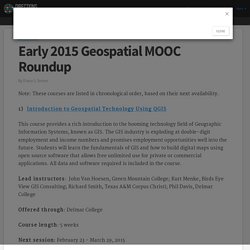
GeoForAll-Europe Info Page. GeoForAll Europe. OSGeo Labs - Mission - "Making geospatial education and opportunities accessible to all" Sign In. GIS - Search - NTER. Home - NTER. FOSS4GAcademy. Lab 2 Task 2. Early 2015 Geospatial MOOC Roundup. Note: These courses are listed in chronological order, based on their next availability. 1) Introduction to Geospatial Technology Using QGIS This course provides a rich introduction to the booming technology field of Geographic Information Systems, known as GIS.

The GIS industry is exploding at double-digit employment and income numbers and promises employment opportunities well into the future. Students will learn the fundamentals of GIS and how to build digital maps using open source software that allows free unlimited use for private or commercial applications. All data and software required is included in the course. Lead instructors: John Van Hoesen, Green Mountain College; Kurt Menke, Birds Eye View GIS Consulting; Richard Smith, Texas A&M Corpus Christi; Phil Davis, Delmar College Offered through: Delmar College Course length: 5 weeks Next session: February 23 - March 29, 2015 More information: Course website 2) Skills for the Digital Earth Lead instructor: Judy Bock, Elmhurst College.
Topic: More Free Stuff. Overview. Inkscape is an open-source vector graphics editor similar to Adobe Illustrator, Corel Draw, Freehand, or Xara X.

What sets Inkscape apart is its use of Scalable Vector Graphics (SVG), an open XML-based W3C standard, as the native format. For Designers of all Kinds The design process may begin by doodles on a napkin, a sketched mindmap, a photo of a memorable object, or a mockup in software which really wouldn't work to complete the project. Inkscape can take you from this stage to a final, professional-grade design format which is ready for publication on the web or in physical form.
If you are new to the process of creating vector graphics it may feel different, but you will quickly be pleased by the flexibility, and power Inkscape offers. There are many learning resources available, take advantage of them! Professional Publishing All Inkscape projects may be exported in formats friendly to web browsers or commercial printer rooms.
Free Community. Case Studies. QGIS Plugins planet. Recently, in order to nicely plan ahead for a birthday lunch at the agritur Malga Brigolina (a farm-restaurant near Sopramonte di Trento, Italy, at 1,000m a.s.l. in the Southern Alps), friends of mine asked me the day before: “Will the place be sunny at lunch time for a nice walk?

“ [well, the weather was close to clear sky conditions but mountains are high here and casting long shadows in the winter time]. A rather easy task I thought, so I got my tools ready since that was an occasion to verify the predictions with some photos! Thanks to the new EU-DEM at 25m I was able to perform the computations right away in a metric system rather than dealing with degree in LatLong.
Direct sunlight can be assessed from the beam radiation map of GRASS GIS’ r.sun when running it for a specific day and time. 1. The first step is to calculate where direct sunlight reaches the ground. I let calculations start at 8am and finish at 5pm which an hourly time step. Welcome to the QGIS project! Mastering QGIS. QGIS is the leading alternative to proprietary GIS software.

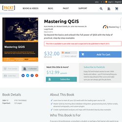
It is a mature, free, and open source desktop GIS software that runs on Windows, Macintosh, and Linux. It is free of onerous licensing schemes and is accessible to everyone who knows how to use it. Generally, GIS software packages are some of the most sophisticated and complex a person can use. QGIS includes tools for managing databases, displaying and editing spatial data, performing spatial analyses, and automating workflows with scripting. Although QGIS is described as intuitive, it is also by default complex. Starting with a quick introduction to get everyone up and running, you will quickly move onto mastering QGIS. Through this practical guide, you will learn everything you need to comprehensively master this powerful and industry-leading GIS software package. Mastering QGIS. GST 103 Data Management Using QGIS.
GST 102 Spatial Analysis Using QGIS. GST 101 Introduction to Geospatial Technology Using QGIS. GST 105 Remote Sensing Using QGIS. GST 105 Remote Sensing Using QGIS.