background preloader

Géographie urbaine

Facebook Twitter

Travel Studies. New York City Subway for Google Earth | Brian Abbott. Home › Projects › New York City Subway for Google Earth New York City Subway for Google Earth Sunday, January 31, 2010 at 9:12 PM Download Last updated: 31 December 2016Updated for the new Second Avenue Subway opening. 
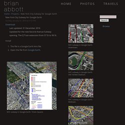
The Q Train extension from 57 St to 96 St. Install The file is a Google Earth kmz file. NYC subway in Google Earth: Times Square. NYC subway in Google Earth: downtown. NYC subway in Google Earth: Old Yankee Stadium.

NYC subway in Google Earth: Midtown. NYC subway in Google Earth: Queens Plaza. Browse © Copyright Brian Abbott. OASIS Map. New York City Temperature and Vegetation. Temperature (1.0 MB JPEG)Vegetation (1.0 MB JPEG) As many urbanites know, summertime has its downside. The things we take for granted in cities—roads, sidewalks, brick buildings, and asphalt roofs—all intensify summer heat by trapping the Sun’s energy and remaining warm long after the Sun has set. This phenomenon has a name: urban heat island. In summer 2002, Stuart Gaffin of Columbia University and his colleagues used satellite temperature data, city-wide land cover maps, and weather data, along with a regional climate model to identify the best strategies for cooling Gaffin’s hometown, New York City.

As part of the study, the team used thermal infrared satellite data measured by NASA’s Landsat Enhanced Thematic Mapper Plus on August 14, one of the hottest days in New York’s 2002 summer. Maps by Robert Simmon, using data from the Landsat Program. Instrument(s): Landsat 5 - TM. 8GFwg.jpg (Image JPEG, 1167x568 pixels)