
MapOSMatic: About. History Of course, MapOSMatic is fully free software, licensed under the AGPLv3.
How does it work? On our server, we run a PostgreSQL server, with the PostGIS extension. In this PostgreSQL server, we have loaded the OpenStreetMap data for the whole world using the osm2pgsql tool. The same tool is also used to apply daily differences of the database, which allows to keep it up to date with the new contributions of OpenStreetMap users. Intro To PostGIS. Part 1: Getting Started With PostGIS: An almost Idiot's Guide (PostGIS 2.0) PostGIS is an open source, freely available, and fairly OGC compliant spatial database extender for the PostgreSQL Database Management System.

In a nutshell it adds spatial functions such as distance, area, union, intersection, and specialty geometry data types to the database. PostGIS is very similar in functionality to SQL Server 2008 Spatial support, ESRI ArcSDE, Oracle Spatial, and DB2 spatial extender. The latest release version now comes packaged with the PostgreSQL DBMS installs as an optional add-on. As of this writing PostGIS 2.0.0 is the latest stable release. Noteable enhancements in this release: We will assume a windows environment for this tutorial, but most of the tutorial will apply to other supported platforms such as Linux, Unix, BSD, Mac etc.
We will not go into too much detail here since the install wizard (at least the windows one) is pretty good. Note for Vista Users Because of the new added security in Vista, you may run into issues installing PostgreSQL. Prj2EPSG. Start with psql command-line tool of PostgreSQL. Today I will explain how to start using PostgreSQL command-line tool.
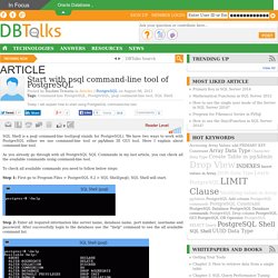
SQL Shell is a psql command-line tool(psql stands for PostgreSQL). We have two ways to work with PostgreSQL either we use command-line tool or pgAdmin III GUI tool. Here I explain about command-line tool. As you already go through with all PostgreSQL SQL Commands in my last article, you can check all the available commands using command-line tool. To check all available commands you need to follow below steps: Step 1: First go to Program Files > PostgreSQL 9.2 > SQL Shell(psql), SQL Shell will start. Step 2: Enter all required information like server name, database name, port number, username and password. Présentation. Web mapping client comparison v.6. This comparison aims to serve as a basis for those seeking a first approach to Web mapping technologies at the client side.
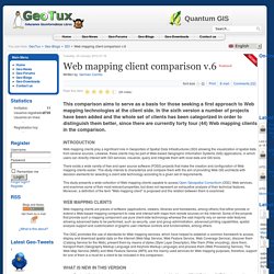
In the sixth version a number of projects have been added and the whole set of clients has been categorized in order to distinguish them better, since there are currently forty four (44) Web mapping clients in the comparison. Web mapping clients play a significant role in Geoportals of Spatial Data Infrastructures (SDI) allowing the visualization of spatial data from several sources.
Likewise, these clients may be part of Web-based Geographic Information Systems (GIS) applications, in which users can directly interact with SDI services, visualize, query and integrate them with local data and GIS tools. There exists a wide variety of free and open source software (FOSS) projects that make the creation and configuration of Web mapping clients easier.
Documentation - Leaflet - a JavaScript library for interactive maps. API Reference This reference reflects Leaflet 0.7.
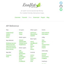
Docs for 0.6 are available in the source form (see instructions for running docs). Map The central class of the API — it is used to create a map on a page and manipulate it. Usage example Creation Options Map State Options Interaction Options Keyboard Navigation Options Panning Inertia Options Control options Animation options Events You can subscribe to the following events using these methods. Methods for Modifying Map State Methods for Getting Map State Methods for Layers and Controls. Kartograph.org. uDig : Home. uDig. uDig has a walkthrough in Flash and also quick start directions for those who wish to complete a full version build to write plug-ins or contribute to the main build. uDig can use GRASS for complex vector operations and also embeds JGRASS and specialized hydrology tools from the Horton Machine.
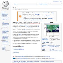
It supports shapefiles, PostGIS, WMS, and many other data sources natively. uDig is commonly used as a framework for building other GIS platforms and applications. Mapbox projet / niveau 3 (javascript/HTML/CSS) Academia.edu - Share research. Open Source GIS – GISWiki. Which are the best open source tools for building a web gis application having PAN, Zoom, Query/search, Label, etc., options? - ResearchGate. Development and Comparison of Open Source based Web GIS Frameworks on WAMP and Apache Tomcat Web Servers. The generic layered architecture of Web GIS consists of three layers namely user interface layer, application layer and database layer.
The clients access the system by interacting with the user interface layers that takes the input and shows the output of the system. It involves graphical user interface therefore it must be designed cautiously so that the user can understand it easily. The application layer provides the map visualization functions like panning, zooming etc. It provides the others functions also like layer selection, editing, querying etc (Lu, 2005). The database layer handles the data present at distributed sources. Et al. Thin Client. uDig : Home.