
Chronique de Stratégie et Tactique navale : fonction garde-côtes, marine côtière et forces de haute-mer. Vendredi 15 avril 2011 5 15 /04 /Avr /2011 06:00 Dans le cadre de notre étude de la stratégie maritime française pour contrôler les zones économiques exclusives, nous avons trouvé un article très intéressant de Caroline Britz (Les Echos).

BOAT PLANS BRUCE ROBERTS, FOUNDED 1966, OFFICIAL SITE, 200 boat plans & boat kits SAILBOATS, POWER BOATS powerboats steel, aluminum, fiberglass, wood epoxy boats. Boat Plans Boat Kits Boatbuilding kits Boatbuilding - By-The-Sea. Cedar strip construction, glass on the exterior.

Cherry gunwales, decks & oars. Laminated spruce ribs & stems, the hull is western red cedar, the bottomboard is pine. The kit includes all the wooden parts, hardware, rowlocks, oarlocks and oar blanks. A supply kit is also available. A builder's manual, photo CD and glassing video are included. "One pull on the long flexible oars will tell you that this is no ordinary rowboat. Sport Boat 18 - Study Plans. An 18'performance trailerable sport boat.

Weight or displacement? Note that we show a hull weight and displacement. The hull weight is just that , the weight of the hull only. Our displacement is the weight of the complete boat with rigging, sails, outboard motor, gas tank half full, gear and crew. Catalogues NauticExpo. Bateau.com - boat plans on line since 1993. Traditional Single-Sheet Nautical Charts. Folio 29, Eastern Aegean and Marmara Seas. Mapmedia Catalog - Nautical Charts. Maps of Aegean Sea. Marine Navigation & Equipment. World Port Source - Port of Call Information for Port of Tripoli. The Essential Site For Captains And Crew - Superports. Welcome to Superports!

With data on more than 500 Superyacht marinas, the Dockwalk team are pleased to launch our online Superports directory. Previously only available in print, the Superports directory contains information including contact details, facilities at the berth and local services. It also provides vital logistical information such as lat/long co-ordinates, berth numbers and sizes, prices and distances to local airports. What's more, the whole thing works with Google mapping. Select a region or enter a location, rollover an anchor and see the name, location and photo of the marina. When you've chosen a marina, you'll notice a list of local services classifications in the right hand column. We're building the site around our users, and we want to publish the things that are most useful to you. Welcome aboard.
Home page. Harbours. Home page. Index of /mgg/ibcm/bathy. IOC IHO IBCM-International Bathymetric Chart of the Mediterranean. Click on map above for a larger preview This bathymetric chart is published by the Charts Division of the Head Department of Navigation and Oceanography in Russia under the authority of the Intergovernmental Oceanographic Commission (IOC) of UNESCO.

Originally compiled from ninety 1:250,000 scale British Admiralty Mercator plotting sheets for oceanic soundings, it presents the bathymetry and land topography as 200 m contours with supplemental 20 m, 50 m, and 100 m contours at sea. Google Ocean : marine data for Google Maps / Google Earth. Google Maps (GM) on the web and Google Earth (GE) as a 3D interactive atlas software application are ideal tools for sharing geographical information in a simple way.
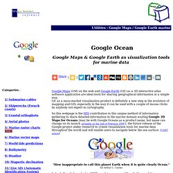
GE as a mass-market visualization product is definitely a new step in the evolution of mapping and GIS, especially in the way it can be used with a couple of mouse clicks by anybody not expert in cartography. So this webpage is the MIS contribution to this unique method of information gathering to share detailed information in the marine domain waiting Google 3D Maps for Oceans (may be with Google Oceans as a product name, but name can change on its launch -probably on the 2nd of February, 2009-), the future release of the Google project under research to create visualization tools for marine data throughout the world and will enable users to navigate below the sea surface. (CNET article) So waiting this new software arrives, just. ShipPlotter. Pocket ShipPlotter is a compact version of ShipPlotter that runs on a Pocket PC (iPaq).

It is intended for use in situations where it is not convenient to use a laptop or decktop computer. Like ShipPlotter, it displays AIS messages on a chart. Pocket ShipPlotter charts are compatible with ShipPlotter charts and calibration files. Pocket ShipPlotter does not include as many options as the desktop version but it can save decoded messages in a log file and complete data in an NMEA serial file.
Unlike ShipPlotter, Pocket ShipPlotter does not accept receiver audio signals - it is only suitable with a serial AIS data source. If you are interested in ShipPlotter, you may also be interested in its sister application DSCdecoder.DSCdecoder decodes the Digital Selective Calling (DSC) messages used under the GMDSS for distress and calling purposes. Marine ebooks by Tony Herrick (some free) of cruising guides, sailing, yachting and general boating subjects for download.
Tony Herrick of CRUISING CONNECTIONS has produced a number of marine ebooks of cruising guides, sailing and general boating (including some FREE ones).

Ebooks are a very useful format for cruising sailors as they can download these cruising guides and sailing notes from any online PC anywhere in the world and be reading the ebooks in a matter of minutes. Tony Herrick has maintained these marine ebook file sizes to under 1 Mb so that they will easily fit onto an empty 3½ inch "floppy" - easy to download and store on board your yacht. Alternatively, save these ebooks directly to your PC hard-drive. No special software is required to read these ebooks as they automatically open in your MSIE® browser (NOTE - NOT compatible with MS® VISTA). (PDF versions are also being added to the list). Marine ebooks compiled by: CRUISER LOG "All the resources for cruising yachts" Copyright ©Tony Herrick 2001/7 exists on ALL material on this website. See CHARTS See BOOKS. Richardsons' Maptech Watercharts, Chartbooks, Maps, Waterways, Guides.
Free Raster Nautical Charts Software - Free Download of Free Raster Nautical Charts at DaolnwoD.Com. SeaClear GPS Navigation Software. Navionics Nautical Charts - Worldwide Marine Chart Collection - Maps for Canada - USA - South America - Europe - Africa - Middle East - Asia - Pacific - Australia - New Zealand for PC, Plotter, iPhone. iPad - 2011.
Route Preparation. FAQ. What is OpenSeaMap?

OpenSeaMap is an open source, worldwide project to create a free nautical chart. There is a great need for freely accessible maps for navigation purposes, so in 2009, OpenSeaMap came into life. The goal of OpenSeaMap is to record interesting and useful nautical information for the sailor which is then incorporated into a free map of the world. This includes beacons, buoys and other navigation aids as well as port information, repair shops and chandlerys. OpenSeaMap is a subproject of OpenStreetMap and uses its database. How can I help? How do I register seamarks? When will the chart cover the whole of the Earth's surface? How to use the offline charts? FreeMarineCharts - Learn to Download Free Marine Charts and Software. Maps - Driving Directions - Map. MapQuest Maps - Driving Directions - Map. The Mother of All Maritime Links: Page 34 of 47. The Mother of All Maritime Links John's Nautical Links List Page 34 of 47 Prev.
Page Contents Search Next Page New or Changed Links Navigation: Advanced Coastal Navigation Course (Free and online) High Sea - Mapy. Ucina & C-Map present: DB Ports.