[TUTO] Récupérer une carte du GPS vers Mapsource. Si comme moi vous vous êtes retrouvés avec une carte dans votre gps, mais que cette dernière n'est pas présente dans mapsource, et que depuis le temps, vous avez paumé votre CD garmin, voici un petit tuto pour récupérer vos cartes.
![[TUTO] Récupérer une carte du GPS vers Mapsource](http://cdn.pearltrees.com/s/pic/th/tuto-recuperer-carte-mapsource-111465020)
(pratique aussi pour ceux qui commandent des cartes directement installées sur SD ou µSD) LOGICIELS NECESSAIRES :Pour celà, il vous faut :- Mapsource (bien entendu)- Gmaptool : téléchargeable ICI- Cgpsmapper : téléchargeable ICI Installer gmaptool et cgpsmapper dans un dossier de votre choix, et facile à retrouver, il faudra y retourner plus tard. Tout d'abord, récupérez le fichier de la carte présente dans votre gps.Le fichier contenant la carte est du type gmapsupp.img ou gmapprom.imgCopiez le sur votre disque dur, ou sur une clé usb. - Lancez Gmaptool- Cliquez sur "ADD FILES"- Cherchez et selectionnez le fichier gmapsupp ou gmapprom que vous venez de copier - Cliquez sur OK - Ensuite, cliquez sur "INFO" Cliquez ensuite sur "SPLIT ALL" Mapsource - scdiscdi. GPS Maps. (OSM) Karten Afrika. FernreiseWiki Sinn und Zweck des FernreiseWikis ist, Informationen zusammen zu tragen und diese der Fernreise Gemeinschaft kostenfrei bereitzustellen.
Jede nützliche Information welche Du hierzu beitragen kannst, hilft Anderen ihre Reise besser zu planen und unterwegs mehr zu Genießen. Das FernreiseWiki basiert wie die Wikipedia auch auf einen Wiki System. Jeder kann mitmachen. Informationen eintragen, diese verändern und mit einem Klick zu aktualisieren. Mehr Handeln statt Spenden Unter dem Titel “Trade statt Aid” hat das Betterplace Lab folgenden Artikel Veröffentlicht. Trying to kill the Toyota Die Jungs von TopGear versuchen in dieser Sendung einen Toyota Hilux zu zerstören. Das Buch zur Reise Nach fast einem Jahr sind wir wieder in Deutschland. Homeland Teil 2 In Windhoek angekommen haben wir zuerst Julians Freunde Jimmy und Heidi in ihrem Workshop der „Southern Cross Safaris“ aufgesucht. Homeland Teil 1 Und noch ein Zaun… and another fence…. Beach, Sun and more Sonne, Strand und „mehr“ Installation des cartes routières avec Mapsource.
Par Germain Malenfant Lorsque vous achetez City Navigator, vous devez installer le logiciel et déverrouillez vos cartes pour que ceux-ci soient fonctionnels et que vous puissiez les transférer avec mapsource.
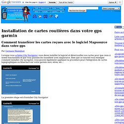
Bien que ce tutoriel vous enseigne comment installer city navigator, vous pouvez également appliquer la procédure pour l'intégration de cartes topographiques ou bluechart sur votre garmin nuvi, etrex, etc... La première étape est d'installer City Navigator Vous devez par la suite accepter le contrat de licence pour l'utilisation du logiciel City navigator NT de Garmin. Cochez les cases Accepte le contrat de licence du logiciel et Accepte le contrat de licence sur les données. Patientez environ une minute Les cartes doivent être déverrouillées afin de pouvoir être affichées dans MapSource. Le code de déverouillage est fonction de l'identifiant de l'appareil.
Map Download - Openmtbmap.org. Why are there New maps and Old Maps CCBYSA?
Well, Opentstreetmap changed their license in July 2012. As there needed to be quite a lot of contributions to be deleted, the state of the maps was for some time quite troublesome. In most countries and areas the maps under the odbl license are as of 2013 far superior. The old maps are also not having all the newest features (e.g. housenumber address search). The New Maps Can be found Here Maps for Mac OSx can be found Here. Map Download – New Maps « Openmtbmap.org – Mountainbike and Hiking Maps based on Openstreetmap. About the Maps – Please Read.
Mapsource Garmin Maps Download. Your file will be ready for download in 1 sec If your download doesn't start click here to download real fast file downloader/mapsource-garmin-slovakia-rapidshare.html real fast file downloader/mapsource-garmin-slovakia-rapidshare.html supremedownloader is a free download manager.

All you need to do is search the files you are looking for from over 30 Million files. Garmin MapSource + Topo France V2. Comment installer une carte dans Garmin map source ? Procédure d’installation Vos cartes sont généralement compressées au format zip ou rar, il est nécessaire de les décompresser dans un répertoire facilement identifiable "mes_cartes" / "nom_pays" décompressez les deux logiciels ci-joint :