

SPACE MAPS. MAPS OF THE WORLD. MAPS OF AUSTRALIA AND OCENIA. Detailed maps of countries Australia and Oceania (Oceania Countries Maps), political maps, administrative and road maps, physical and topographical maps, maps of cities, etc.
The continent of Oceania comprises Australia and New Zealand, which are the two largest countries of the continent, as well as numerous island dotting the Pacific Ocean, notably Fiji, Papua New Guinea, Polynesia and Micronesia. Throughout the countries and islands there are many different cultures typical to the land, such as the Aborigines of Australia and the Maori of New Zealand, offering a diverse cultural heritage.
This vast and scattered continent boasts islands and waters of rare, pristine beauty, tropical landscapes and diverse flora and fauna both on land and in water. Australia’s landscape varies considerably from mountain ranges to desert land onto the magnificent Barrier Reef off the Northwest coast of the country. MAPS OF AFRICA. Detailed maps of countries Africa (African Countries Maps), political, administrative and road maps, physical and topographical maps, maps of cities, etc.
The land of savannas, deserts and jungles the African continent includes 53 countries and offers an enormous variety of wildlife and rare vegetation species. Africa has a diverse cultural heritage due to past conquering countries, thus English, French, Portuguese as well as thousands of African dialects are spoken throughout the country. To the East lies the Indian Ocean while to the West the Atlantic. Africa is separated from Europe by the Mediterranean Sea and from Asia by the Red Sea. Africa can be divided into specific geographic zones representing the coastal plains, mountain ranges, jungles and desert areas.
Africa is not only synonymous of safaris and wildlife spotting; it also has a rich cultural heritage, notably in the north with the architectural sites of ancient Egypt. MAPS OF SOUTH AMERICA. Detailed maps of countries South America (South America Countries Maps), political maps, administrative and road maps, physical and topographical maps, maps of cities, etc.
Situated in the southern hemisphere, South America is the fourth largest continent in the world encompassing 15 countries with most of the population speaking Spanish and Portuguese along with many different indigenous dialects. The climate can vary to sub-tropical to tropical depending on the latitude. South America offers travelers a widespread choice of attractions, activities and beautiful natural sites to visit, ranging from glaciers, volcanoes, and mountain ranges to the impenetrable Amazon rainforest and pristine beaches that offer rare tropical flora and fauna. South America is also rich in historical and architectural heritage, with relics from the pre-Colombian and Colonial periods with Inca, Aztec and Mayan archaeological sites and art.
MAPS OF NORTH AMERICA. Detailed maps of countries North America (North American Countries Maps), political maps, administrative and road maps, physical and topographical maps, maps of cities, etc.
North America is the third largest continent in the world made up of 23 countries including the Caribbean Islands, Central American countries, Greenland, Canada and the United States, the main languages being English and Spanish. This huge continent flanked by two oceans offers an extensive and varied landscape as well as an incredible blend of different cultures and traditions. The land is rich in vast plains, mountain ranges, breathtaking coastlines as well as numerous national parks. MAPS OF ASIA.
Detailed maps of countries Asia (Asia Countries Maps), political maps, administrative and road maps, physical and topographical maps, relief and satellite maps, maps of cities, etc.
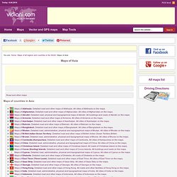
The Asian continent is the largest and most densely populated of the seven continents and can be divided into three sectors, South East Asia, Far East Asia and Central Asia. Brunei, Cambodia, Indonesia, Laos, Thailand, Malaysia are amongst the countries comprised in South East Asia, while Far East Asia includes China, Hong Kong, Taiwan, Korea, Japan and Macao. Afghanistan, Mongolia and Azerbaijan are part of Central Asian countries, to name a few. Asia stretches from Japan in the East through Russia in the West. It encompasses Saudi Arabia and everything above Asia.
With such a vast territory it is inevitable to find a wide variety of different religions ranging from Hinduism, Buddhism and Islam cultures, which count the largest number of adherents. MAPS OF EUROPE. Detailed maps of countries Europe (European Countries Maps), political, administrative and road maps, physical and topographical maps, maps of cities, etc.
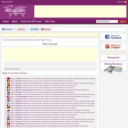
Situated in the northern hemisphere, Europe has no less than five major geographic regions offering a great diversity of culture, natural sites, historical heritage and pristine landscapes. Each of the 50 countries has its own particular characteristics, although most countries have in common rich historical past, beautiful examples of architecture and art as well as a geographically diverse land.