
EASA - Unmanned Aircraft Systems (UAS) and Remotely Piloted Aircraft Systems (RPAS) Regulation (EC) No 216/2008 mandates the Agency to regulate Unmanned Aircraft Systems (UAS) and in particular Remotely Piloted Aircraft Systems (RPAS), when used for civil applications and with an operating mass of 150 Kg or more.

Experimental or amateur build RPAS, military and non-military governmental RPAS flights, civil RPAS below 150 Kg as well as model aircraft are regulated by individual Member States of the European Union. Toys, even if capable of flying but not equipped with internal combustion engine, are subject to Directive 2009/48/EC .
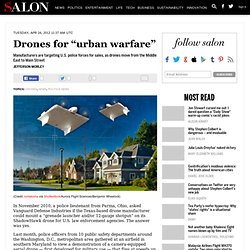
Congress Passes Bill That Opens US Skies To Unmanned Drones. Drones for “urban warfare” In November 2010, a police lieutenant from Parma, Ohio, asked Vanguard Defense Industries if the Texas-based drone manufacturer could mount a “grenade launcher and/or 12-gauge shotgun” on its ShadowHawk drone for U.S. law enforcement agencies.
The answer was yes. Last month, police officers from 10 public safety departments around the Washington, D.C., metropolitan area gathered at an airfield in southern Maryland to view a demonstration of a camera-equipped aerial drone — first developed for military use — that flies at speeds up to 20 knots or hovers for as long as an hour. In short, the business of marketing drones to law enforcement is booming. Now that Congress has ordered the Federal Aviation Administration to open up U.S. airspace to unmanned vehicles, the aerial surveillance technology first developed in the battle space of Iraq, Afghanistan and Pakistan is fueling a burgeoning market in North America. Puma AE (All Environment) Unmanned Aircraft System (UAS) Northrop Grumman Bat UAV. The Bat, formerly known as the KillerBee, is a low altitude and long endurance unmanned air vehicle (UAV) system.

It was designed and developed jointly by Northrop Grumman and Swift Engineering to meet the requirements of the US Air Force, Marine Corps, Navy and the Department of Homeland Security. The Bat can perform intelligence, surveillance and reconnaissance (ISR) operations over a large area. Rheinmetall Shows New Hybrid UAV. Free Project Management Software Reviews: Online & Open Source PM Sofware Tools. Our sweet little web based Aerial Imagery and UAV Flight Tracker with Ortho-Mosaic/GIS/KMZ Tile Builder. Beautiful Orthophotos! Hello fellow UAVers, dronemapper.com My UAV partner (Ross) and I have been working on a project that we'd love to get some feedback and additional ideas for.

Our intention is to allow free access to this web based tool and also a really cheap subscription model per month (think $4 range) to support hosting costs and the large amount of cpu processing power needed to generate maps. Technology: Drones fly into nascent civilian market ripe with energy, environmental applications. Advertisement As a Russian tanker plowed through the frozen Bering Sea to deliver fuel to Nome, Alaska, earlier this month, it had an unlikely helper: a small drone that hovered overhead, sending images of the sea ice to researchers onshore who were plotting the vessel's path and planning oil spill contingencies.

Drone technology, which revolutionized the way the U.S. military spies and fights, is now opening vast new opportunities for environmental researchers and the energy industry. Nano Patents and Innovations: Military UAVs To Get Hands And Arms. The team, led by Dr.

Paul Oh, a professor in Drexel’s College of Engineering and head of the Mechanical Engineering and Mechanics department, will examine the reaction forces and torques associated with applying robotic arms to UAVs as part of his work in the Drexel Autonomous Systems Laboratory. UAVs currently perform passive tasks such as gathering in-flight visual data and intelligence, tasks that are performed well above ground. Tilting Tri-Rotor VTOL v.3.b unveiling. VerticopterTutorial Part 1. The UAV Payload and Subsystems Market 2012-2022 - Report - Defence - visiongain. Asia Pacific Satellite-based Earth Observation Market. The EO Market is poised for growth in the coming years with a larger number of players, advances in technology and a political environment that should improve with regards to data.

In a nutshell, Earth Observation via satellite is supporting sustainable human activity on the local, regional and global scale. The range of capabilities offered by EO satellites and its acc has progressed rapidly in recent years. Asia is going to show a healthy growth in both the commercial data revenues and the EO VAS revenues side. The commercial data revenues are expected to increase by more than three times in the next 10 years. This research service titled Asia Pacific Satellite-based Earth Observation Market provides an in-depth analysis of the market drivers and restraints, industry trends, and competitive environment in addition to the challenges and issues faced by market participants.
Market Overview Competition from Established Markets Impairs Market Growth Market Sectors - Satellites - Technologies. Unmanned Aerial Vehicles (UAV) for Border Security – Global Market & Technologies Outlook – 2013-2021. The use of Unmanned Aerial Vehicles (UAVs) in border security missions around the world is expanding rapidly as nations apply lessons from NATO UAV operations to their border and national security needs.

This expansion, which began with the US, Brazil and Israel, will create new markets and new business opportunities. That’s particularly true for integrated capabilities guided by an Operating Concept and turnkey packages that include equipment, training, operations and maintenance. Small nations are discovering this technology. Smaller UAV types will especially benefit in these new markets where the established players have less influence and the more complex UAVs have less relevance. This new report is the only available research that examines, analyses and predicts the evolution of Border Security markets and the relevant UAV technologies in light of the whole global market. The report covers these technologies: The report identifies, analyzes and forecasts these topics, among others: Commercial Unmanned Aerial Systems (UAS): Market Shares, Strategies, and Forecasts, Worldwide, 2012 to 2018.
WinterGreen Research announces that it has published a new study Commercial Unmanned Aerial Systems (UAS): Market Shares, Strategy, and Forecasts, Worldwide, 2012 to 2018.

The 2012 study has 794 pages, 288 tables and figures. Worldwide markets are poised to achieve significant growth as the commercial unmanned aerial systems provide a way to automate surveillance of wide areas and implement strategic mapping and first responder support. Small unit surveillance, urban monitoring, force protection, and aerial mapping are core uses for commercial unmanned aerial systems. Why is Commercial UAV Information So Hard to Find? A quick look at Thirty Thousand Feet (Aviation directory) finds dozens of UAV manufacturers who claim their product has commercial capabilities.

Yet there is almost no information available on the size of those markets, what capabilities will be most profitable or which UAVs are best suited. Even an article from 2005 makes the top ten on a Google search. Pipeline Security Assessment. Roper W. E., and Dutta S. (2005). Remote Sensing and GIS Applications for Pipeline Security Assessment. Proceedings of the Twenty-Fifth Annual ESRI User Conference. Oil leakage article conclusion. Conclusion The use of Unmanned Aircraft, with an on-board thermal imaging camera, to map the ground temperature would be a particularly energy and cost effective way in which this task could be routinely performed, with minimal atmospheric pollution:
Using UAVs to detect oil and gas leakage from pipelines. A suggested way to detect oil leakage Use a small Unmanned Aircraft (UA), on which is mounted a small thermal imagingcamera, to fly autonomously along the pipeline, just after sunset, to record the thermal images of the ground, from which one can deduce the thermal heat capacity of the ground, around the pipeline. UAVs aid in exploration, production. Airborne - Visual Pipeline Inspection Services.
Airborne - Oil & Gas Industry Aviation Services. IED’s, Mines, Route Clearance and Talisman. Fugro Airborne Surveys. Your eye in the sky. Scout Micro UAV Helps Libyan Rebels in March to Tripoli. Category: Press Releases. SURVEY Copter - AREAS OF APPLICATION OF REMOTE CONTROLLED UAVS AND ROBOTS. Home - AirShip Technologies Group. Eye in the sky uav. Commercial. UAV Industry. Economic Forecast Dr. Revealed: who can fly drones in UK airspace. Defence firms, police forces and fire services are among more than 130 organisations that have permission to fly small drones in UK airspace, the Guardian can reveal. Drone of your own: low-cost UAVs take to the skies. 12 December 2012 | By Stephen Harris A team of UK engineers is showing how to bring the cost of unmanned aerial vehicles down to Earth. Inc. Integrator™ UAS. Mar 18, 2014. BML web site information. Parrot AR.Drone. Unmanned Aerial Vehicles (UAVs)
Northrop Grumman RQ-4 Global Hawk. More Features » Ascending Technologies. U.S. Military Unmanned Aerial Vehicles (UAV) Market Forecast 2013-2018.