
Cartography. Milestones in the History of Thematic Cartography, Statistical Graphics, and Data Visualization. Carto-viz-method. Map projection. Geospatial info-mobility service by real-time data-integration and generalisation. Map_collections. Map symbols. Mapping & Cartography. Maps & intelligence. Mapping informat. Practical mapping. Make Maps People Want to Look At.
Winter 2012 Edition Five primary design principles for cartography By Aileen Buckley, Esri This article as a PDF.
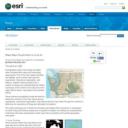
Cartographers apply many design principles when compiling their maps and constructing page layouts. Five of the main design principles are legibility, visual contrast, figure-ground organization, hierarchical organization, and balance. How We Use Maps and Globes: An Illustrated Guide from 1968. By Maria Popova A charming reminder of how far we’ve come — and what we’ve given up along the way.
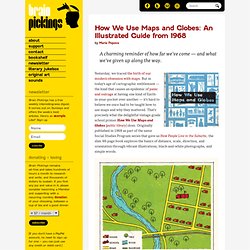
Yesterday, we traced the birth of our modern obsession with maps. But in today’s age of cartographic entitlement — the kind that causes an epidemic of panic and outrage at having one kind of Earth-in-your-pocket over another — it’s hard to believe we once had to be taught how to use maps and why they mattered.
Maps&Stats. Atlas. Open-map-data.