
Calculate distance and bearing between two Latitude/Longitude points using Haversine formula in JavaScript. Parade of Rain » Blog Archive » Lessons Learned in Tilt Controls. Ahh, my first idevblogaday post!

For those that don’t know, idevblogaday is a group of indie dev bloggers started by Miguel Á. Friginal of @mysterycoconut games to get developers blogging more regularly. Calculate distance and bearing between two Latitude/Longitude points using Haversine formula in JavaScript. Python Point-in-Polygon with Shapely. Shapely 1.2.14. Geometric objects, predicates, and operations Latest Version: 1.3.0 PostGIS-ish operations outside a database context for Pythoneers and Pythonistas.
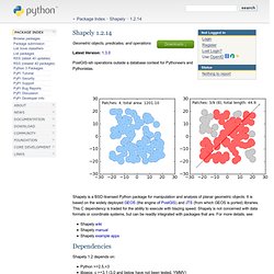
Shapely is a BSD-licensed Python package for manipulation and analysis of planar geometric objects. It is based on the widely deployed GEOS (the engine of PostGIS) and JTS (from which GEOS is ported) libraries. This C dependency is traded for the ability to execute with blazing speed.