
Mauritius. Island country in the Indian Ocean Mauritius ( mə-RISH-(ee-)əs, maw-; French: Maurice [mɔʁis, moʁis] ( listen); Creole: Moris [moʁis]), officially the Republic of Mauritius (French: République de Maurice; Creole: Repiblik Moris[8]), is an island nation in the Indian Ocean about 2,000 kilometres (1,200 mi) off the southeast coast of the African continent.
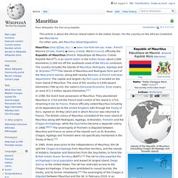
The country includes the islands of Mauritius, Rodrigues, Agaléga and St. Brandon.[9][10] The islands of Mauritius and Rodrigues form part of the Mascarene Islands, along with nearby Réunion, a French overseas department. The capital and largest city Port Louis is located on the main island of Mauritius. The people of Mauritius are multiethnic, multi-religious, multicultural and multilingual.
Along with the other Mascarene Islands, Mauritius is known for its varied flora and fauna, with many species endemic to the island. Etymology[edit] History[edit] Early history[edit] Dutch Mauritius (1638–1710)[edit] French Mauritius (1715–1810)[edit] British Indian Ocean Territory. The British Indian Ocean Territory (BIOT) or Chagos Islands is an overseas territory of the United Kingdom situated in the Indian Ocean halfway between Tanzania and Indonesia.
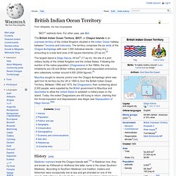
The territory comprises the six atolls of the Chagos Archipelago with over 1,000 individual islands – many tiny – amounting to a total land area of 60 square kilometres (23 sq mi).[5] The largest island is Diego Garcia, 44 km2 (17 sq mi), the site of a joint military facility of the United Kingdom and the United States. Following the eviction of the native population (Chagossians) in the 1960s, the only inhabitants are US and British military personnel and associated contractors, who collectively number around 4,000 (2004 figures).[5] Mauritius sought to resume control over the Chagos Archipelago which was split from its territory by the UK in 1965 to form the British Indian Ocean Territory.
History[edit] In 1990, the first BIOT flag was unfurled.
Tibet. Un article de Wikipédia, l'encyclopédie libre.
Sous l'appellation « Tibet historique » (terme équivoque[1]), cette aire, revendiquée par le gouvernement tibétain en exil, est composée de trois régions traditionnelles : l'Ü-Tsang (dont la plus grande partie du territoire est comprise dans la Région autonome du Tibet), l'Amdo (éclaté entre les provinces du Qinghai, du Gansu et du Sichuan) et le Kham (dont le territoire est partagé entre les provinces du Sichuan et du Yunnan et la région autonome du Tibet)[2]. Au recensement de 2000, le nombre de Tibétains dans l'ensemble de ces régions était de 5 020 000, selon le bureau des statistiques de la Chine[3], et d'environ 6 millions selon le gouvernement tibétain en exil à Dharamsala (Inde)[4].
Quelque 150 000 Tibétains vivent actuellement en exil, principalement en Inde, principalement suite à l'exode tibétain de 1959. Définitions du Tibet[modifier | modifier le code] La question « Qu'est-ce que le Tibet ? Selon Melvyn C. Pour le professeur A. Afghanistan. Un article de Wikipédia, l'encyclopédie libre.
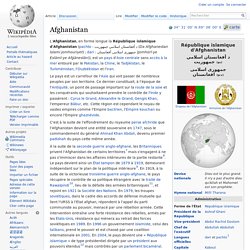
République islamique d'Afghanistan د أفغانستان اسلامي جمهوریت (ps) جمهوری اسلامی افغانستان (prs) South Asia. Southern region of Asia South Asia or Southern Asia, is the southern region of the Asian continent, which comprises the sub-Himalayan SAARC countries and, for some authorities, adjoining countries to the west and east.
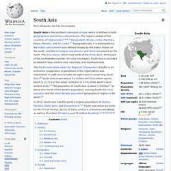
Topographically, it is dominated by the Indian Plate, which rises above sea level as Nepal and northern parts of India situated south of the Himalayas and the Hindu Kush. South Asia is bounded on the south by the Indian Ocean and on land (clockwise, from west) by Western Asia, Central Asia, East Asia and Southeast Asia. The current territories of Afghanistan, Bangladesh, Bhutan, Maldives, Nepal, India, Pakistan and Sri Lanka form South Asia.[4] The South Asian Association for Regional Cooperation (SAARC) is an economic cooperation organisation in the region which was established in 1985 and includes all eight nations comprising South Asia.[5]
Asie du Sud. Un article de Wikipédia, l'encyclopédie libre.
La définition commune de l'Asie du Sud L'Asie du Sud est la région méridionale de l'Asie. Elle comprend le sous-continent indien (Afghanistan, Bangladesh, Bhoutan, Inde, Maldives, Népal, Pakistan, Sri Lanka)[1],[2],[3]. Démographie[modifier | modifier le code] L'Asie du Sud au sens large est la région la plus peuplée du monde avec 1,8 milliard d'habitants en 2015, soit environ un quart de la population mondiale. La densité de population y est forte depuis longtemps, même si certaines régions montagneuses et désertiques sont peu peuplées voire inoccupées. Notes et références[modifier | modifier le code] Voir aussi[modifier | modifier le code] Sous-continent indien Liens externes[modifier | modifier le code] Effects of global warming on South Asia (en) Portail de l’Asie.
Inde.