
CampgroundListFeb2013.pdf. National Park, State Park & Forest Campgrounds near Moab, Utah. BLM Campgrounds surrounding Moab, Utah. The Bureau of Land Management (BLM) maintains 24 campgrounds in the Moab area.
Individual Campsites are available on a first-come/first-served basis. No reservations are accepted. All BLM campgrounds and camping areas have vault toilets, fire rings, are open year round, and a fee is charged. Note that firewood gathering is not allowed so bring your own wood (available at convenience stores in Moab). RV Sites have no hook-ups. Sand Flats Recreation Area – Most sites accommodate up to a 26 foot RV. BLM Camping Map Primitive Camping On Public Lands Camping is restricted to designated sites along Highway 313, the Gemini Bridges Road, the Black Ridge Road and Pack Creek Roads, the area accessed by the Mill Canyon Road and the Blue Hills Road, in the Castle Rock area, and south of Moab in the Blue Hill/Picture Frame Arch area.
Gemini Bridges Road - There are six campsites located in Bride Canyon. There are several areas in which no sites are designated and camping is not allowed. Moab Campgrounds. Mill Creek North Fork - Moab - Swimming Hole and Petroglyphs. Circle of Friends: Mill Creek is part of the "Circle of Friends" program.
Members of the "Circle of Friends" have access to more specific information, explicit route information, GPS waypoints, trailhead location and detailed maps. If you would like more information on joining the "Circle of Friends" visit the sign up page. "Circle of Friends" General Information: The North Fork of Mill Creek Canyon is a fun hike up a beautiful canyon with a warm clear flowing stream. The route can be enjoyed by any healthy adult or child. A GPS is extremely useful in locating the petroglyphs and pictographs. Hiking trails with swimming holes/creeks - Moab Forum. Arches and Canyonlands National Parks. Flying out of Salt Lake City airport early on Monday morning I could see in the distance the breathtaking expanse of southeastern Utah that encompasses both Arches and Canyonlands national parks.
The 3 day weekend that I had just spent doing photography there was among the most satisfying I'd ever done. I did more good photography in those 3 days than almost anywhere or anywhen else. This essay is to try and help you to have a similar experience. Getting There Southeastern Utah is remote. On 6 you will pass through the town of Hope. Mesa Arch Photo Tips - Canyonlands, Moab - Fototripper. Purchase a High Quality Print of This Image I'm willing to bet that Mesa Arch is one of THE most photographed natural stone arches.
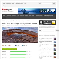
It's no surprise that thousands of photographers a year set their alarm clocks at some ungodly hour so that they can beat the crowd for sunrise. I'm not ashamed to admit I was one of them. I think it's because the arch creates a perfect frame for the spectacular view of the mesa below while the sun rises over the La Sal mountain range. If you can use a camera and the light is right you can virtually guarantee an awesome shot. That being said, it's better to go prepared so here are my Mesa Arch Photo Tips. 1 - Go in Winter Time Canyonlands in Moab gets less tourism in the winter so you can expect less competition for the premium spot in front of the arch. Winter will give you better atmospherics with a higher chance of mist and of course if you're really lucky, snow!
That being said, it's stunning all year round. 2 - Go Early  3 - Allow the Crowd to Clear Camping. Canyonlands National Park - Plan your trip to Canyonlands National Park. The largest national park in Utah, with diversity that staggers the imagination.
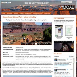
Needles.pdf. Dead Horse Point State Park. Weather in Canyonlands. Long Hikes in the Needles - Canyonlands National Park (U.S. National Park Service) The Needles District offers over 60 miles of interconnecting trails as challenging as they are rewarding.
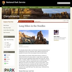
Many different itineraries are possible, but some of the more popular ones are listed below. Trail conditions are primitive. Most trails traverse a mixture of slickrock benches and sandy washes. Longer trails are especially rough and require negotiating steep passes with drop-offs, narrow spots, or ladders. Water in the backcountry is unreliable and scarce in some areas. Chesler Park Loop / Joint Trail Length: 11 mi/18 km round-trip Start: Elephant Hill Trailhead Hiking three miles along this trail brings visitors to a saddle overlooking Chesler Park, a scenic expanse of desert grasses and shrubs surrounded by colorful sandstone spires.
Elephant Canyon / Druid Arch Length: 11 mi/18 km round-trip Start: Elephant Hill Trailhead This trail offers one of the most spectacular views in the Needles. Canyonlands National Park. 2015CANYVisitorGuide_Optimized.