
Choose a project - OSGeo. Live 12.0 Project Metrics — OSGeoLive 12.0 Documentation. Openstreetmap/iD: The easy-to-use OpenStreetMap editor in JavaScript. uDig : Home. Gallery — GeoNetwork opensource. PgRouting Project — Open Source Routing Library. iD. MapProxy — The accelerating web map proxy. MapProxy — The accelerating web map proxy.
OpenGIS Web Map Tile Service Implementation Standard. Search form info@opengeospatial.org OpenGIS Web Map Tile Service Implementation Standard 1) Downloads2) Official Schemas 3) Related News.
Web Map Service. 1) Overview2) Downloads3) Official Schemas4) Related News 1) Overview The OpenGIS® Web Map Service Interface Standard (WMS) provides a simple HTTP interface for requesting geo-registered map images from one or more distributed geospatial databases.
A WMS request defines the geographic layer(s) and area of interest to be processed. M.App Analyzer Suite. EVO-ODAS. Welcome to ows.EOX.at. Welcome to The Open Geospatial Consortium. Mundi Web Services. Welcome - GEOSS. Infrastructure d'information géographique dans la Communauté européenne. AMAP géoportail. IVS FEB RAS Metadata Catalogue - IVS FEB RAS. Tutoriel QGIS Passages. Bienvenue sur le projet QGIS ! GRASS GIS - Cartography. GRASS GIS - Home. uDig : Home. The gvSIG Desktop 2 Open Source Project on Open Hub. Welcome to OSGeoLive 12.0 — OSGeoLive 12.0 Documentation. Index of / Gis/LiveImages.
Outdated Information The information on this page is no longer updated.
To make it easier to try the GIS tools provided in Debian, the Debian GIS project is making a live CD. It is based on the live-helper package with custom configuration and build scripts held in DebianGIS's SVN repository. Boot with 'live locale=nb_NO.UTF-8 keyb=no' or similar to activate your language. Content. Mapserver/tinyows. An Introduction to MapServer — MapServer 7.2.2 documentation. MapServer Overview MapServer is a popular Open Source project whose purpose is to display dynamic spatial maps over the Internet.
Some of its major features include: support for display and querying of hundreds of raster, vector, and database formatsability to run on various operating systems (Windows, Linux, Mac OS X, etc.)support for popular scripting languages and development environments (PHP, Python, Perl, Ruby, Java, .NET)on-the-fly projectionshigh quality renderingfully customizable application outputmany ready-to-use Open Source application environments In its most basic form, MapServer is a CGI program that sits inactive on your Web server. When a request is sent to MapServer, it uses information passed in the request URL and the Mapfile to create an image of the requested map.
Welcome to MapServer — MapServer 7.2.2 documentation. Bienvenue! - GeoAvalanche. City Futures Research Centre. Explore - MapStory. How to Download Free Sentinel Satellite Data - GIS Geography. Download Sentinel-1 and Sentinel-2 Satellite Data If you want to download Sentinel satellite data, then you’ve come to the right place. One of the most exciting developments in remote sensing at this time is the European Space Agency’s Copernicus Programme.
Copernicus’ six Sentinel satellites collects comprehensive pictures of our land, ocean, emergency response, atmosphere, security and climate change to understand the health of our planet. Until very recently, this data has become available to the public at no cost. OpenStreetMap Data: How to Download Crowd-Sourced OSM Data - GIS Geography. SRTM Tile Grabber. Each tile comes in GeoTIFF format at 90-meter resolution (6000x6000 pixels), from various mirrors I've found on the web.
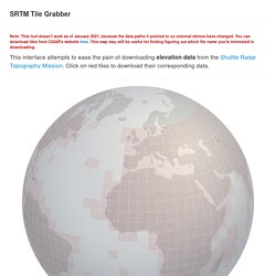
Try Development Seed or Linfiniti or this cheat sheet for some help on doing nice things with this data using GDAL. The files linked here are version 4.1 of an effort by the folks at CIAT-CSI to scrub, polish, and remove gaps in the raw SRTM data released by NASA. The SRTM grid originally comes from this KMZ file for browsing the same data in Google Earth. Any download policies of the respective mirrors apply. SRTM Tile Grabber. THEIA-LAND – Données et services pour les surfaces continentales. Downloads. Data themes are available in three levels of detail. For each scale, themes are listed on Cultural, Physical, and Raster category pages. Stay up to date! Annuaire de la Géomatique et des SIG > Données.
Serveur de fiches. MAPS.ME (MapsWithMe), detailed offline maps of the world for iPhone, iPad, Android. Geograph Ireland - photograph every grid square! OpenStreetMap. Where is this?
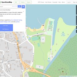
Reverse Directions Welcome to OpenStreetMap! OpenStreetMap is a map of the world, created by people like you and free to use under an open license. Hosting is supported by UCL, Bytemark Hosting, Imperial College London, and other partners. Learn More Start Mapping. Mapbox.
Polymaps. Kartograph.org. Observable. InstantAtlas – visualize. Modest Maps. Cartes et plans libres pour sites web. How to draw a map. This tutorial covers my entire process for how to draw a map – from start to finish.
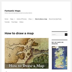
In this case I’m illustrating a simple town map, but the steps apply to any map. Tools and Software I used Photoshop for this map, but all of this can be done in Gimp (for free). I also use a graphics tablet. Tablets are great for this work, and if you’re thinking about digital map making I’d recommend picking one up. Atlas of Design. Demo Showcase. CesiumJS Demo Showcase. Marble - find your way and explore the world.
Récupérer des données OpenStreetMap via GDAL/OGR. Cartes OpenStreetMap-Garmin. Documentation - geOrchestra Spatial Data Infrastructure. GeoServer User Manual — GeoServer 2.12.x User Manual. GeoServer 2.12.x User Manual next GeoServer is an open source software server written in Java that allows users to share and edit geospatial data.
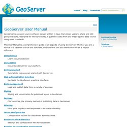
Designed for interoperability, it publishes data from any major spatial data source using open standards. This User Manual is a comprehensive guide to all aspects of using GeoServer. Whether you are a novice or a veteran user of this software, we hope that this documentation will be a helpful reference. Introduction. SANSA-EO Catalogue. Projecta: GeoNode. QGIS Plugins planet. Visualiseur - mapfishapp. Bienvenue sur le projet QGIS ! iTowns API : Home. Home · iTowns/itowns-project Wiki. iTowns. iTowns. Introduction — GeOxygene.
GeOxygene aims at providing an open framework which implements OGC / ISO specifications for the development and deployment of geographic (GIS) applications.
It is a open source contribution of the COGIT laboratory at the IGN (Institut Géographique National), the French National Mapping Agency. GeOxygene is based on Java and open source technologies and provides users with an extensible object data model (geographic features, geometry, topology and metadata) which implements OGC specifications and ISO standards in the geographic information domain.
The support of the Java interfaces developped by the open source GeoAPI project is planned. GeOxygene is an open source project made available to you using an open source license described here. Accueil. Géoportail. Geographic Information Systems Stack Exchange. QGIS. QGIS Tutorial. Items covered in this tutorial include importing spatial data, dealing with projections, basic raster and vector manipulations, using some plugins, and creating a map.
Use the links below to access the tutorial and data files: An older version, for QGIS 2.12, and largely still applicable to QGIS 2.x is available here. (For use with the same sample data.) Alternatively, download all materials (including archived versions) as a .zip or Tarball file using one of the icons above, or go to the main GitHub repository. Tutoriel QGIS Passages. Tutoqgis. GRASS GIS pas à pas pour les débutants: 2 - importer des couches vectorielles.
Esri : logiciel de cartographie SIG, analyse des données spatiales et plateforme géographique. GDAL: GDAL - Geospatial Data Abstraction Library. Sign In. GeoDa on Github. GeoDa Release This GeoDa 1.12 is the most current version of GeoDa with new features. We found it to be stable but if you encounter a bug, please let us know. You can also report bugs and issues on our Github site. This version is continuously updated when bugs are fixed. GRASS GIS - Home. Explore - Map for Environment. Homepage - OSGeo. Global Mapper - All-in-one GIS Software. Global Mapper is an affordable and easy-to-use GIS application that offers access to an unparalleled variety of spatial datasets and provides just the right level of functionality to satisfy both experienced GIS professionals and beginning users.
Multivariate attribute querying 3D line exporting from profile paths 3D mesh creation in the Pixels-to-Points™ tool. Cartographie – TartareFR. Open Source Routing Machine DEMO. Mapillary - Street-level imagery, powered by collaboration and computer vision. GeoJSON. Geographic JSON (geojson) - Note: The data for concluded WGs is occasionally incorrect. Charter for Working Group GeoJSON is a format for encoding data about geographic features using JavaScript Object Notation (JSON) [RFC7159]. Geographic features need not be physical things; any thing with properties that are bounded in space may be considered a feature. GeoJSON provides a means of representing both the properties and spatial extent of features. App. GpxRando. GeoDa on Github. Kepler.gl. OpenTopoMap - Topographische Karten aus OpenStreetMap. Le GEIPAN.