Forest fire southern progression. 2010-9-6-evening - 303Photo's Photos | SmugMug. Boulder Four Mile fire. WITNESSES TO THE FOURMILE CANYON FIRE. Four Mile Canyon Fire 2010 #boulderfire. Via BoulderOSteens Fire broke out yesterday just a few miles from Boulder. Quite a lot of information is available. The emergency scanner is here. Weather Underground has a fire map as well here. If you are not near the fire and want to grasp just the scale, this photo by James Azure is stunning.
CNN has the best video shot from a plane. Two user generated google map mashups have been amazing uses of data from the scanner. full map here. I had a live stream last night that had 17,000 viewers watch the smoke plume. Red flag warnings just went out, basically saying this could be very, very bad. The Boulder Office of Emergency Management has the most up to date official news. 7:41 a.m. – Sept. 7, 2010 – Boulder County officials will be on hand to update the public and media on the status of the Fourmile Canyon Fire at a briefing scheduled for 9 a.m.
I watched the fire in my back yard yesterday with the plume towering overhead. Fire as seen from space. Related Posts: No Related Posts. Audio Dispatch. WILDFIRE UPDATE. Fire near Boulder, CO - Panasonic HMC150. Fight the Boulder Wildfire | Serve Those Who Serve. TtT_BoulderFire Google Spreadsheet. ConnectColorado (ConnectColorado) Commulinks. Fourmile Fire: Readers can post offers of help here. Boulder Fire Help • Index page. Boulder County Public Health - Boulder County Government. Air Quality Search CO. Smoke2003final. Air - Smoke Health and Safety Questions & Answers. What new fires are starting up and what’s the status on the current fires? Check for a daily update in fire status. The Department of Natural Resources also has a website with a number of links, How can I see if the weather will continue to impact the fires? The National Weather Service, Alaska site, has useful information about hazards: Is there any way to see the fires or smoke impacts?
There are at least two webcams in the Fairbanks area: Where can I learn more information about the fires? Call the Alaska Interagency Fire Information Center for questions about fires in Alaska - (907) 356-5511. What is the health threat from fires and smoke? Smoke from wildfires is a mixture of gases and fine particles from burning trees and other plant materials. How can I tell if the smoke is affecting my family or me? I have a head cold; will I be affected more? No. Boulder Fire. FourMileFireWebPerimeter. The Board of County Commissioners consists of three individuals elected to serve four-year terms as leaders of the Boulder County government. All three commissioners are elected at-large by the voters of Boulder County and represent the county as a whole.
Visit the Commissioners' Hearings page for public meeting agendas, minutes and live webcasts. Visit the Commissioners' Office page for news and staff information Duties As full-time public servants, the commissioners approve the budget for the entire county government, spearhead individual initiatives and oversee management of 10 county departments. They also provide leadership and work collaboratively with fellow elected officials in the Assessor’s, Clerk’s, Coroner’s, District Attorney’s, Sheriff’s and Treasurer’s offices to ensure that Boulder County continues to provide the best in public service.
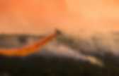
Each commissioner plays a role representing Boulder County on various regional and statewide committees and organizations. The Incident Information System: Four Mile Canyon Fire Large Map. Boulder Forest Fire. Fourmile Canyon fire near Boulder, Colorado « CIMSS Satellite Blog. GOES-13 3.9 µm shortwave IR images A wildfire started in the Fourmile Canyon area northwest of Boulder, Colorado on the morning of 06 September 2010 — and strong winds (gusting to around 45 mph) in the wake of a cold frontal passage helped the fire to spread very quickly to a size of about 3500 acres.
Some homes and buildings were destroyed, a few evacuations were ordered, and there were a number of road closures in the area. AWIPS images of 4-km resolution GOES-13 3.9 µm shortwave IR data (above) showed the associated “hot spots” (black to red to yellow pixels) as the fire continued to grow during the day. Note the presence of very dry air over parts of the region – the dew point was as low as -17º F at Boulder, due to downsloping winds. AWIPS images of 1-km resolution MODIS 0.65 µm visible, MODIS 3.7 µm shortwave IR, and MODIS 11.0 µm IR channel data (below) showed a more detailed view of the fire smoke plume and hot spots at 18:13 UTC (12:13 pm local time).
Photo of the smoke plume. PBH_Evac_Map_0909. List of evacuated neighborhoods in Boulder fire. The Denver Post Posted: 09/07/2010 07:24:38 PM MDT|Updated: 3 years ago Area of the Boulder County fire Evacuations have not been ordered within the city limits of Boulder. The following residential areas have been ordered to evacuate, which can also be viewed on a PDF map of the Fourmile Canyon fire from the Boulder County government website.
The communities east of the Peak-to-Peak Highwaywest of Highway 36south of Lefthand Canyon Roadnorth of Boulder Canyonalong Sugarloaf RoadAll homes within a three-mile radius of Gold HillMountain meadows subdivisionSierra Antigua subdivisionMountain Meadows and Mountain PinesPine BrookBoulder HeightsWhispering PinesMile marker three — Sugarloaf to Boulder CanyonLickskillet west to Sawmill Road conditions, according to the Boulder Office of Emergency Management website: Boulder Canyon is openLefthand Canyon is open to JamestownLefthand Canyon is closed from Lee Hill to LickskilletFourmile Canyon and Sugarloaf roads are closed. Boulder Fire. #boulderfire. Fourmile Fire.
CO - Emergency Mgmt (COEmergency) Boulder County Sheriff's Office | Joe Pelle Sheriff. Emergency Status. Evacuation information | Boulder Mountain Fire. Boulder Reservoir to shelter firefighters. Contact: Sarah Huntley, Relations, 303-441-3155 City of Boulder closes Boulder Reservoir to shelter firefighters City Manager Jane Brautigam has ordered the closure of Boulder Reservoir to the public starting at Tuesday, Sept. 7, until further notice. The city property will be used to shelter firefighters who are working the wildfire in . Emergency crews will be allowed to utilize camping equipment for the duration of the closure.
The public will not be allowed access to the Reservoir during this time. This includes pedestrians, cyclists and all vehicles from all points of entry. The Boulder Reservoir location was chosen because of its proximity to the Incident Command Post at the . “We know the Boulder Reservoir is a popular destination this time of year, but this closure is necessary to help the courageous firefighting crews who are working this very difficult situation,” Brautigam said. For additional information about the wildfire, please visit www.boulderoem.com . Fire chars 144 acres west of Boulder; neighborhoods are evacuated. Flames shoot into the sky from the Dome fire on Friday morning. (Paul Aiken, The Camera) A wildland fire that started this morning in Boulder Canyon has charred at least 144 acres of Boulder Mountain Parks property and prompted widespread evacuations in the city and foothills.
The Dome Fire started at about 8:10 a.m., about a quarter mile west of Elephant Buttress above Dome Rock on the north side of Boulder Canyon. Earlier, 100 firefighters from 20 agencies were battling the fire that has been shooting flames into the air and spreading thick white smoke over Boulder. City of Boulder spokeswoman Sarah Huntley said 200 firefighters are expected to be on scene by evening. A total of 1,600 homes in the foothills and Boulder have received reverse notification calls to evacuate. This evening, city officials said the evacuations would last at least until Saturday morning. Officials say that about 1,700 people live in the city evacuation area. The backburns were to occur under power lines. EVACUEES SPEAK ABOUT WILDLAND FIRE. County seeking contact with evacuees. Boulder OEM (BoulderOEM) American Red Cross Colorado Chapters - Red Cross Services - Service Overview.
Sorry, it appears what you are seeking may have moved or may no longer exist. Please try using the links on this page or the search box in the top right. Looking for assistance or a shelter? Want to make a donation? Other ways to helpMake a blood donation appointmentTake a classFind your local chapter. Red Cross Denver (RedCrossDenver) American Red Cross: Longmont Humane Society - Dogs Available for Adoption. Pet Info Left-behind pets rescued. By Whitney Bryen bryen@coloradodaily.com Posted: 09/07/2010 08:07:44 PM MDT | Updated: 4 years ago Nancy Engellenner gets a hug from Jean Gatza, with back to camera, in the parking lot of the Boulder County Justice Center on Tuesday. Engellenner, who lives in Sunshine Canyon, believes her house was destroyed in the fire. ( PAUL AIKEN ) Humane Society donations Donations are needed by the Humane Society's local branches to keep up with unusually high demand as a result of the Fourmile Fire.
Humane Society of Boulder Valley needs blankets, towels, cat litter, canned dog and cat food, six-foot leashes and cash donations. Longmont Humane Society needs machine washable blankets, towels, canned dog and cat food, and pet toys. Rescuing pets To request rescue for a left-behind pet, call Boulder County Animal Control at 720-564-2942. To find a pet, contact Longmont Humane Society at longmonthumane.org or 303-772-1232, or the Humane Society of Boulder Valley at boulderhumane.org or 303-442-4030. Humane Society of Boulder Valley. 2-1-1 Call Center Search. Insurance association: Fourmile Fire evacuees should contact insurers now.
The 3,500 Boulder County mountain residents who have been evacuated because of the Fourmile Fire should call their insurance companies right away -- even if they don't know whether their houses are still standing. In general, people who have been forced out of their homes by a mandatory evacuation order have coverage for "additional living expenses" under their regular homeowners' insurance, which should provide them with money to cover things such as hotel rooms and groceries, according to Carole Walker, executive director of the Rocky Mountain Insurance Information Association. "Unfortunately, no one thinks that the unthinkable can happen, but as we've seen, it can happen even on Labor Day weekend. It's just heartbreaking to see this," Walker said. "The good news is that a standard homeowner's insurance policy does cover damage to your structure and your personal belongings in the fire. But longtime Sunshine Canyon resident Steve Spencer said he's confident his house is gone.
Twitterfall. Boulder Fire Tweet Map. Wildfire Social Media Map | Disaster Relief and Support. Boulder_Co_Emer_Prep_Guide. Boulder County Land Use Department: Wildfire Mitigation - Introduction to Wildfire Mitigation. Visit www.BoulderCountyFlood.org for information regarding road closures, applying for FEMA disaster assistance, and debris management. The Flood Rebuilding & Permit Information Center is a resource for those facing rebuilding, and is staffed by functional experts in onsite wastewater (septic) systems, floodplain regulations, transportation (driveways, roads & bridges), planning and building codes.
Review 2013 Flood Restoration and Repair for information on minor flood restoration and repair to residential structures. The Boulder County Land Use Department actively promotes the preservation of the integrity of our landscape, conservation of natural resources for a sustainable future, and provision of safety and well being of the citizens of Boulder County through the best in service, public policy, and process. Dale Case, AICP Director, Boulder County Land Use Tuesday Plan Review Office Hours Change in Effect Full-service Tuesday office hours will be restored as soon as possible.