Hydraulics™ Reservoir Product Tour. Timber Lake Trail #733 Hiking Trail, Warm Springs, Oregon. Sign Up or Log In Your FREE account works with all Adventure Projects sites Connect with Facebook Password help Share on Hiking Project Create Recommended Route or Trail Add a Symbol Share a Photo Share a Video Share a Gem Particularly Special Place Taking other people's content (text, photos, etc) without permission is a copyright violation and NOT OKAY!

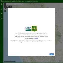
Flag Inappropriate Post If it's not super-obvious, tell us why: Cancel An Adventure Projects staff member will review this and take an appropriate action, but we generally don't reply. Sign In Search Trail Guide Best Photos Top Hikes Trail Guide Best Trails & Photos Get the app Timber Lake Trail #733 Easy Be the first to rate! © OpenMapTiles © OSM Zoom in to see details Map Key Miles. USFS Pacific Northwest Region: Emergency Closures. Esri, HERE, Garmin, FAO, NOAA, USGS, EPA, NPS | The USDA Forest Service makes no warranty, expressed or implied, including the warranties of merchantability and fitness for a particular purpose, nor assumes any legal liability or responsibility for the accuracy, reliability, completeness or utility of these geospatial data, or for the improper or incorrect use of these geospatial data.
These geospatial data and related maps or graphics are not legal documents and are not intended to be used as such. USA Hot Springs from NOAA - Google My Maps.
Eastern oregon. Region 6 - Recreation. Search for Places - website.name. Adams. Where you can’t go outside: Oregon trails and parks that have closed to the public. A wave of outdoor recreation closures over the last six days have hit Oregon hard, as land management agencies shut down trails and parks in an ongoing effort to slow the spread of the coronavirus outbreak in the Pacific Northwest.
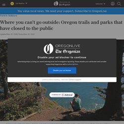
Oregon has seen widespread closures of trails and campgrounds before – think of the Eagle Creek fire closures that still haunt the Columbia River Gorge – but the extent of these new closures is unprecedented. A vast number of hiking trails, parks, and day-use areas in the state are now closed to the public. All campgrounds, private and public, are also closed. Most of the Oregon coast is now off-limits to visitors.
A huge swath of the Cascade Mountains, from Mount Baker to Mount Shasta, is virtually inaccessible. It’s a heartbreaking, albeit understandable reaction to the coronavirus pandemic. After flocks of hikers crowded popular trailheads and parks last weekend, it became clear that was going to be a tall order. Our Trails » Portland Trails. Trail Closures and Delays. Please see Portland Parks & Recreation's Inclement Weather Policy for additional closure information during extreme weather.
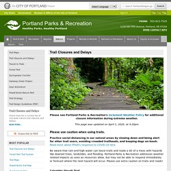
This page was updated on April 1, 2020, at 4:20pm Practice social distancing in our natural areas by slowing down and being alert for other trail users, avoiding crowded trailheads, and keeping dogs on-leash. Read more about PP&R's response to COVID-19 here. Be aware that rain and high water can leave trails and roads a bit of a mess with hazards like downed trees, landslides, and flooding.
Goat Rocks Wilderness backpacking. Day 1 We were planning to spend four nights on this trip, but the weather made slight changes to those plans.
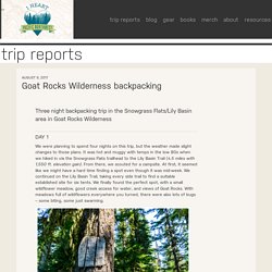
It was hot and muggy with temps in the low 80s when we hiked in via the Snowgrass Flats trailhead to the Lily Basin Trail (4.5 miles with 1,550 ft. elevation gain). From there, we scouted for a campsite. ALPS OutdoorZ Commander + Pack Bag. Alps Outdoorz Commander with Pack Bag Test and Review RGO Ep 80. Publications and Maps. Publications and Data. What Paracord is Right for Me? - Paracord Planet.
Gear I Won't Hike Without. Interactive Visitor Map. Trail Resources - Oregon Natural Desert Association. These free resources are available as PDF downloads.
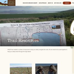
Click on links to start downloads. Trail maps include waypoints, distances between waypoints, trail surface type, water information, declination, private land boundaries, information on public land and a selection of alternates including: Christmas Valley, Orejana Canyon, Blitzen River, Alvord Hot Springs, McDermitt, and many more options in the Owyhee Canyonlands. The ODT Guidebook provides an introduction and “know before you go” information that is helpful in preparing for a hike along the route. Trail Resources - Oregon Natural Desert Association.
These free resources are available as PDF downloads.
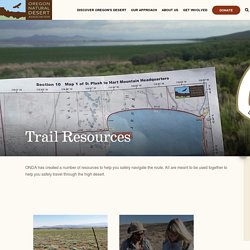
Click on links to start downloads. Trail maps include waypoints, distances between waypoints, trail surface type, water information, declination, private land boundaries, information on public land and a selection of alternates including: Christmas Valley, Orejana Canyon, Blitzen River, Alvord Hot Springs, McDermitt, and many more options in the Owyhee Canyonlands.
The ODT Guidebook provides an introduction and “know before you go” information that is helpful in preparing for a hike along the route. ODFW Maps. ODFW Wildlife Viewing Map - Google My Maps. Hunting Access Map. OWEB 1017 2 Alvord. Alvord. Pacific Northwest Interagency Natural Areas Network. Report. Welcome to Harney County Government's Official Website. North Oregon Coast Forest Fire Lookout Tower Sites. | Home | Oregon | Mt.
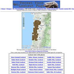
Hood Region | OR North Coast | Southwest OR | West Central OR | South Central OR | East Central OR | Northeast OR | The map above is clickable, select site from map above or list below View Above Map on Separate Full Page. Wasco County Base Map. Stott mt n alsea page2. Stott mt n alsea page1. N coast south geopdf. Hunting on private lands: Access & Habitat Program. The program’s motto, “Landowners & Hunters Together for Wildlife,” conveys the program’s basic mission - to foster partnerships between landowners and hunters for the benefit of the wildlife they value.

The program also seeks to recognize and encourage the important contributions made by landowners to the state’s wildlife resource. Private land hunting opportunities North Coast Access Area Law Enforcement Project North Region Map (pdf); South Region Map (pdf)Project information: These industrial timberlands are a conglomerate of forest land that has multiple owners. A&H funds are being used to hire 5 Oregon State Police Senior Troopers to patrol the private timberlands from August to December. Willamette Private Timberlands Law Enforcement Project Linn County Forest Patrol Project Project information: This area is industrial timberland with multiple landowners. Lincoln County Forest Patrol Project Jackson Access & Cooperative Travel Management Area Bentz Access Project Kueny Ranch Access Area. N coast north geopdf. Nehalem, Oregon Mining Claims And Mineral Deposits. NW Adventures, Maps & GPS Tracks – Karl's climbing and adventure-thrash blog. Current Snow Depth.
Imagery with Labels Sources: Esri, USGS, NOAA | NWS/NOHRSC | Sources: Esri, Garmin, USGS, NPS | US Forest Service Enterprise Map Services Program | Zoom to +Zoom In −Zoom Out 10km.
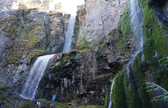
Boots McFarland Cartoon a ajouté une photo. - Boots McFarland Cartoon. Aaron's Waterfall World - Google My Maps. Mount Shasta Area Waterfalls: Avoiding A Dry Whitney Falls. Whitney Falls. As noted here, Whitney Falls is one of the prettier waterfalls on Mount Shasta. Its feathery plunge into a narrow grotto is as graceful as it is striking. The 200 foot waterfall seems particularly out of place set against the black, jagged flows of lava and loose volcanic ash that surround it. Though some of the other waterfalls on Mount Shasta rank higher in beauty and power, Whitney Falls remains the most heralded waterfall on Mount Shasta. USGS 3DEP Viewer. Viewers, Applications & Tools. Skip to main content Science+ Science Explorer Mission Areas. TripCheck - Oregon Traveler Information. Lidar-explorer. PDF Quads. PDF Quads - Trail Maps. King County Parcel Viewer.
Tips. Your browser isn't supported. GIS Data Oregon/Washington BLM. Land Cover Viewer - Map. Washington State Geospatial Open Data Portal. Welcome to the Northwest Waterfall Survey. Clackamas County. How do I search for an address? On the upper right corner of the application, next to the magnifying glass, is an arrow or triangle pointing down. Clicking on the arrow will reveal a list of search options. The first option is "Address". Address is the default search option. watch the videoStart typing an address in the search window and a list of suggested results will appear. To refine the list, continue typing the desired address. Watch the videoreturn to topClackamas Maps shows my neighbor’s house crossing my property line. Clackamas County. How do I search for an address? On the upper right corner of the application, next to the magnifying glass, is an arrow or triangle pointing down. Clicking on the arrow will reveal a list of search options.
The first option is "Address". Address is the default search option. watch the videoStart typing an address in the search window and a list of suggested results will appear. To refine the list, continue typing the desired address. Watch the videoreturn to topClackamas Maps shows my neighbor’s house crossing my property line. The Oregon Map GIS Viewer. Klickitat County. 3D Geology. 3D geologic models are a method of portraying complex data interactively.
Incredibly good geology GE files – merelunacy
The interactivity of the models allows non-geologists a better understanding of this complex data than is possible using a 2D map. For example, try to explain to someone what a tree looks like with only a drawing. Now explain the tree again using a picture. Publications and Maps. Geologyportal.dnr.wa. 3D Geology. Geologic Information Portal. Aircraft Wrecks Of The Pacific Northwest. There is a pretty good story about this one: The Unlikely Bond Between Japanese Fighter Pilot Nobuo Fujita And Brookings, Oregon . Arts & Life. View topic - Japanese Bombsite Trail. Storm Prediction Center Fire Weather Forecasts. EOSDIS Worldview. 2017 Total Solar Eclipse Viewing Tips. Pacific Northwest Stream Survey. 2009 Fish Propagation Annual Report. 2011 04 Comp Plan. ReimersPaul1964. Frances Hunter's American Heroes Blog.
Pacific Northwest Stream Survey. Pacific Northwest Stream Survey. Pacific Northwest Stream Survey. Survey of the Columbia River and its tributarie... Oregon Department of Geology and Mineral Industries. Springfield MAIN MESSAGE AUG 2016. CorporateClosures. Columbia River Gorge and Mount Hood Timeline. Friends of the Columbia Gorge : 3D Gorge Trail Map.
Columbia Gorge: A Unique American Treasure - Michael S. Spranger. Mount Hood WebCams.
Random research. World Waterfall Database - The webs most authoritive source about Waterfalls. Portland Hikers. Build a stone wall by Charles Sanders. Food.