
Ecosistema Urbano. Ecosistema Urbano combine expertise in architecture, civil engineering and landscape architecture, focusing on designing sustainable urban environments.
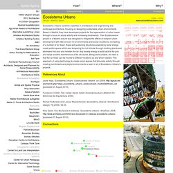
Based in Madrid, they have developed projects for the regeneration of urban areas through a focus on social activity and increasing biodiversity. Their EcoBoulevard project in a Madrid suburb was designed to mitigate the effects of rampant urban development with little concern for environmental and social conditions. Consisting of a number of 'air trees', these self-sustaining structures powered by solar energy create public space whilst also tempering the hot climate through climbing plants and atomisers that cool and moisten the air. Any excess energy is sold back to the grid and helps fund the maintenance of the structures. Being demountable, the idea is that the 'air trees' can be moved to different locations as and when needed. References About Javier Arpa, 'Ecosistema Urbano. Connections.
Introduction to Political Philosophy. About the Course This course is intended as an introduction to political philosophy as seen through an examination of some of the major texts and thinkers of the Western political tradition.
Three broad themes that are central to understanding political life are focused upon: the polis experience (Plato, Aristotle), the sovereign state (Machiavelli, Hobbes), constitutional government (Locke), and democracy (Rousseau, Tocqueville). The way in which different political philosophies have given expression to various forms of political institutions and our ways of life are examined throughout the course. View class sessions » Course Structure This Yale College course, taught on campus twice per week for 50 minutes, was videotaped for Open Yale Courses in Fall 2006. The Open Yale Courses Series For more information about Professor Smith’s book Political Philosophy, click here. Course Materials Download all course pages [zip - 10MB] Video and audio elements from this course are also available on: Texts.
Mapping global urban and rural population distributions. The previous chapter reviewed definitions of urban and rural areas, and analysed what statistical data are available and what georeferenced datasets could be used as potential inputs into models of population distribution.
In this chapter, the two most widely known and used georeferenced global population distribution databases that have been developed based on these sources are reviewed and several recent efforts to model population distribution, taking urban and rural areas explicitly into account are described. The Gridded Population of the World (GPW), originally developed at the National Center for Geographic Information Analysis (NCGIA) and subsequently updated by the Center for International Earth Science Network (CIESIN) at Columbia University, attributes population to the lowest subnational administrative units for which population counts are available.
Gridded Population of the World - GPW v3. Introduction Note: "Gridded Population of the World, v4" is now available and supersedes GPWv3.
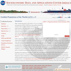
GPWv4 provides gridded population estimates with an output resolution of 30 arc-seconds (approximately 1 km at the equator) for the years 2000, 2005, 2010, 2015, and 2020 based on the results of the 2010 round of censuses, which occurred between 2005 and 2014. For more details about GPWv4 and to access the new data see GPWv3 depicts the distribution of human population across the globe. GPWv3 provides globally consistent and spatially explicit human population information and data for use in research, policy making, and communications. Population data estimates are provided for 1990, 1995, and 2000, and projected (in 2004, when GPWv3 was released) to 2005, 2010, and 2015. List of countries by population growth rate. The population growth rate estimates (by United Nations) for the period 2005–2010 using the medium variant.
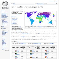
This article includes three lists of countries and self-governing dependent territories by population growth rate. Methodology[edit] The first list is based on the estimates taken from the 2006 edition of the United Nations World Population Prospects report.[1] Figures are population growth rate estimates for the period 2005–2010 using the medium variant. The second list is based on CIA World Factbook estimates for year 2011.[2] Dependent territories and not fully recognized states are not ranked. The third list is based on World Bank estimates for year 2009.[3] Population is based on the de facto definition of population, which counts all residents regardless of legal status or citizenship—except for refugees not permanently settled in the country of asylum, who are generally considered part of the population of the country of origin.
Countries[edit] See also[edit] Home Page. Occupy Wall Street. Beyond Keynesianism : global infrastructure investments in times of crisis.