
Bike Share Map: London. CiBi.me. Using open data to plan NYC bike share system. Welcome back to Gehl Institute’s partnership with Untapped Cities in New York, looking at the impact of data, both open and collected, in the design of cities.

On March 7, New York City became the first local government to pass legislation ensuring public access to data. The passing of the bill symbolizes a political embrace of the “open” culture already underway in New York City’s “Silicon Alley.” City agencies and non-profit organizations in New York are making new correlations between urban conditions and social phenomenon, utilizing crowdsourcing and open data, to support traditional methods of data analysis.
Visualizing the Bikes of Boston. Last week, Hubway announced its Data Visualization Challenge.

Hubway is a bike sharing system located in the Boston area: you simply pick up a bike at a particular station and drop it off at the closest station near your destination. For this challenge, Hubway released a CSV-file, containing over half a million rides. Each entry contains the origin and destination station as well as the timing-information and some anonymoused demographic information.
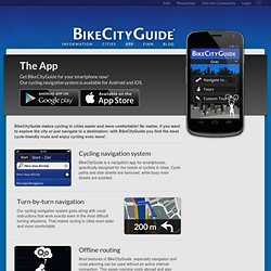
The App - BikeCityGuide. BikeCityGuide makes cycling in cities easier and more comfortable!

No matter, if you want to explore the city or just navigate to a destination: with BikeCityGuide you find the most cycle-friendly route and enjoy cycling even more! Cycling navigation system BikeCityGuide is a navigation app for smartphones, specifically designed for the needs of cyclists in cities. CycleStreets: UK-wide Cycle Journey Planner and Photomap. London Cycling Campaign. VeloMap.org -Roadbike – Bicycle – Maps based on Openstreetmap.