
INNOVATIONS-6-1_Hagen.pdf (application/pdf-Objekt) Audio slideshow: On the map. 18 January 2011Last updated at 00:20 Until recently, what is often billed as one of Africa's largest slums - Kibera, in the Kenyan capital Nairobi - was a blank spot on official maps.
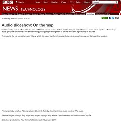
But a group of volunteers have been training young people living there to create their own digital map of the area. The result is the first complete map of Kibera, which it is hoped can form the basis of plans to improve the area and the lives of its residents. Continue reading the main story Photographs by Jonathan Fildes and Adam Blenford. Satellite images copyright Bing Maps. Slideshow production by Paul Kerley.
Related links: Map Kibera OpenStreetMap The BBC is not responsible for the content of external internet sites. More audio slideshows: Australia's inland sea Voodoo art and raucous rhythms in Haiti The photographs of Sir Wilfred Thesiger We remember... in 2010. Map Kibera. Map Kibera Project - Maps and Statistics. Wem hilft Map Kibera? « Anja Krieger. Future of Health: Map Kibera Creates An Infrastructure For Health Care. As part of the Future of Health report published last week, we interviewed key innovators during our research to illuminate ideas and innovation developing in healthcare.

Map Kibera is an open-source project started in 2009 in response to the lack of information available for the Kibera district of Nairobi, Kenya – one of the world’s largest slums. The majority of Nairobi is geographically documented for health, education, and sanitation purposes, but these basic requirements are neglected without any mapping to guide the municipal infrastructure. Health geographers Jamie Lundine and Joshua Goldstein of the Map Kibera team share their insights on the project below: Tell us how you describe the Kibera mapping project and any technological integrations that are helping your team along.
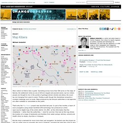
Kanal von mapkibera. Map Kibera. Project William Underhill Detail of current Kibera plan, from mapkibera.org.
Wise visitors to Kibera take a guide. Sprawling across more than 500 acres on the edge of Nairobi, the settlement ranks as one of Africa’s largest and poorest slums. Up to a million people are thought to live in the jumble of garbage-strewn streets and alleys, the exact lay-out changing from week to week. Development and mapping - Jamie Lundine of mapkibera. Myth shattered: Kibera numbers fail to add up. By MUCHIRI KARANJA pmuchiri@ke.nationmedia.com It has been billed as Africa’s biggest slum and even by some accounts, the world’s largest.
Some say it is home to two million people, others a million. But the 2009 Kenya Population and Housing Census results released this week make everything you have heard about the size of Kibera improbable. Numbers do not lie, and figures from the 2009 census indicate that Kibera barely makes it to Nairobi’s largest slum. According to the census figures, the eight locations that form Kibera slums combined host a paltry 170,070. Located five kilometers from the city centre, Kibera forms less than half of Langa’ta constituency. Another major city slum, Mukuru Kwa Njenga, in Nairobi West with 130,402 people is slowly edging towards the largest slum in Kenya status. For a long time Kibera has been touted as Africa’s largest slum, with various ‘experts’ putting its population at anything between one and two million.
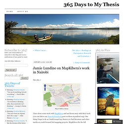
It turns out to one big lie. Jamie Lundine on MapKibera’s work in Nairobi. Day 365 -1 Map of Kibera, Kenya I have done some work with MapKibera and am blown away with their work (you can link to my Nairobi Notebook post on them at pradical.org).
One thing I hope to do as I build toward my thesis is to find literature and other media on youth focused/led mapping projects. MapKibera fits the bill perfectly. So … following through on this idea … here is an interview with Jamie Lundine, coordinator of MapKibera. Bottomless Pit of Needs A mapping project builds on what is concretely there, the strengths and assets of the community as defined by the community. So, if you are still interested, listen/read on below to both the audio of the interview and then the transcription. Doug. Untitled.