
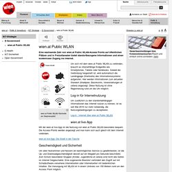
Zusammenschluss von selbstorganisierten Hausprojekten. Wien.at Public WLAN. Eine wachsende Zahl von wien.at Public WLAN-Access Points auf öffentlichen Plätzen und in Freizeitarealen bietet standortbezogene Informationen und einen kostenlosen Zugang ins Internet. wien.at Public WLAN-Startseite am Stephansplatz Um sich mit dem wien.at Public WLAN zu verbinden, braucht es internetfähige Endgeräte wie Smartphones, Tablets oder Notebooks.
Untitled. About. HealthMap, a team of researchers, epidemiologists and software developers at Boston Children's Hospital founded in 2006, is an established global leader in utilizing online informal sources for disease outbreak monitoring and real-time surveillance of emerging public health threats.
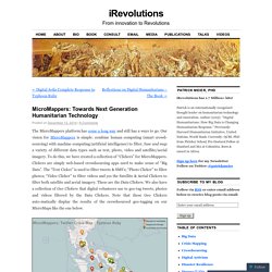
The freely available Web site 'healthmap.org' and mobile app 'Outbreaks Near Me' deliver real-time intelligence on a broad range of emerging infectious diseases for a diverse audience including libraries, local health departments, governments, and international travelers. Big Data. Farbliche Darstellung der Aktivität eines Wikipedia-Bots über einen längeren Zeitraum: typisches Beispiel der Veranschaulichung von „Big Data“ mit einer Visualisierung Der aus dem englischen Sprachraum stammende Begriff Big Data [ˈbɪɡ ˈdeɪtə] (von englisch big ‚groß‘ und data ‚Daten‘) bezeichnet Datenmengen, welche zu groß,zu komplex,zu schnelllebig oderzu schwach strukturiert.
Big data. Cnet. QCRI - Projects. Home - Humanitarian UAV Network. Decision Scaffolding and Crisis Mapping. I’m working on a series of illustrations to highlight the need for decision scaffolding during an aide mission.
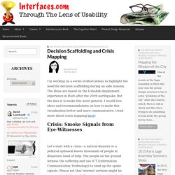
The ideas are based on the Ushahidi deployment experience in Haiti after the 2009 earthquake. But the idea is to make this more general. I would love ideas and recommendations on how to make this visualization better and more communicative. (read more about crisis mapping here) Crisis: Smoke Signals from Eye-Witnesses Let’s start with a crisis—a natural disaster or a political upheaval leaves thousands of people in desperate need of help. During the current Libyan crisis, people were very creative: “To avoid detection by Libyan secret police, who monitor Facebook and Twitter, Mahmoudi, the leader of the Ekhtalef (“Difference”) Movement, used what’s considered the Match.com of the Middle East to send coded love letters to rally the revolution”—ABC News article “Muslim Dating Site Madawi Seeds Libyan Revolution” by By Jeffrey Kofman and Ki Mae Heussner.
Mr. How to Become a Digital Sherlock Holmes and Support Relief Efforts. Humanitarian organizations need both timely and accurate information when responding to disasters.
Where is the most damage located? Who needs the most help? What other threats exist? Respectable news organizations also need timely and accurate information during crisis events to responsibly inform the public. Alas, both humanitarian & mainstream news organizations are often confronted with countless rumors and unconfirmed reports. The purpose of Verily is to rapidly crowdsource the verification of unconfirmed reports during major disasters. Verily helps humanitarian & news organizations find answers to these questions by rapidly crowdsourcing the collection of clues that can help answer said questions. Summary about Social Media Research in Disaster/Emergency Response Systems - Knoesis wiki. From Knoesis wiki SoCS: Social Media Enhanced Organizational Sensemaking in Emergency Response Keywords: Social Networking, Emergency Response, Content Analysis, Network Analysis, Organizational Sensemaking, Collaborative Decision Making.
MicroMappers: Towards Next Generation Humanitarian Technology. The MicroMappers platform has come a long way and still has a ways to go.
Our vision for MicroMappers is simple: combine human computing (smart crowd-sourcing) with machine computing (artificial intelligence) to filter, fuse and map a variety of different data types such as text, photo, video and satellite/aerial imagery. To do this, we have created a collection of “Clickers” for MicroMappers. Clickers are simply web-based crowdsourcing apps used to make sense of “Big Data”.
The “Text Cicker” is used to filter tweets & SMS’s; “Photo Clicker” to filter photos; “Video Clicker” to filter videos and yes the Satellite & Aerial Clickers to filter both satellite and aerial imagery. These are the Data Clickers. UN-SPIDER - Promotional Video (full version) Patrick Meier - Changing the World, One Map at a Time. UN-SPIDER: Space-based information for Crowdsource Mapping. A UN initiative to boost emergency response by crowdsourced mapping and space technology How to ensure that space-based information for crowdsource mapping benefits the emergency response community and disaster risk reduction?
This is the key question that specialists around the world will attempt to answer during the Expert Meeting being held in Geneva, this November, which is being held to coincide with the International Conference on Crisis Mapping. The Expert Meeting is a fundamental part of the programme that is being organized by the United Nations Platform for Space-based Information for Disaster Management and Emergency Response (SPIDER).
The SPIDER program was established by the United Nations General Assembly with the mandate of ensuring that all countries, international and regional organizations, have access to space-based information, and to ensure they develop the capacity to use all types of space-based information to support the full, disaster management cycle. 1. Mr. OpenStreetMap Deutschland: Die freie Wiki-Weltkarte. Taifun Haiyan: Was blieb stehen? Halbleere Colaflaschen und herumliegende Rucksäcke, viele Kapuzenpullis, wenig Platz.
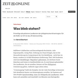
Ordnung ins Chaos bringen, das ist die Herausforderung im Computerpool der Uni Heidelberg – nicht hier im Raum, sondern in 10.000 Kilometern Entfernung. Über 160 Studenten sind zum Heidelberger "Mapathon" gekommen, sie zeichnen bunte Kästchen und Linien in Satellitenbilder ein. Hochauflösende Satellitenbilder. AP / ESA / P.
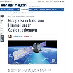
Carril Satelllit: Der Blick auf die Erde wird immer schärfer Ein Blick vom Himmel auf die Erde - über Google Earth ist er auch Otto-Normalverbraucher längst möglich. Crisis mapping. Crowdsourcing. Crowdsourcing, a modern business term coined in 2005, is defined by Merriam-Webster as the process of obtaining needed services, ideas, or content by soliciting contributions from a large group of people, and especially from an online community, rather than from traditional employees or suppliers;[1][2] a portmanteau of "crowd" and "outsourcing,"[3][4] its more specific definitions are yet heavily debated.[5] This mode of sourcing is often used to divide tedious work between participants,[6] and has a history of success prior to the digital age—"offline," see the linked and examples appearing below.
Crowdsourcing can apply to a wide range of activities.[2] Crowdsourcing can involve division of labor for tedious tasks split to use crowd-based outsourcing, but it can also apply to specific requests, such as crowdfunding, a broad-based competition, and a general search for answers, solutions, or a missing person. Definitions[edit] In a February 1, 2008 article, Daren C. Examples[edit] G.